Temperatures dropping ahead of severe weather for Chicago area

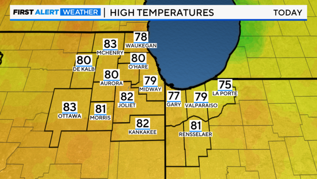
CHICAGO (CBS) -- Sunday has been the warmest day of the year so far for Chicago as the area reached 80 degrees for the first time this year. The record temperature is 85 degrees and was set in 2003.
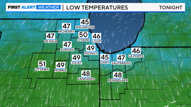
A lake breeze is pulling cooler air into the area, and temperatures near the lake are falling.
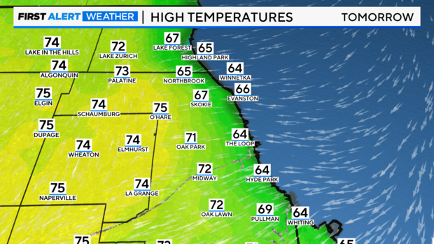
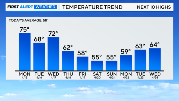
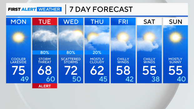
Monday will be sunny and quiet, though not as warm, with highs in the middle 70s. A lake breeze will keep things cooler along the shoreline again.
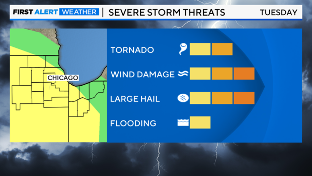
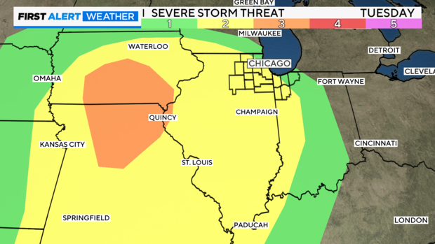
A storm threat calls for a Weather Alert day on Tuesday. Models are slowing the forward speed of the storm system. Gusty winds off the lake up to 30mph will probably keep temperatures in the 60s area-wide. Also, the warm front is slow to lift northward.
The highest severe weather timeframe looks to be sunset to midnight Tuesday. All hazards are possible, including damaging winds, large hail, and possible tornadoes.
The area could even have gusty thunderstorms for Wednesday morning rush as the storm complex is overhead.
Once it departs, a cooler northwest gusty flow takes temperatures into the weekend colder than normal, especially considering the winds.
Severe weather timing for Tuesday could still change as system takes shape and targets Chicago.
Forecast
SUNDAY NIGHT: Clear. LOW: 50
MONDAY: Sunny. HIGH: 75, cooler lakeside
TUESDAY: Storm threat, windy. HIGH: 68