High Winds Persist; Flood Risk Continues For Some Rivers
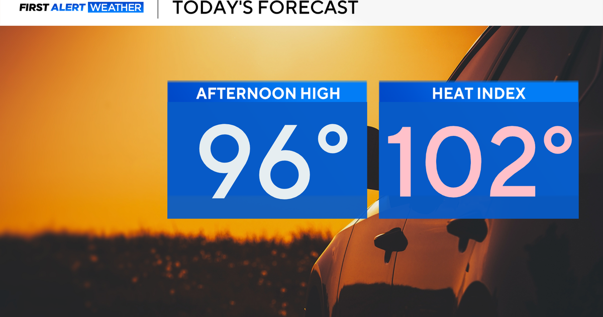
CHICAGO (CBS) -- High winds have subsided a bit since Thursday's storm, when four tornadoes might have touched down in central Illinois, but dangerous winds will persist through the afternoon, and gusts of up to 45 mph are likely on Friday.
Meantime, some local rivers still are at risk of flooding, in the wake of three days of thawing snow and ice, and more than an inch of rain in Chicago on Thursday.
The National Weather Service has issued a wind advisory until 3 p.m. Friday. Wind gusts could make travel dangerous, especially for high-profile vehicles like semi-trailers.
The advisory comes on the heels of a high wind warning Thursday night, when wind gusts of up to 76 mph were recorded in parts of Central Illinois, and gusts of nearly 60 mph were recorded at Midway International Airport, which was temporarily shut down for about an hour, due to the combination of high wind and heavy fog.
More than 180 flights were canceled. At O'Hare, more than 420 flights were canceled, although the airport continued operating amid the wind and fog, which were not quite as severe at O'Hare.
Conditions were more severe in central Illinois, where four tornadoes might have touched down, causing minor damage. The National Weather Service said it was reviewing preliminary reports to confirm whether tornadoes did touch down Thursday in Cass County, Sangamon County, Christian County, and Effingham County.
High winds knocked down power lines on the North Side of Chicago late Thursday, knocking out power to approximately 1,100 homes and businesses in the West Ridge and Rogers Park neighborhoods.
A downed power line also might have sparked a fire in the 6000 block of North Ravenswood Avenue.
Winds also blew out a window pane at the Macy's store at Water Tower Place on Thursday, sending shattered glass raining onto Michigan Avenue.
Police swarmed the scene and closed lanes of traffic while investigating. No serious injuries were reported, though at least one person was hit by glass.
Allie Vladimiroff was panhandling when she was struck by falling glass.
"I have a headache, a little bit, but I'm fine. It was just shocking and crazy," she said.
Wind was not the only weather problem for the Chicago area on Friday. Although rain has stopped, runoff from melting snow continued to flow into local rivers and streams, with some waterways at or near flood stage.
The National Weather Service has issued a flood warning for the Des Plaines River in west suburban Riverside until Saturday morning.
As of 6:45 a.m. Friday, the river was at 7.9 feet, nine-tenths of a foot beyond flood stage, and nearly half a foot shy of the point when it could begin damaging homes near the junction of the Des Plaines River and Salt Creek. The river should fall below flood stage by Saturday morning.
A flood watch also was in effect for the Thorn Creek at Thornton until Saturday morning. The creek could reach flood stage sometime Friday morning, according to the National Weather Service.