Map shows where plowable snow could fall in Massachusetts Wednesday

BOSTON – There is a chance of plowable snow in parts of Massachusetts this week.
Monday promises to be a bright and seasonable day, with highs in the 30s.
Winds will remain breezy throughout the day, picking up in intensity as the evening approaches and continuing into the night.
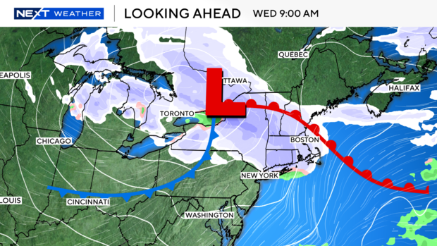
Massachusetts snow chances
Tuesday brings the arrival of a weak frontal boundary, which will edge into New England with a slight chance for snow accumulation.
While most of the precipitation is expected to fizzle out before reaching Boston, areas in Vermont and New Hampshire stand a better chance of seeing measurable snowfall.
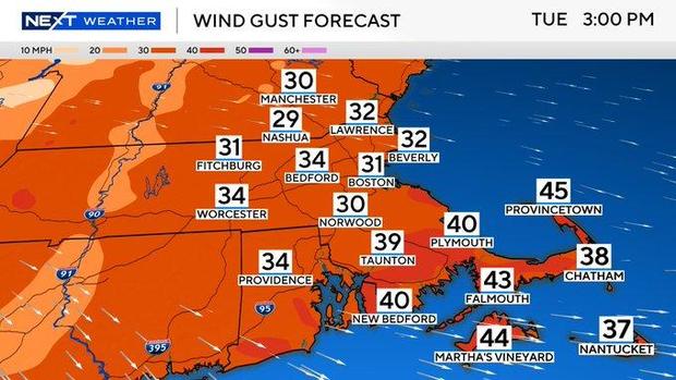
Windy and chilly Tuesday
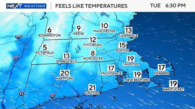
Winds will gust close to 40 mph Tuesday afternoon. While air temperatures will be rising into the middle 30s for Tuesday, the gusty winds will make it feel much colder.
This will bring wind chills down into the teens for Tuesday. This may cause it to actually feel colder in the afternoon rather than the morning, despite the air temperature warming. This is all thanks to the gusty wind factor associated with a cold front ahead of Wednesday snow chances.
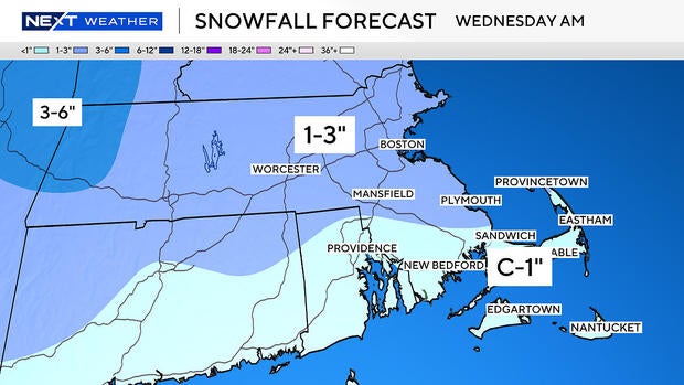
How much snow?
Wednesday ushers in a fast-moving Alberta Clipper system, bringing a solid chance for snow.
North and west of Boston could see totals surpassing 3 inches, while areas closer to the city are likely to see lighter amounts. Snowfall will taper off significantly to the south and east of Boston.
Frigid end to January
Behind Wednesday's clipper, a fresh surge of cold air will settle over the region, ensuring a frigid end to the month.
Temperatures will plunge once again, bringing a stark reminder that winter is far from over in Massachusetts.
Stay with the WBZ NEXT Weather Team for updates on this week's evolving weather patterns.
Catch us on CBS News Boston, WBZ-TV, and WBZ.com for the latest forecasts and snow updates.


