Back To The Deep Freeze
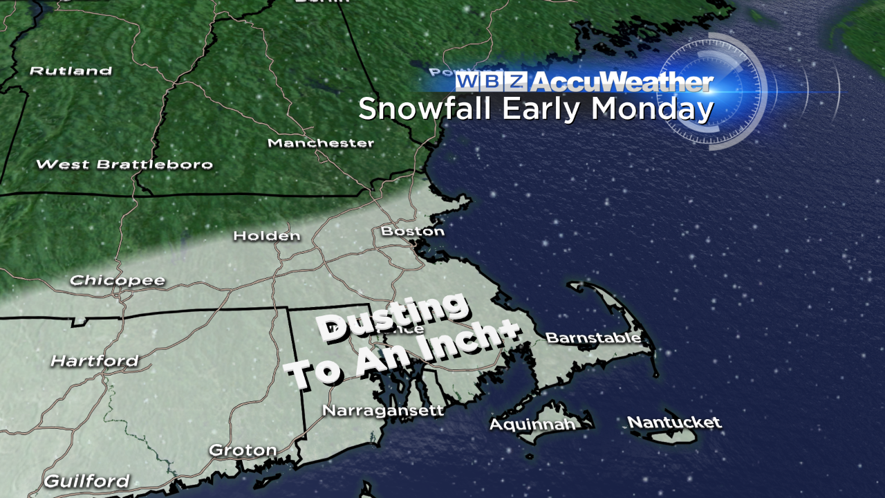 What a beautiful day with temperatures flirting with and exceeding 50 degrees in many areas. Boston checked in with 50 degrees at 2:58 this afternoon. This was only the 7th day this month that featured above average temperatures which means 15 have been below average! The mean temperature for February is a bit over 2 degrees below average and the last 5 days of this month will be below average which is contrast to last February's mean temperature of -0.5 degrees. If you loved today and I can't imagine that there were too many that didn't, you'll enjoy tomorrow because it will be almost as warm. In fact, it will probably feel warmer than today because the wind will be much more gentle than today. I am predicting middle 40s farther north and west of Boston to near 50 in the city and lower 50s over southeastern MA. A cold front is on the move and it will pass across the region during the day but, unlike its predecessor, this front will be starved for moisture and dynamics so nothing more than a brief shower or sprinkle is probable. There will be varying amounts of clouds and some sunshine throughout the day. A weak upper level disturbance and minor frontal wave could blossom a plume of rain to snow later tomorrow night across southern New England. There should be nothing more than a coating to an inch or so mainly from near the MA Pike southward in the predawn hours of Monday. Consequently, it might be slippery in places early Monday with morning commute temperatures rising slowly from the upper 20s to near 30. It's back to reality as early afternoon highs will not exceed the middle 30s and that is about 5 degrees below average.
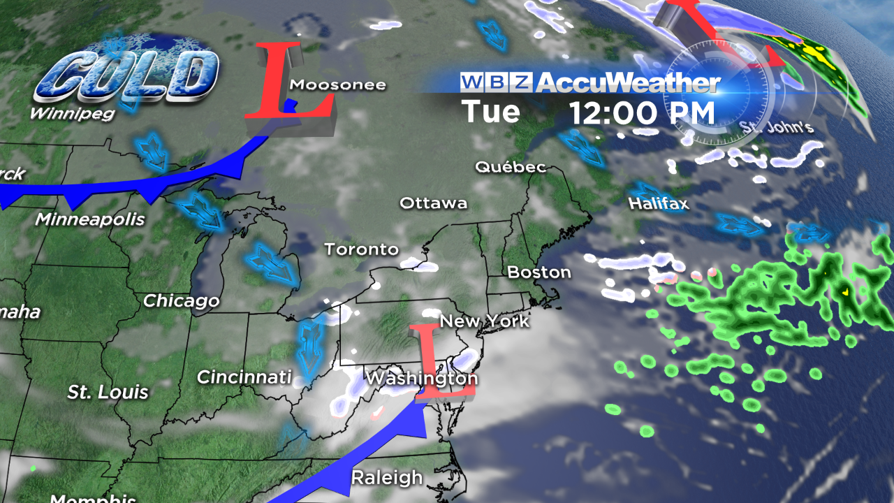 Looking ahead, Tuesday will be quiet with sunshine and clouds with highs only near 30. The next weather maker will arrive Wednesday with some light snow. A weak low pressure system in the southern stream may inject some moisture into New England but it appears the bulk of it will slip out to sea south of New England. There is upper level support for some light snow across much of the region as a trough of low pressure passes through so it is possible that a few inches of 1 up to 4" snow could fall across the region. Based upon current guidance, a major storm is not expected. Following that feature, the next upper level trough and cold front could trigger some passing snow showers on Thursday. If a sharpening trough descends from central and eastern Canada next Saturday, another round of light snow could be created. Despite the start of meteorological spring next Saturday, winter cold will rule through next weekend. Daily high temperatures will decrease during the week to 20 on Friday which will be 21 degrees below the average and that will probably be matched again a week from tomorrow! If this frigid air was striking us in early to mid-January, the highs would be closer to 5-10 degrees! Fortunately, the sun is becoming more powerful so the arctic air will be modified somewhat.
The winter resorts are featuring machine-groomed snow with some loose granular and frozen granular surface conditions. Rain did fall over most of the mountains yesterday but it really didn't warm much to reduce the deep snow cover. It will be turning colder up north tomorrow as the winter chill returns. A few snow showers could occur on Monday with a few more episodes of mostly light snow with a few brief bursts of heavier snow over the mountains through the week. Watch for icy patches but decent conditions will exist for alpine and nordic skiing, snowboarding, snowmobiling and snow shoeing this coming week. The second half of the week will be frigid again so layering will be essential with a helmet, goggles, mittens, etc. Enjoy the trails of New England and please be courteous and in control.
Danielle Niles posts her thoughts again tomorrow morning and I shall return later in the day.
Enjoy your Sunday!