WEATHER BLOG: Unseasonably Warm Weather
Unseasonably warm weather will return to the mid-Atlantic states and much of the Northeast today, but it will quickly be getting replaced by much cooler air tomorrow and Saturday... There'll be
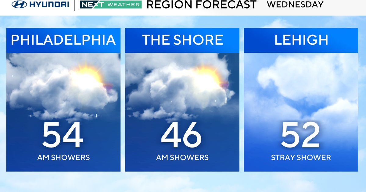
a decent amount of sunshine this morning and during midday, but the leading edge of the much cooler air mass which is expected to arrive tonight will generate some clouds later this afternoon and this evening... As far as precipitation is concerned, we're applying the 'persistence method' to our current forecasts, which allow for a spotty shower in areas east of the Appalachians late this afternoon and this evening.
We've pointed out the past couple of days that quantitative rainfall forecasts have shown very little happening around here, and many cities will probably only get a trace amount of rain before midnight tonight... High temperatures this afternoon will be in the mid or upper 70s along the I-95 corridor and near the immediate coast... However, the tendency for clouds to start gathering earlier farther inland may limit the temperature to the upper 60s in portions of northeastern and central Pennsylvania, as well as in western and central New York State...
The sky tonight will average partly cloudy, and any shower activity will end early... By daybreak tomorrow, it will be in the 50s in most places... And, even though there ought to be a good deal of sunshine tomorrow, afternoon temperatures will be in upper 50s and lower 60s -- levels much more typical for late in October... Prevailing winds will be out of the north and northwest tomorrow, but it will also be fairly light, averaging a sustained 10 or 15 mph.
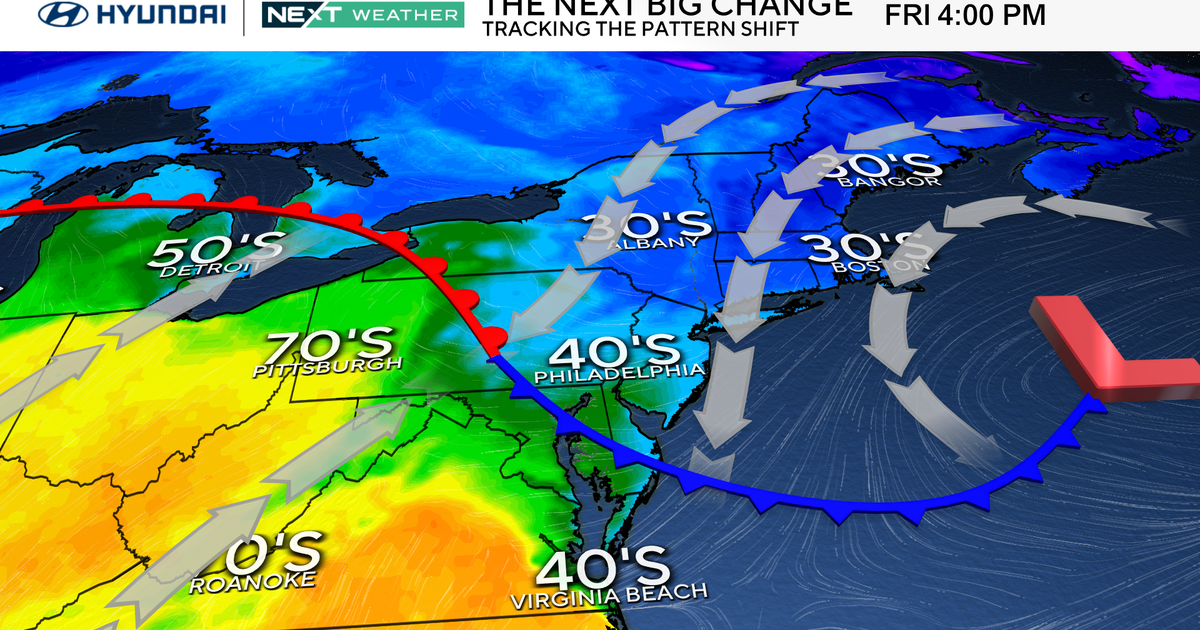
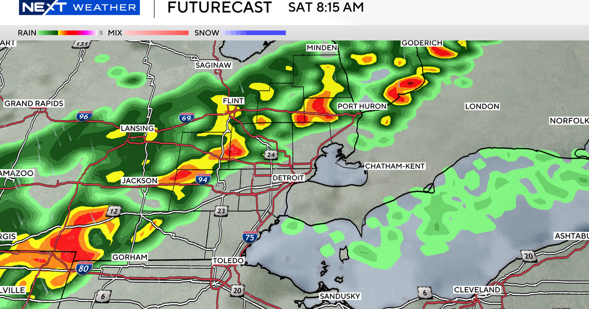
A ridge of high pressure building into the eastern third of the country tomorrow night and Saturday will continue to usher in some cool air... In fact, with a clear sky and very light winds tomorrow night, many temperatures will be in the upper 30s and lower 40s early on Saturday morning... The balance of Saturday will be dry, but the temperature should be no higher than the 50s in most of the region because sunshine will begin to fade behind increasing clouds in the afternoon... The next front moving across the Great Lakes on Saturday will waste no time pushing all the way to the East Coast by early Sunday morning... Therefore, we should allow for a shower or two very late on Saturday night and the first half of Sunday... But if clouds manage to break for some sunshine on Sunday afternoon, most high temperatures will be in the mid or upper 60s..
Dry weather is expected to prevail early next week... Have a good day!!