Weather Blog: Light Snowfall Leads To A Frigid Forecast
BALTIMORE (WJZ) — Phase one is now ongoing as a light snowfall overnight could accumulate an inch or so of snow but end in the early morning.
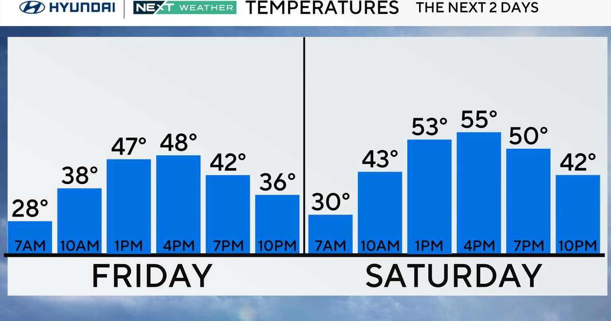
Friday, the sun will warm us back up into the low or mid-40s.
Round two will break out on Saturday with a period of light snow or some sleet. Then as we warm up, soaking rain is expected into Sunday before Arctic air pushes all the moisture out to sea.
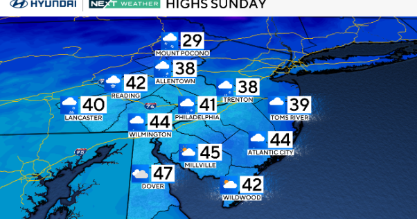
We may have a brief period of snow on Sunday morning before it clears out.
A very cold air mass will move in during the afternoon, and evening temperatures will drop from 47, to a low of 7 degrees by Monday morning!
Wind chills will drop to -10 to -15 on Monday.
A brief snow shower is also possible on Monday, along with the very brutal cold.
Do stay warm and watch out for your pets!
Total snow this weekend may only be an inch but the rain will likely wash all of it away. As the cold comes in on Sunday, a flash freeze is likely!
Any standing water will freeze very fast before it can dry up with the wind. It could get very slippery, very quickly at that time!
Be safe!
--Bob Turk
Follow @WJZ on Twitter and like WJZ-TV | CBS Baltimore on Facebook