Maryland Weather: Arctic Air Loses Its Grip, Plus Chances For Snow Ahead
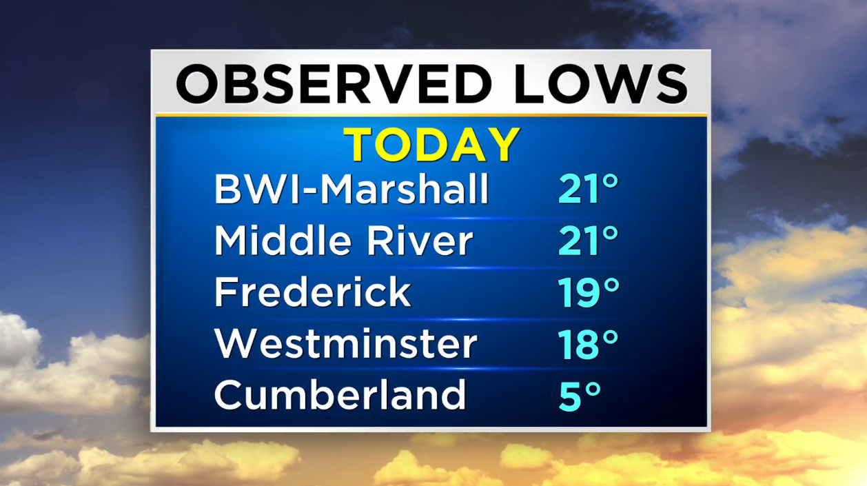
BALTIMORE (WJZ) -- We started out Tuesday morning with many areas in the 10s and 20s. Parts of western Maryland actually bottomed out in the single digits with below zero wind chills as the sun rose in the morning.
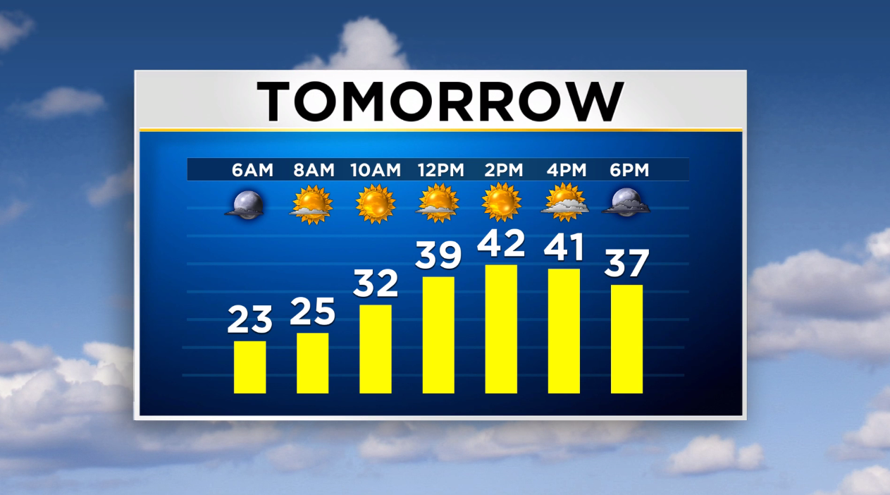
The forecast high for Tuesday is around 28 degrees for the Baltimore area. It is potentially the coldest day that we have seen in nearly three years. The last time the official high temperature was in the 20s at BWI-Marshall was on Feb. 1, 2019. This arctic blast has certainly been a shock to the system, but the chill is expected to ease-up as early as Wednesday. High temperatures are forecast to return to more seasonable values. After a cold start to the day, expect temperatures in the lower 40s by Wednesday afternoon.
 Another chill will settle in later this week as we enter the coldest time of the year, on average, for the Baltimore area (Jan. 13-29). Starting on Friday, temperatures are forecast to be a few degrees below normal. Cold air will be in place and any moisture that develops over the coming days has the potential to fall and even accumulate in a wintry form.
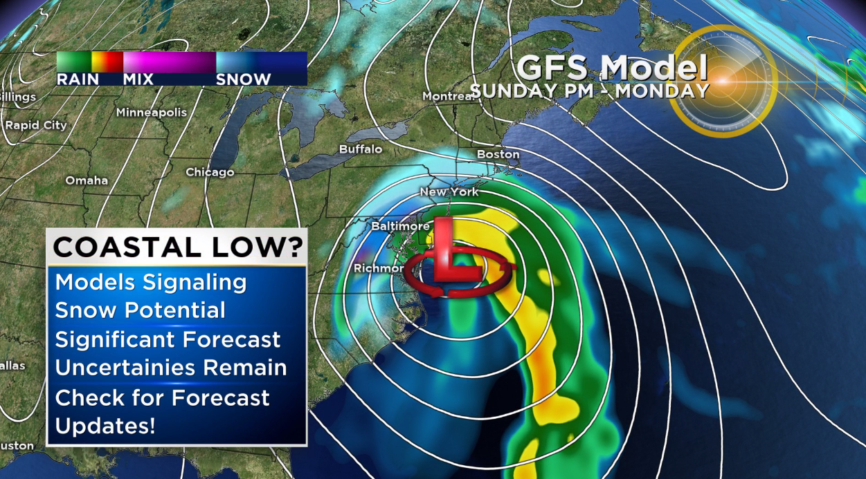
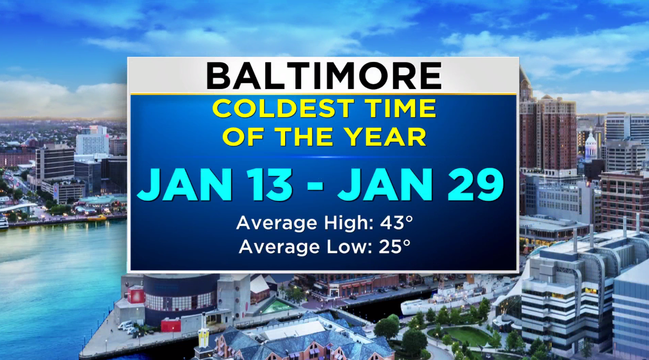 There remains a lot of uncertainty with how things will play out this weekend and into next week, however our team is closely monitoring a solution from the GFS model that suggests a coastal storm could develop and bring accumulating snow to the region. It's tough to even nail down timing potential right now because significant forecast uncertainty remains and other models suggest no snow at all with this wave of moisture.
For now we ask that you continue to check back for forecast updates knowing this scenario is a possibility. Snow or not, we will continue to fine-tune the forecast so that you know how to prepare and plan.