BLOG: Foggy Then Warm
While there are some fog patches out there early Friday morning, these should manage to dissipate by around 8 or 9 a.m.
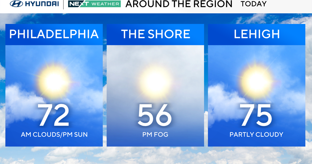
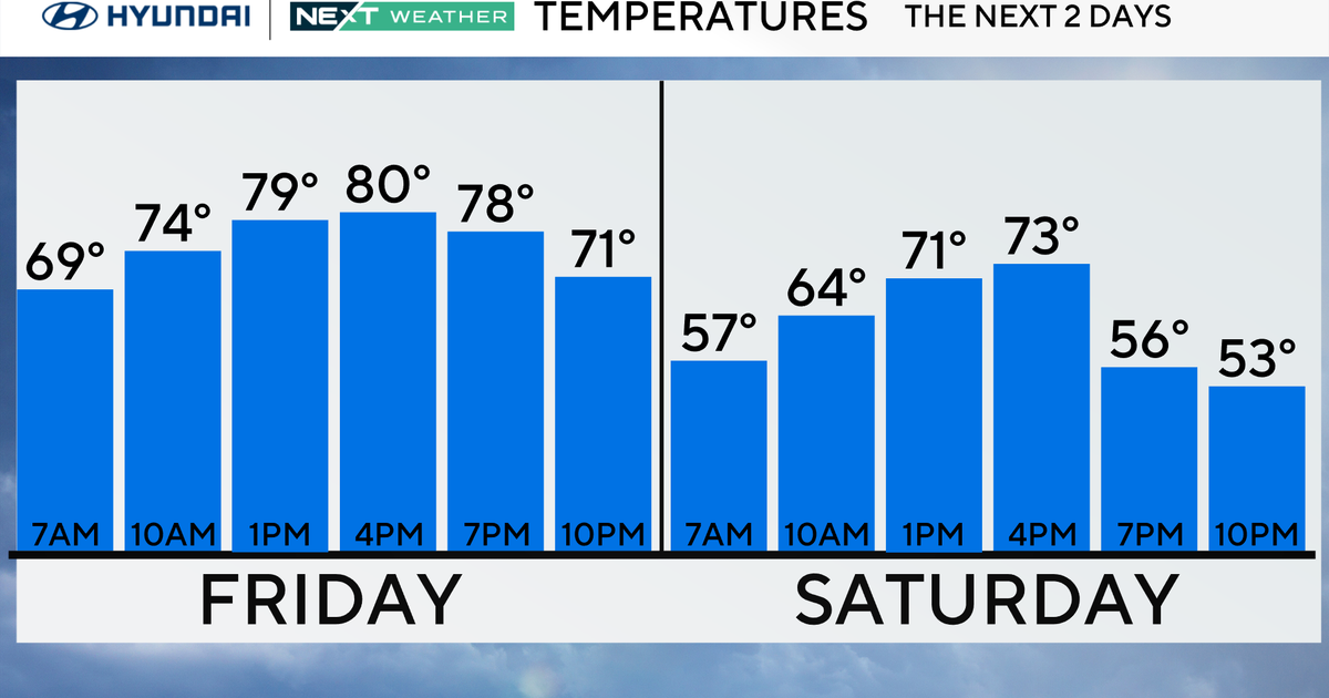
It'll be another relatively warm day, with no less than partial sunshine and temperatures mostly in the mid and upper 70s Friday afternoon. However, there are a couple of influences that will combine to change the weather pattern heading into the weekend. A back door cool front Friday night will be pushing down from the north and east, and clouds/showers located to our south and west will also begin to close in on the area. The "most likely" time periods when we will be encountering a couple of showers and a thunderstorm or two around here will be late Friday and
at virtually any time Saturday. And we'll probably also be experiencing some additional rain Saturday night and on Sunday, as well as some noticeably cooler air (temperatures Sunday will probably be no higher than the lower 60s, compared with the lower 70s Saturday.)
We should start to dry out on Sunday night, and then a cooler weather pattern should prevail early next week. We'll have to watch for the possibility of some frost during the nighttime hours (it's probably MOST LIKELY on Tuesday night, because of the combination of a clear sky and light winds.) After so many trees and shrubs have started "blooming" with the recent warmth, some of the more sensitive vegetation could be damaged by a hard freeze.
Have a good weekend !!!