Flood watch issued for much of north Georgia as up to 5 inches of rain could trigger flash flooding
The National Weather Service has issued a Flood Watch for much of north, northeast and northwest Georgia through Friday evening as multiple rounds of heavy rain move across the region.
Forecasters say widespread rainfall totals of 2 to 4 inches are expected, with isolated locations potentially receiving more than 5 inches. Urban areas and locations with poor drainage are expected to face the greatest risk of flash flooding, with the highest impacts forecast for communities north of Interstate 20.
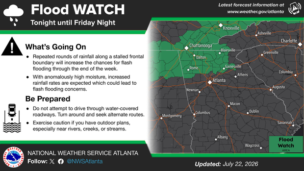
The watch includes the following counties:
Banks, Bartow, Catoosa, Chattooga, Cherokee, Dade, Dawson, Fannin, Floyd, Forsyth, Gilmer, Gordon, Hall, Lumpkin, Murray, Pickens, Polk, Rabun, Towns, Union, Walker, White and Whitfield.
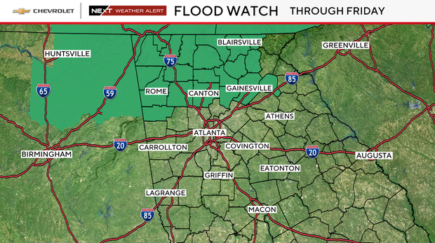
The National Weather Service warns excessive runoff could cause rivers, creeks, streams and other low-lying, flood-prone locations to overflow. Residents in flood-prone areas are urged to stay alert for possible Flood Warnings and be prepared to act if flooding develops.
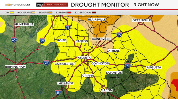
CBS News Atlanta NEXT Weather meteorologist Jonathan Myers said the rainfall will also bring some relief to portions of extreme north and northeast Georgia that remain in moderate to severe drought.
"Hopefully without damage, we can get some drought mitigation from this rain event," CBS News Atlanta NEXT Weather meteorologist Orlean Sidney said.
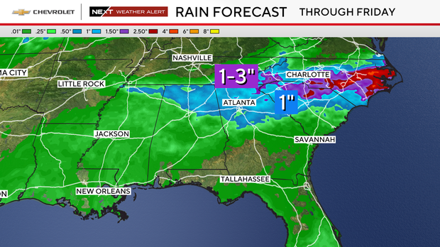
Forecasters encourage Georgians to monitor the latest forecasts as conditions evolve through the end of the week.


