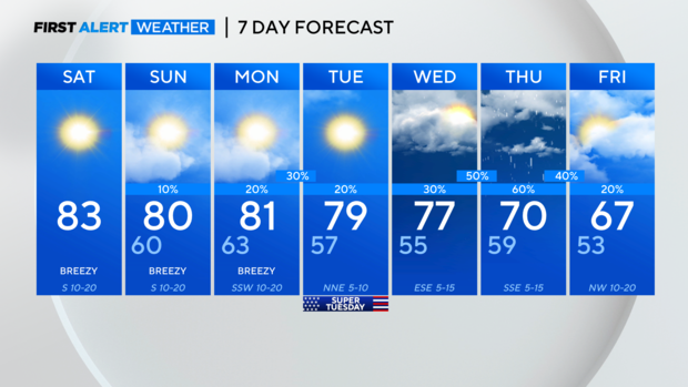
Clear skies across North Texas for a sunny Saturday
NORTH TEXAS - We are starting off with clear skies and temperatures in the low 50s. Expect lots of sunshine and breezy southerly winds today helping to boost temperatures into the low 80s!
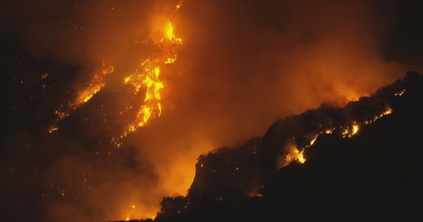
The breezy winds and dry air lead to an elevated grass fire threat for areas west of 281. Any fire that develops could spread quickly out of control.

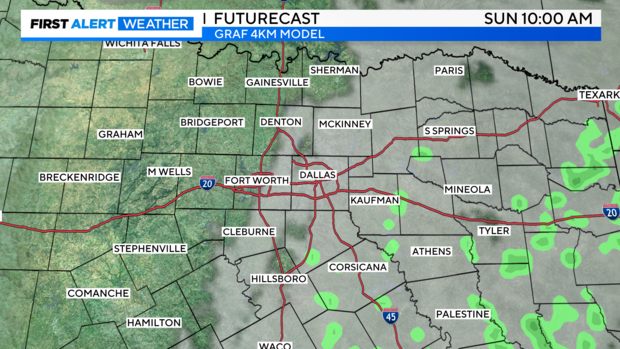
We wake up Sunday morning to some clouds and patchy fog east of I-35 with temperatures in the low 60s. A few sprinkles are possible through mid-morning for our eastern areas, while DFW will remain dry.
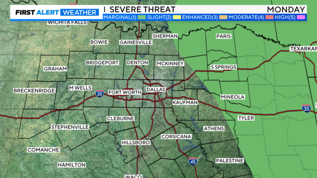
Temperatures remain 15 to 20 degrees above normal for Sunday and Monday, topping out in the low 80s. A weak front will move through Monday night returning the chance for rain and storms mainly east of I-35. An isolated strong to severe storm is possible in our eastern counties where there is a level 1, Marginal Risk, for large hail and damaging winds.
Tuesday is our lull between rain chances with sunny skies, northerly winds and temperatures in the upper 70s. Our next chance for more widespread precipitation arrives Wednesday into Thursday and also brings the potential for thunderstorms, a few may be strong to severe. We are back to more seasonal temperatures, in the upper 60s by the end of the week.