Timing out rain and snow across Northern California; here's the impacts it may bring to your commute
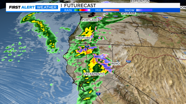
Our first storm system has entered the region bringing rain to lower elevations and snow to the mountains. This will continue to bring impacts through the rest of the day Wednesday before a second storm lines up Thursday.
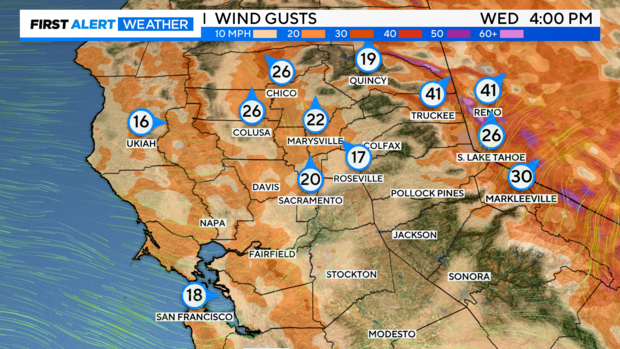
This will bring a wet and breezy evening commute, and we could see some delays and closures across our mountain passes with heavy snow expected.
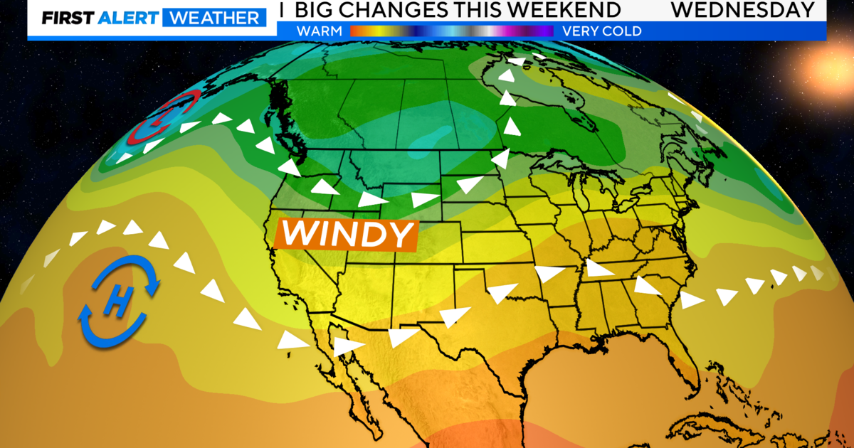
A large Atmospheric River has been stretched the Pacific Northwest bringing heavy rain, snow and flooding to Washington and Oregon. The weaker part of this system is what we will be catching Wednesday into Thursday.
Both systems will not be a big rain producer for the valley as light accumulations are expected during the 48-hour weather event. But there will be periods of moderate-heavy rain and larger precipitation amounts for the foothills and Sierra.
Traveling over the mountains may become difficult with heavy snow at times and strong wind gusts.
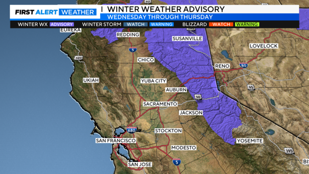
A Winter Weather Advisory is in effect starting at 4 p.m. Wednesday through 10 p.m. Thursday.
Valley Rain
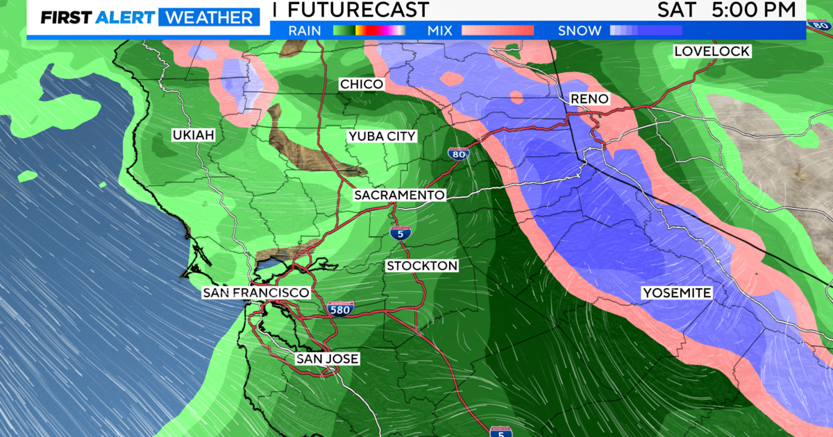
Rain will be light to moderate across the valley through the early Wednesday evening then partially clear late in the day with more rain expected Thursday.
Showers trek west to east with heavier pockets of rain across the foothills and mountains.
An isolated thunderstorm can't be ruled out from I-80 up to Redding through Wednesday afternoon. These storms could produce brief heavy rain, gusty winds, lightning and small hail.
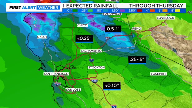
We're expecting up to .25'' across the Valley with larger amounts the further north and east you travel from the Sacramento Valley.
Across the foothills and Sierra .50'' to an inch can be expected through Thursday.
Slick roads will be possible across the region. Make sure to give yourself a little extra time and slow down Wednesday evening through Thursday morning.
Sierra Snow
Snow has started off at pass level Wednesday afternoon, but will drop to 4,000 feet in elevation as colder air arrives Thursday.
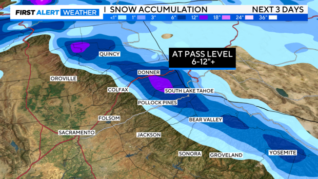
Main passes could get 2-4" of snow on Wednesday, with more expected throughout the day Thursday.
Our second round of snow will arrive through Thursday afternoon. This will be part of our second storm system, which will bring colder air.
Combined with what we receive Wednesday, 6'' to a foot of snow is expected over the passes. Some of our taller peaks may pick up over a foot depending on how long cold air sticks around and how quickly the second system moves across.
Wind will play a factor across the Sierra on Wednesday as gusts up to 45 - 50mph will be likely. This could lower visibility and produce blowing snow.
Be prepared for the winter weather and travel delays if driving you are driving over the passes over the next few days. Chain controls may be possible.
Looking Ahead
Storm systems move to the east as we head into Friday. We may see more fog develop early Friday before more sun and cool temperatures to finish off the workweek. Your weekend forecast is also looking nice with highs in the upper 50s.
Make sure to stay with the CBS Sacramento First Alert Weather team for forecast updates.
