J. B. Macelwane archives, Saint Louis University
Wrecked arches, Geology Building, Stanford University.
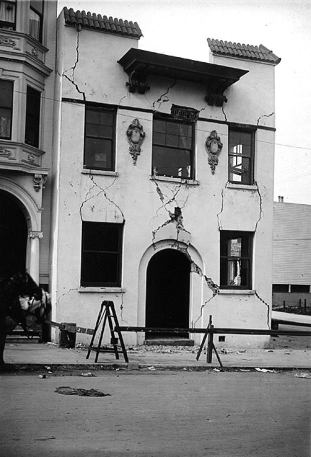
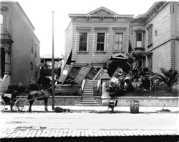
San Francisco Earthquake, 1906
J. B. Macelwane archives, Saint Louis University
Plastered brick house on 15th St., San Francisco, corner Landes looking east.
San Francisco Earthquake, 1906
J. B. Macelwane archives, Saint Louis University
San Francisco, Howard St., just south of 21st St.
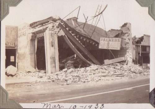
The Destroyed Building of an Automotive Garage, Southern California, 1933
contributed by the Griffin Family, U.S. Geological Survey
The destroyed building of an automotive garage. Location: Long Beach, CA, USA March 10, 1933.
Mexico City's Hotel Intercontinental,1985
The upper floors of Mexico City's Hotel Intercontinental collapsed onto lower floors during a magnitude 8.1 earthquake on Sep. 19, 1985.
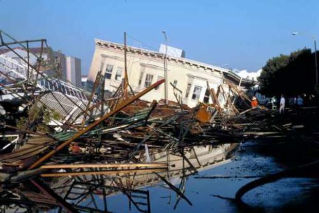
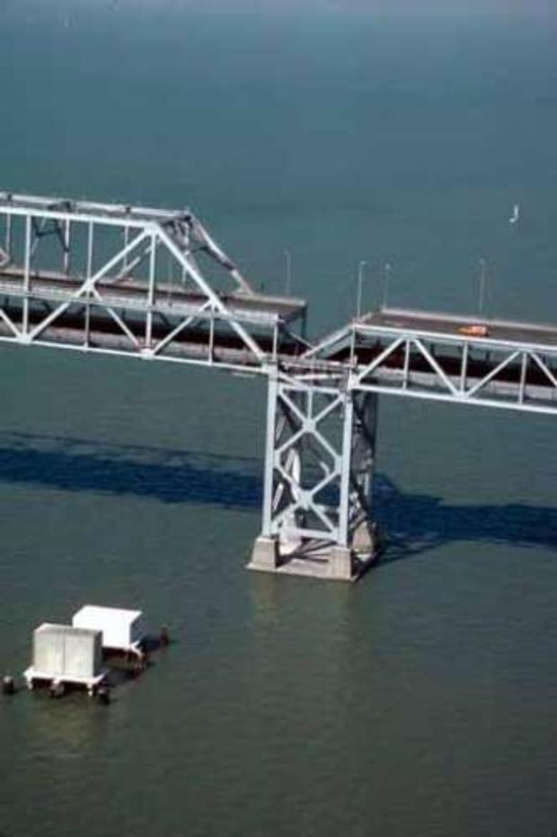
Loma Prieta Earthquake, 1989
C.E. Meyer, U.S. Geological Survey
Ground view of collapsed building and burned area, Beach and Divisadero Streets, Marina District. Location: San Francisco, October 19, 1989.
Loma Prieta Earthquake, 1989
C.E. Meyer, U.S. Geological Survey
Aerial view of roadbed collapse near the interface of the cantilever and truss sections of the San Francisco-Oakland Bay Bridge. View northwestward.
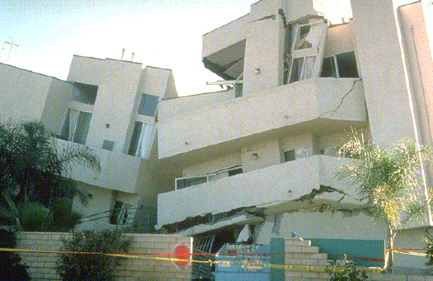
Northridge Earthquake, 1994
Ken Fowler, SCEC Data Center
Rear view of a damaged three-story apartment house with a first-level garage. The two wings of the building collapsed into each other across the formerly intervening courtyard during the partial collapse of the parking level.
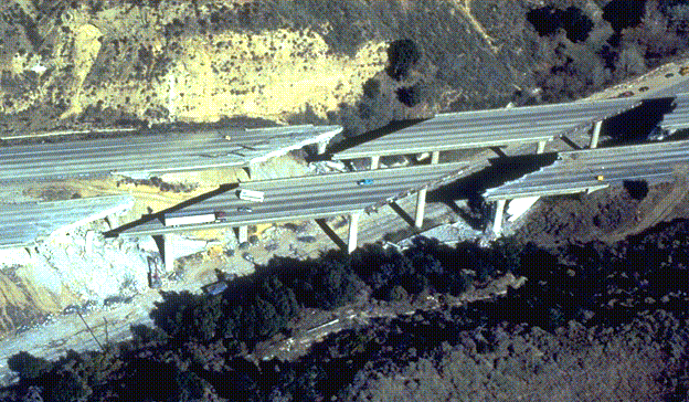
Northridge Earthquake, 1994
Ken Fowler, SCEC Data Center
Aerial view of the collapsed freeway interchange between I-5 and the Antelope Valley Freeway.
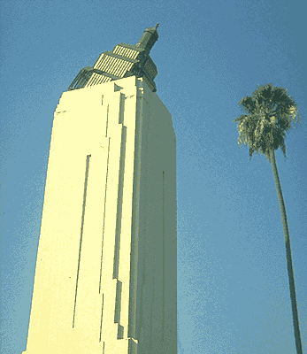
Northridge Earthquake, 1994
Ken Fowler, SCEC Data Center
The toppled crown atop the 95-foot high tower of a 1920 Art Deco building on Hollywood Boulevard, Los Angeles.
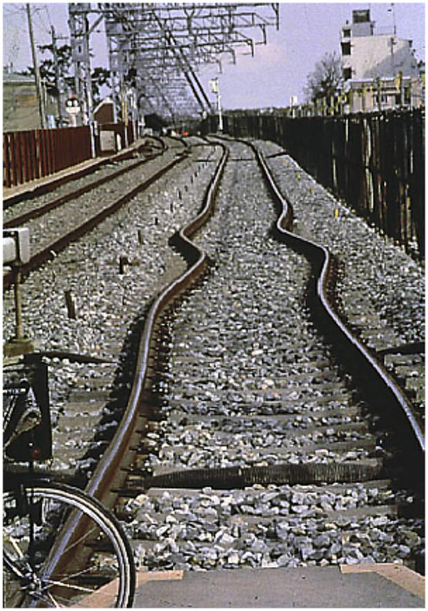
Kobe, Japan, 1995
U.S. Geological Survey
These bent rail tracks from Kobe, Japan, provide a vivid reminder of the power of the magnitude 6.9 Hyogo-ken Nanbu earthquake that struck on Jan. 17, 1995 and caused more than 5,000 deaths.
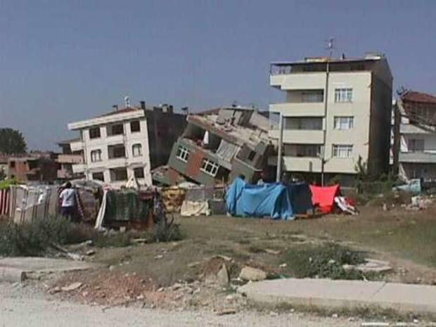
Izmit, Turkey Earthquake, 1999
U.S. Geological Survey
A view of a few damaged buildings in the earthquake region, August 26, 1999.
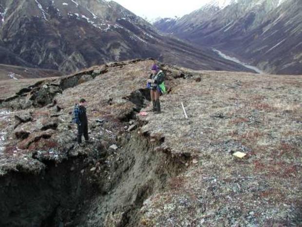
Denali Fault: Sustina Glacier, 2002
Peter Haeussler, U.S. Geological Survey
Peter Haeussler examining the Denali fault trace on the Susitna Glacier to find matching ice surfaces to determine amount of fault offset.
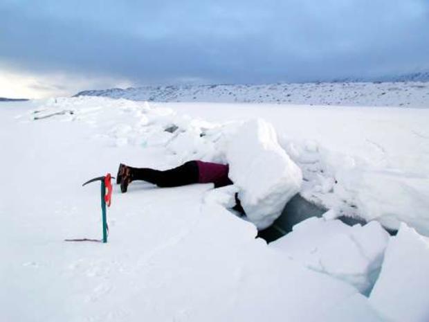
Delta River, Alaska, 2002
Peter Haeussler, U.S. Geological Survey
At pass west of Delta River, Alaska. Here there was roughly 5 m of offset. Note the push up in the background. There is permafrost at the bottom of the cracks.