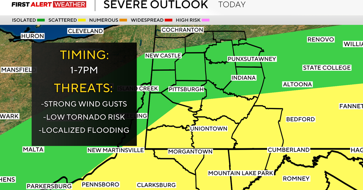
Philadelphia Winter Weather Outlook: Should Delaware Valley Residents Be Bracing For Harsh Winter?
PHILADELPHIA (CBS) -- Record cold in November brought a winter preview to the area, and it won't be long before real winter descends on the Delaware Valley. So just what kind of winter should we be expecting?
When creating or evaluating a winter outlook, it's important to know the limitations. It's difficult to forecast a particular storm, let alone an entire season.
The Eyewitness News Weather Team looks at trends, past years and forecast models to provide a clearer picture of what winter could be like.
However, we all know that a forecast made months in advance is not truly a forecast but more of an educated guess about what could happen. Most of the actual forecasting comes down to the synoptic level – monitoring storms as they form instead of trying to guess how many there will be in advance.
This is useful, however, to be able to have a read on the forecast, even in a general sense, to prepare for what the harshest months of the year will bring.
Professor Dan Leathers from the University of Delaware at Newark recently authored a journal article about the changes in weather forecasting -- in particular, snowfall. CBS3 meteorologist Lauren Casey visited the college to ask him why winter forecasts are so difficult to pinpoint.
He says that our area is much more difficult than many other parts of the country because we have so many micro-climates -- much of that is because of our proximity to the ocean. Also, we have the Delaware Bay and many different topographic areas to consider.
Leathers also states that forecasting snowfall is best done in indicating its likely comparison to average -- that is to say, whether it'll be an above-average or below-average winter, rather than trying to pinpoint a range or a number. He remarked that you could have the warmest winter on record but if the conditions set up perfectly and you get one major snowstorm, you could get your annual average in one day.
With that hefty disclaimer stated, let's talk about the winter outlook for 2019-2020.
This year is interesting in that it lacks any one major driving factor. We often use the southern oscillation, more commonly known as El Nino or La Nina, as a jumping-off point for winter forecasting. This year, we have neither -- this is called ENSO neutral.
One development in the sea surface temperature arena is building warmth in the northeast Pacific. If that warmth continues to build through the winter, it may result in ridging in the west and persistent cold in the east. This would lead to prolonged cold shots and a potential storm track right through our area.
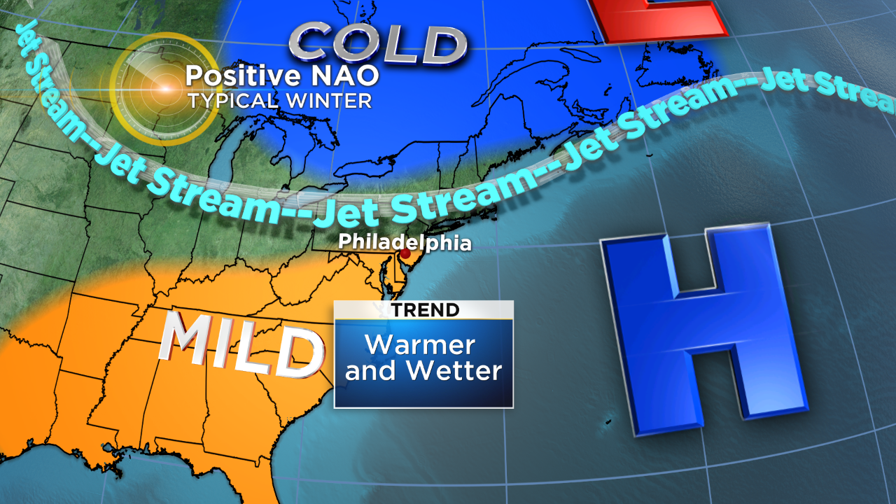
And then there's the NAO.
The NAO is a very important fluctuation in the atmosphere that has a direct correlation to our winter weather. When the NAO is positive, we tend to be warmer and less stormy.
A negative NAO tends to correlate to cold and snow.
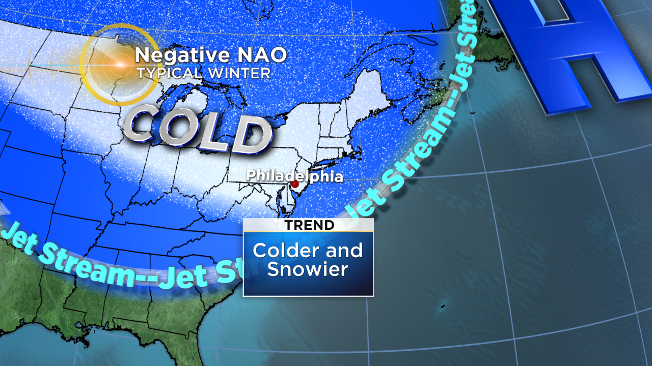
You might say, OK, so look at the NAO and make the forecast from there. The problem is that the NAO can only be forecasted several weeks in advance, not months.
We often look at other similar years, which are called "analog" years to gain insight on an upcoming winter. This winter setup, including the warmth in the Pacific Ocean, is actually quite similar to a winter we enduring five years ago -- the winter of 2014-2015.
That winter featured record cold, especially in February and March and near average snow -- slightly above average but not a blockbuster snowfall year.
Because of our cold month of November, the weather team also looked at the top 10 coldest Novembers in Philadelphia. When averaged out, snowfall in these 10 winters was near normal.
However, one of those years was the winter of 1995-96 when, of course, the blizzard of '96 helped bump our snow total to over 65 inches. This perfectly illustrates how even a perfectly crafted forecast can be undone with one huge blizzard.
So what does this all mean for the coming winter?
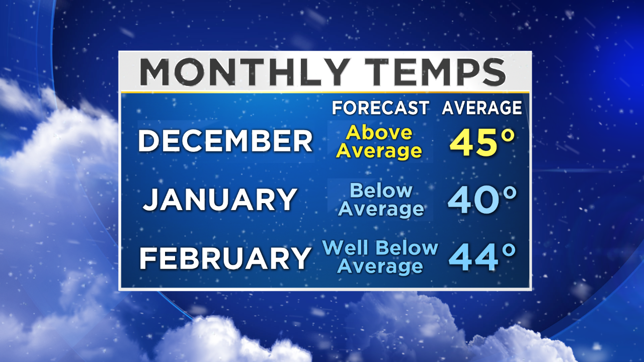
After the cold November, the weather team expects a flip to a milder month of December before the worst of the winter cold arrives in January and February. It's quite likely this will last into March as well.
Another of our analog years was the winter of 1980-1981 -- a year with a cold November and ENSO neutral state coming off of a weak El Nino. This winter had below-average snowfall but record cold in December and January.
Since both our close analogs featured extreme cold, the team thinks there's a good chance the set up this year will be favorable to prolonged arctic cold spells.
Overall, temperatures will be slightly below average this winter.
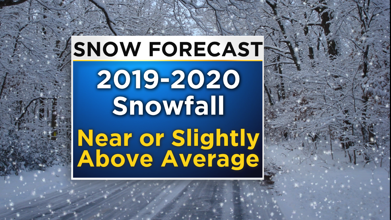
Our average snowfall in Philadelphia is 22.6 inches, and this winter it looks likely that we'll be near or slightly above average. We will have several decent snows but also issues with mixing and changing over to rain, especially around the city and points south.
If a moisture-rich storm does happen to arrive during one of the aforementioned arctic cold snaps, watch out.
It's important to remember that even one major blockbuster storm can completely change the outcome of winter, and those storms cannot be forecasted months in advance.