Philadelphia weather: Plenty of ups and downs this week

PHILADELPHIA (CBS) -- It's a shorter work week for many, with Presidents Day kicking off Monday — but there's no shortage of interesting weather for the Delaware Valley!
With extremes at both ends of the temperature spectrum, and a few chances for rain, it's best to have your year-round weather gear close at hand.
A mild start
Sunday was warmer than Saturday, and Monday will continue that trend. After a foggy start (especially along the Jersey Shore), expect partly to mostly cloudy skies and highs in the upper 50s to near 60 degrees. Despite a chance for a stray shower or two along an approaching cold front, breezy south winds will help to propel temperatures 15 degrees above average.
Better rain chances come into play, although briefly, overnight into Tuesday. Tuesday morning's commute, with many of us back to work and school should be fine, with a bulk of the showers east and out before 7 a.m.
Highs Tuesday will once again approach 60 degrees.
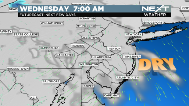
Mid-week changes
While Wednesday starts off dry, an approaching warm front will lift across the area, increasing the wind and a chance for rain.
Showers should move in late Wednesday evening for Philadelphia and South Jersey and last overnight into early Thursday. Further north, enough cold air may be in place Tuesday night and Wednesday morning that the precipitation starts off as a brief period of snow or a wintry mix.
The area with the best chance to receive this would be the northern Lehigh Valley region over toward the Poconos. Rain exits Thursday morning.
Overall, Wednesday is a cool day—that is until the warm front clears the area in the evening. As it lifts north, our temperatures rise Wednesday night, giving us a close-to-record breaking Thursday…
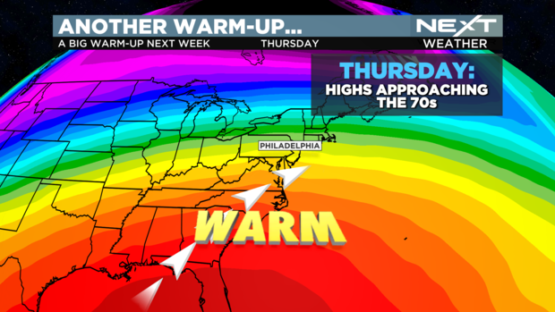
Thursday
Thursday gets its own header, as seen above. With the rain ending early and some sun peeking out, Thursday's high could very well top 70 degrees in the city and potentially get close to the mid-70s for South Jersey. The record in Philadelphia is 75, so while we may not break it, we'll certainly get close. Thursday night should be clear and mild, before the cold front moves in for Friday, significantly cooling us down.
Back to reality…
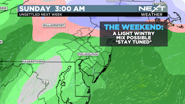
The truth is, we *should* be in the middle 40s this time of year and at least some of the time be tracking some winter weather. For you winter lovers, the good news is that we will see decreasing temperatures Friday (mostly sunny skies) followed by our next system moving in for the weekend.
Here's the thing: it's still early. There are a lot of factors that may change the weekend outlook, but for now, expect a brief period of a wintry mix Saturday, changing to all rain Sunday. The temperatures look to significantly warm up for the second half of the weekend, so anything that does fall as snow or ice Saturday won't be sticking around long.
What we *DO* know, is that this will not be a significant winter storm for Philadelphia. We'll continue to monitor these drastic and dramatic changes and temperature swings and continue to keep you posted all week long.
Have a great week!


