Philadelphia Weather: Will region finally see snow Wednesday?
PHILADELPHIA (CBS) -- The NEXT Weather team is tracking a mid-week storm in the Philadelphia region, but the biggest question remains: Will Philadelphia finally see snow?
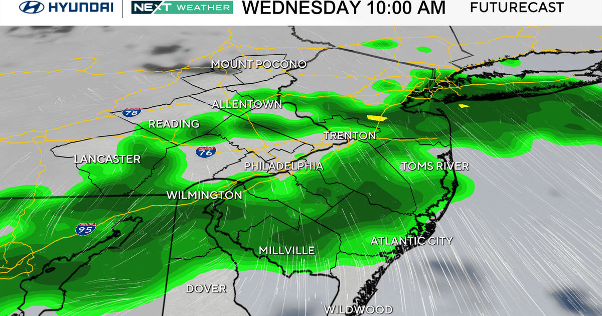
With plenty of sunshine and slightly above-average temperatures, Tuesday was the "calm before the storm" as a major system from the southwest moved into the Delaware Valley Wednesday morning. As of right now, the NEXT Weather team is anticipating:
- Precipitation to enter much of the area by the mid-late morning
- Some snow across the Lehigh Valley, mainly rain along the Jersey Shore, a brief mix of both in the Philadelphia and the metro area
- Warmer air changing much of the snow to all rain by the mid-late afternoon
- Fierce winds gusting over 35 mph
Plan on budgeting extra time to travel throughout the day, as roads will be wet all the way through the evening commute and beyond.
Our team has designated Wednesday as a NEXT Weather Alert Day.
The Timing
The good news is that the morning commute will be OK, with dry air making it difficult for much of anything to reach the ground early on. In fact, even later commuters should see rain and snow-free roads through at least 9:30 a.m. to 10 a.m. By the late morning, the system will start sending snow to the Lehigh Valley and a few flurries to the Philadelphia area.
Farther south and east, precipitation along southern New Jersey and the shore will start and remain all rain.
North of I-78, cold enough air will allow the snow to stick. This will last through the afternoon before the warmer air arrives.
For everyone, precipitation leaves us late Wednesday night in the form of a few sprinkles and showers, with some clearing likely by Thursday morning.
The Impacts
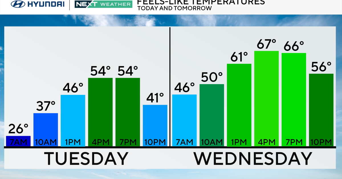
While a few snowflakes are possible for Philadelphia, accumulation is unlikely. Warm air moved into the region ahead of the main front, pulling us into the 40s, and changing the precipitation to rain. For Philly, this is a big rain and wind event, with a very treacherous evening commute likely. Rain amounts could exceed 1.5 inches, resulting in flash flooding.
Southern Jersey and the shore are likely to experience an all-rain event, with torrential downpours through the early evening. Combine this with the wind, and it's advisable to avoid being out throughout much of the day, if possible.
Rain will eventually become steady Wednesday afternoon and into the evening commute.
As for the snow, expect a coating at best in the city, with 2-4 inches in the Lehigh Valley, and 4-6 inches in the Poconos, before the late-day changeover to rain. With increasing temperatures, much of the accumulating snow, even in the mountains, should wash away before the system exits the area early Thursday.
Stay with the CBS News Philadelphia NEXT Weather team as we track the storm, tweak the totals, and keep YOU informed.
