A white, windy Christmas is forecast
Updated 4:43 p.m. ET
A string of powerful storms in the West, Midwest and Southeast may generate a white Christmas for parts of the country, but the snow will come with hazardous travel conditions. The South and southeast could even see tornadoes.
Motorists are encouraged to allow extra travel time for traveling during the holiday.
AAA expects 93 million people to drive at least 50 miles this holiday season, but even those who've dug themselves out from last week's heavy snow in the Midwest should keep their shovels handy.
Those hoping for a white Christmas will get their wish, but many may be stuck seeing Santa in the airport. More than 5,000 flights have been canceled this week as snow smothered the Midwest.
In New York City, Shannon Hennessey and her daughter Lydia were among thousands of stranded travelers, determined to find a way to get where they are going before the holiday.
"We don't want to spend Christmas in Laguardia," Hennessey told CBS News.
Meteorologist Jeff Berardelli of CBS Station WFOR says much of the country's East and Southeast will be affected by a system moving through the region, bringing snow in places like Pennsylvania and New York, causing minor flight delays there.
There were already whiteout conditions in Reno Nevada. CBS Utah affiliate KUTV reports cars with four-wheel drive or chains on their tires were allowed to drive in the area Tuesday afternoon.
But the bigger story, Berardelli says, is what happens in the South and Southeast during the day Tuesday into Wednesday: A widespread severe weather outbreak affecting eastern Texas, Louisiana, Mississippi, Alabama, and Georgia, bringing the threat of isolated tornadoes and strong, damaging winds of more than 60 mph.
"We urge you to stay vigilant if you're in the Southeast," Berardelli said on "CBS This Morning."
On the northern side of this same system is a lot of heavy snow, which will bring a white Christmas to places like Little Rock and parts of St. Louis. But the same storm, as it moves into the Ohio Valley, Great Lakes, and interior Northeast on Wednesday, will dump more than a foot of snow in places. "That's going to cause major travel problems as we head on into Wednesday and Thursday morning as well," he said.
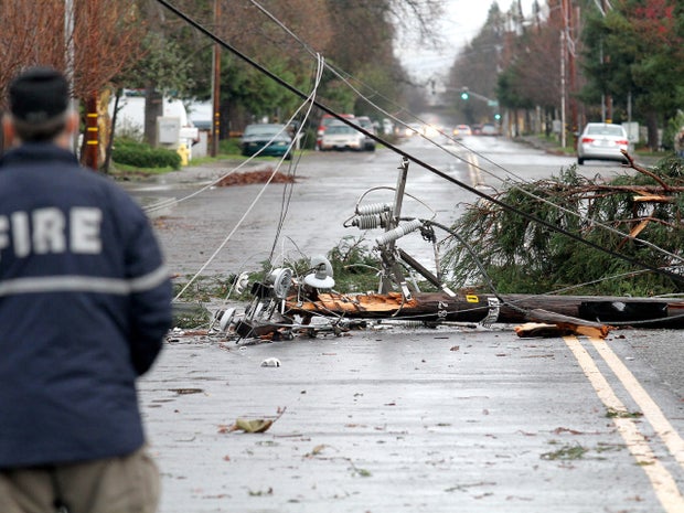
On the Pacific coast, another fast-moving storm has been drenching the Bay Area with so much rain that flood warnings have been issued near San Francisco, and in the higher elevations of the Sierra Mountains more than three feet of snow trapped drivers for hours over the weekend.
As the storm passes over the Rocky Mountains, it is expected to dump snow across eastern Utah and parts of Wyoming and Colorado on Monday and disrupt travel at Salt Lake City's airport on Christmas Eve. The Denver area is expected to get between 6 to 10 inches in high country by Christmas Day, as the storm piles more snow onto the Midwest today into tomorrow.
The National Weather Service says up to 10 inches of snow is possible in some areas of Oklahoma and Arkansas.