Miami Weather: Alert Day declared due to deluge of rain
MIAMI - Monday's soggy morning has led to a NEXT Weather Alert Day across South Florida.
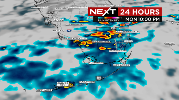
The main impact is heavy and slow-moving rain that will cause flooding especially now that the ground is already saturated enough from Sunday's washout.
Monday's rainfall forecast is between 1" to 2" inches but higher amounts are possible in localized areas.
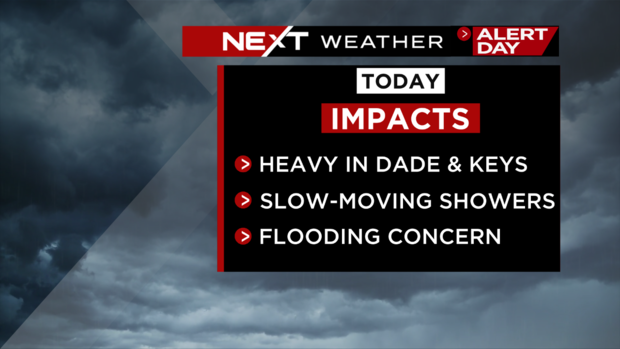
Through the rest of Monday expect the rain to impact areas of Miami-Dade and the Florida Keys.
There is a chance for storms to develop over the Atlantic and Straits and produce waterspouts.
Broward hasn't seen much rain but is not out of the clear. The forecast models show heavy showers developing later in the day into the evening across Broward.
It's cloudy and breezy which will keep temperatures cooler than normal with highs in the mid to upper 70s.
The wet pattern will continue through Tuesday with spotty showers developing early in the day. Once Wednesday arrives, the rain chance will drop and it will be noticeably less humid with more sunshine by Thursday in time for the Thanksgiving holiday.
The next cold front will sweep South Florida Saturday night with cooler temperatures behind the front arriving on Sunday.
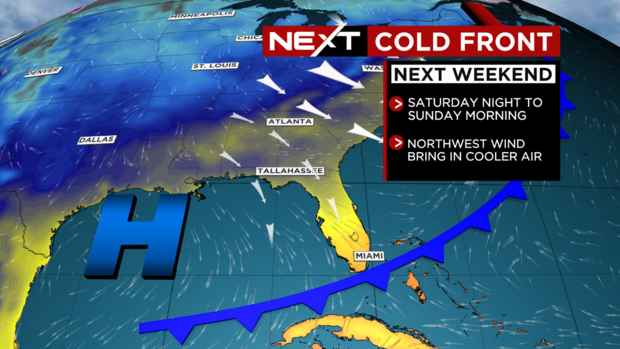
Temperatures are expected to jump back to the seasonable low-80s as the drier weather returns for Thursday, Friday, and Saturday. Then dropping to the low 60s on Sunday morning with mid to upper 70s Sunday afternoon.