Josh Rubenstein's Weather Forecast (October 25)
STUDIO CITY (CBS) — It will be cool again Tuesday, as the trough that's off to the west sweeps through our area.
Aside from an overnight sprinkle and a little early morning patchy drizzle from the marine layer, we're not expecting much after the cloud cover clears away.
We will then transition into an off-shore flow event that will bring us very low humidity.
As the trough of low pressure exits and high pressure builds into the Great Basin, we get a classic inside slider, which means the air will be very dry.
The National Weather Service has issued a fire weather watch for the mountains of Los Angeles and Ventura counties.
Temperatures will bump up as we make our way through the middle of the week.
Look for highs to reach into the upper 70s and low 80s. The height of this event will be Wednesday evening into Thursday morning. We will get some cooling next week.
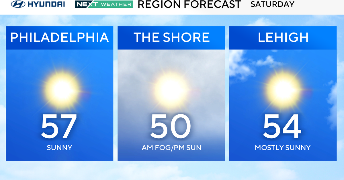
Coastal - mid 60s
Basin - upper 60s
Valleys - low 70s
Mountains - low 60s
Deserts - mid 70s