Severe thunderstorms could hit Southern California as Easter weekend storm continues
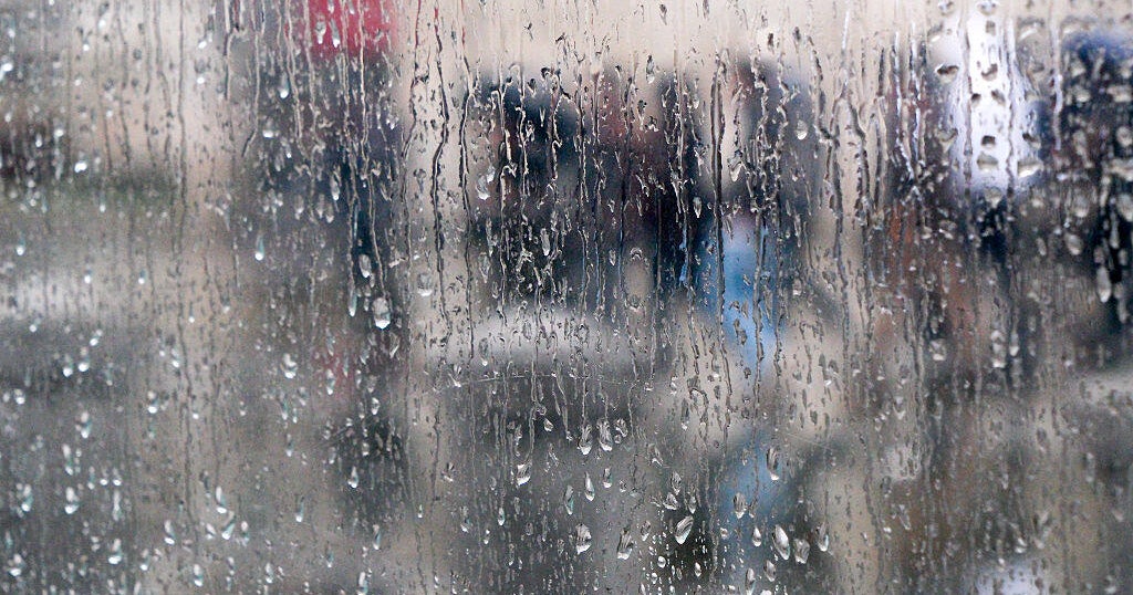
A storm system has moved in the region and is expected to give the Southland a wet Easter weekend.
The "unseasonably cold and vigorous storm system" is expected to bring rain to most areas, including a chance of thunderstorms, along with mountain snow, according to the National Weather Service.
The system is expected to hit hardest late Friday night through midday Saturday, with showers and possible thunderstorms lingering through Sunday, "some of which could be very strong with very heavy downpours, hail, gusty winds and possibly even a small tornado or waterspout."
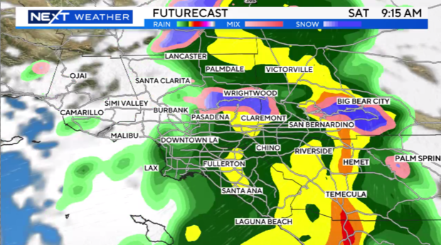
At around 1 p.m. on Saturday, NWS officials reported that "thunderstorms are forming" and "are expected to expand in coverage" through the evening.
"Some may become severe with damaging winds and/or hail," officials continued.
The storms were predicted to hit northern LA County between 6 p.m. Saturday evening and 6 a.m. Sunday morning.
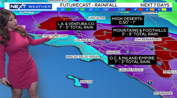
Rain totals of 1.5 to 3 inches are anticipated in coastal and valley areas, with as much as 5 inches possible along some south-facing mountain slopes.
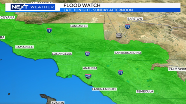
Early Saturday morning, flash flood warnings were issued through much of Central and Southern Los Angeles County starting on Friday evening and lasting through Sunday afternoon.
As usual during periods of heavy rain, county officials closed the Sepulveda Basin due to the heightened risk of flooding in the area. The closure impacts Burbank Boulevard between Balboa Boulevard and the 405 Freeway, and Woodley Avenue from Victory to Burbank Boulevard.
Most of the precipitation is anticipated late Friday and Saturday, but showers are likely to continue through Sunday, according to the NWS.
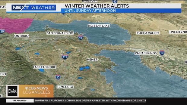
Snow could fall at elevations as low as 4,500 feet, with forecasters saying there's a chance of as much as 3 inches falling at even lower elevations. A foot or two of snow is anticipated above 6,000 feet, affecting motorists on Angeles Crest Highway and Highway 39. Drivers heading through the Cajon Pass on Saturday morning had to deal with some light snow and gusts of wind as well.
Watch: Southern California mountain communities hit hard by snow
A winter storm warning will be in effect from 2 a.m. Saturday through 11 p.m. Sunday for the San Gabriel Mountains and the Golden State (5) and Antelope Valley (14) freeway corridors, with forecasters warning that "travel could be very difficult to impossible."
Gusty winds are also expected to accompany the storm, beginning Friday in San Luis Obispo County then spreading south through Saturday.
There will be a slight chance the storm activity could linger into early Monday, but "otherwise dry and warmer conditions are expected next week, with highs back into the 70s across the valleys and inland coastal plain areas by Tuesday."
Evacuation orders
An evacuation order has been issued for residents in the unincorporated area of Santa Paula along SR-150 due to additional slide activity, according to the Ventura County Sheriff's Department. The order went into effect at 10 a.m. on Friday.
RELATED: Massive mudslide shuts down SR-150 in Santa Paula
A mudslide happened in the area after rainstorm in February, causing a 12-mile stretch of SR-150 to remain closed in both directions.