Temperature records could fall in Northern California as heatwave arrives Tuesday
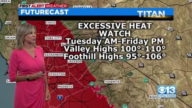
An excessive heat watch goes into effect Tuesday morning and will extend all the way through Friday night. We'll see near-record high temperatures.
During the heat watch, in the daytime, we could see temperatures anywhere from 96 to 110 degrees. Our records are anywhere from 105 to 110. Overnight low records are in the 70s. We could see those as well, so plan your day as we move through the week. The hottest hours of the day are between about 2:45 p.m. and 6 p.m.
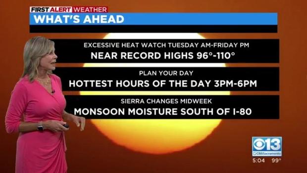
Monsoon moisture will start to move back into the picture and much of that will remain south of Interstate 80. This is not combined with any fire weather but it will be hot and dry.
We won't have the winds and the relative humidity. The low relative humidity extends all the way through the Central Valley into the lower foothills as well as all Bay Area communities. Lake, Napa, Sonoma Solano, Contra Costa counties -- all of that will be encompassed by this intense heat watch.
A high-pressure area that is building is going to park over us and this is the reason for the heatwave. This is going to be in place all week long.


