First Alert Weather Day until afternoon, more heat this weekend
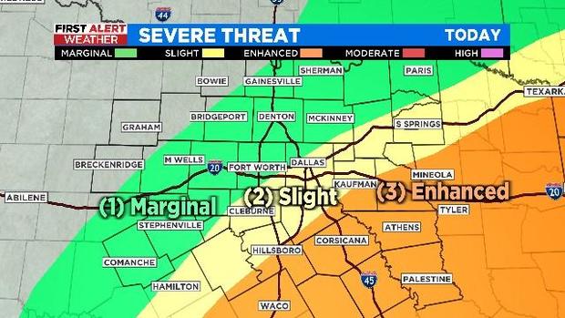
NORTH TEXAS (CBSDFW.COM) - Chances are growing slimmer that North Texas will experience a last round of severe weather on Thursday.
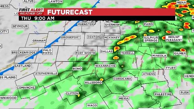
The showers and storms are developing ahead of a cold front this morning into early afternoon. Some areas west of Interstate-35 won't see any rain today, most of the precipitation will be focused east of I-35.
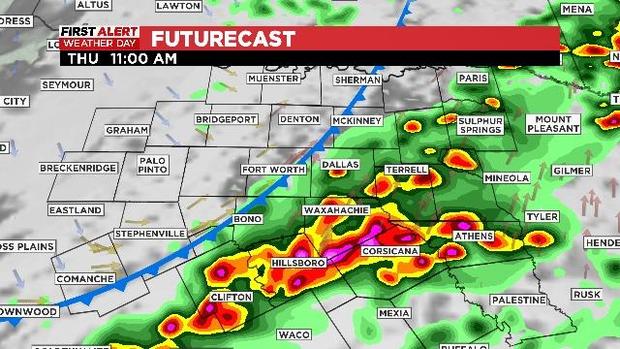
As of 11:00 a.m. storms were already popping up northeast of DFW.
With the latest update, the national Weather Service Storm Prediction Center has shifted the severe risk a bit to the east, lowering the severe threat in the Metroplex.
The main concern for DFW is damaging winds -- between 60 and 65 mph. The severe threat increases towards midday and early afternoon, as the storms head east into the enhanced risk area.
Large hail, damaging winds and an isolated tornado are possible south and east of DFW. Localized flooding is also possible.
Are you heading out this evening to celebrate Cinco de Mayo? Well, leave the umbrella at home. The storms will end from west to east as skies across North Texas clear behind the front.

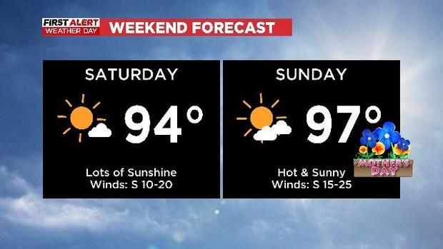
Enjoy the last vestiges of spring Friday morning, with temperatures in the upper 50s under clear skies. Sunny skies during the afternoon will extend into the weekend as temperatures heat up. A hot and windy Mother's Day on the way.
But I would love to see your family pictures. Send them my way so I can include them in my weekend update emails, and maybe, just maybe, you will find yourself in a weather graphic on air this weekend.


