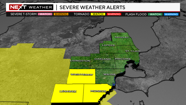
Tornado watch issued for Lenawee, Monroe and Washtenaw counties until 11 p.m. Tuesday

(CBS DETROIT) - Rain has already moved through, but now we are tracking the stronger storms approaching Southeast Michigan.
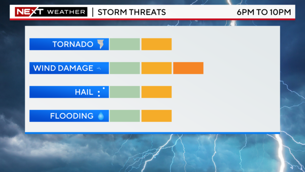
After the first round of rain, comes the second, which is anticipated to be followed by stronger storms around dinnertime 6 p.m. to 11 p.m.
A tornado watch has been issued for Lenawee, Washtenaw and Monroe counties until 11 p.m. Tuesday.
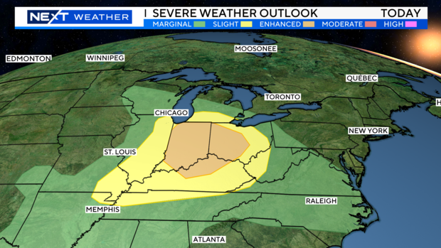
The Storm Prediction Center has highlighted the I-94 corridor and points north under a marginal risk for severe weather. (Category 1 out of 5). Then a slight risk from I-94 to the south (Category 2 out of 5, severe storm risk.)
The biggest threat with this storm system will be winds gusting to 60 miles per hour, large hail around 1 inch in diameter, and heavy rainfall within the storms. However, an isolated tornado cannot be ruled out.
Stay weather aware for today and follow your NEXT Weather team for the latest updates. Also, in case a watch or warning gets issued for your area make sure you have a way to get those weather alerts.
For your latest NEXT Weather forecast, watch on air on CBS Detroit, online on CBSDetroit.com, or streaming on the CBS Detroit app, Paramount+, or PlutoTV.


