Denver Weather: Near 70 Degrees Today Before Winter Returns With Cold And Snow
DENVER (CBS4) - A storm approaching from the west and a cold front approaching from the north will bring significant changes to Colorado's weather starting Thursday.
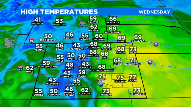
Prior to the front and storm arriving, temperatures will soar into the upper 60s to near 70 degrees in the Denver, Boulder, and Fort Collins areas on Wednesday. It will also be mostly sunny and breezy at times with southwesterly winds gusting up to 25 mph. Temperatures will be about 15 degrees above normal but far from a record. The record high in Denver for March 11 is 79 degrees set in 1900.
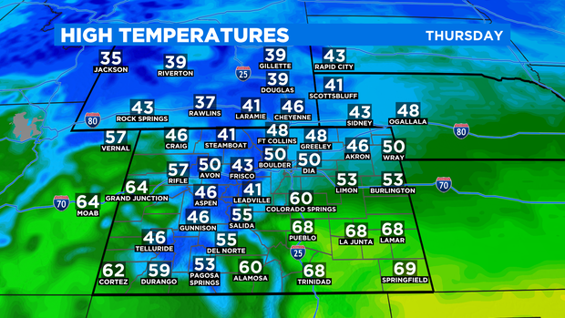
Thursday will be about 20 degrees colder with highs reaching near 50 degrees in the morning before a cold front arrives. Behind the front, temperatures will be in the 30s and 40s the remainder of the day.
It's possible a few sprinkles or even snow flurries could be squeezed out as the cold front passes on Thursday but any precipitation will be very limited and there is no chance for accumulating snow in the metro area on Thursday. Snow will wait until Friday when the actual storm system arrives behind the front.
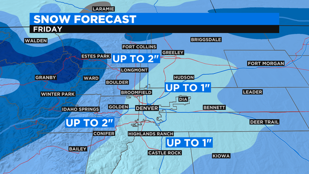
As of Wednesday morning, it looked likely most of the the Denver metro area would see up to 1 inch of slushy, wet snow on Friday. Areas farther north including Boulder, Longmont, Loveland, and Fort Collins could see up to 2 inches. It should be emphasized there is no lower threshold with the snow forecast and some areas may get no accumulation whatsoever.
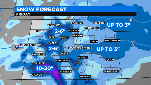
Farther east amounts are expected to be higher. Locations east of Limon and Fort Morgan including Sterling, Holyoke, and Burlington could see up to 3 inches of snow. Most mountain areas are looking at 2 to 6 inches of wet snow on Friday expect in the San Juan Mountains where amounts could reach 20 inches.
Snow chances will end Friday night for the metro area while a few snow showers could linger in the mountains into Saturday. Dry weather is expected statewide for Sunday.