Colorado Weather: Cooler Today With Mountain Snow, Wind On The Way
DENVER (CBS4) - After a brief break from the recent stormy weather pattern things will turn active once again this weekend. In fact as early as tonight we'll see snow return to the northern and central mountains along with gusty wind at times.
It's all part of a powerful jet stream with a flow of moisture coming straight out of the central part of the Pacific Ocean. The active weather pattern will last into Tuesday or Wednesday the way it looks right now.
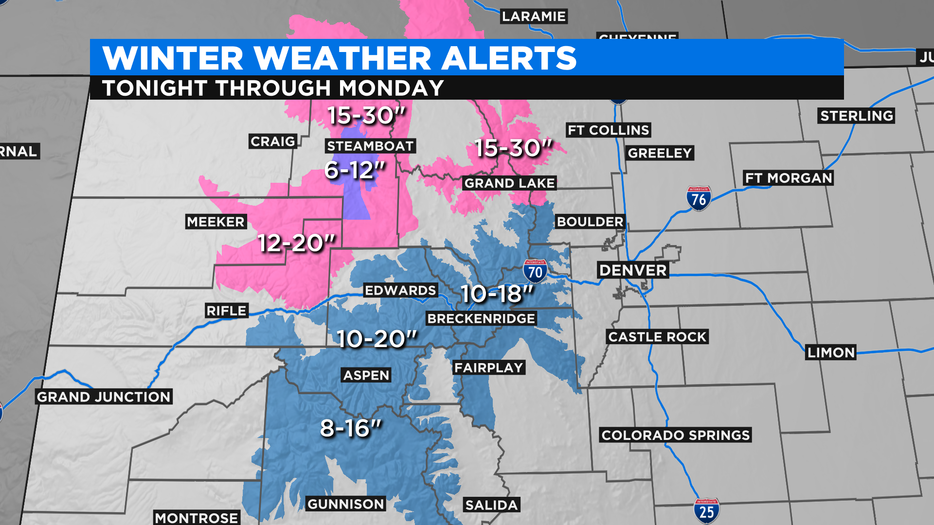
The heaviest snow with this next round will fall in the Park Mountains around Steamboat Springs and in the mountains around Rocky Mountain National Park. Those places could see 15-30 inches before all is said and done.
Another foot will be possible in the city of Steamboat Springs with 10-20 inches along the Interstate 70 corridor between Vail and Idaho Springs. This will be a long duration event with snow starting late Saturday and falling through the day on Monday.
In Denver, the urban corridor and on the eastern plains we will see a relatively quiet Saturday and Sunday with temperatures mostly in the 40s. A few flurries or showers are possible Sunday night as a cold front gets closer to the state. Then the snow chance will increase by Monday afternoon with the potential to see accumulations. Stay tuned for further updates to the forecast!