Fall and winter weather predictions for Chicago 2026-2027: What El Niño could mean

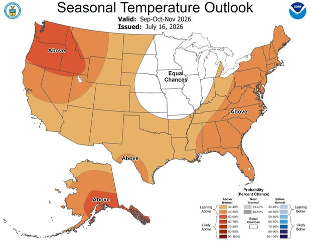
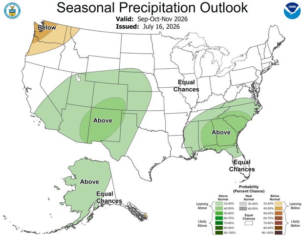
As we move closer to the fall months, the NOAA Climate Prediction Center is not showing a strong temperature or precipitation signal for the Chicago area. However, looking farther ahead to winter, a strengthening El Niño could play a major role in our weather.
For fall, Chicago currently has equal chances for above-, near- or below-average temperatures. The precipitation outlook also shows equal chances for wetter, drier or near-normal conditions.
Typically, fall in Chicago sees a steady drop in temperatures, from an average high of 75.5 degrees in September to around 48.4 degrees by November.
Rainfall remains fairly consistent early in the season, with both September and October typically receiving more than 3 inches of precipitation. By November, that amount drops to around 2.5 inches.
The first signs of snow can also arrive during the fall. Chicago averages around 0.2 inches of snow in October and 1.8 inches in November.
NOAA defines meteorological fall as Sept. 1 through Nov. 30.
Looking ahead to winter, the Climate Prediction Center currently favors above-average temperatures for the Chicago area, while the precipitation outlook shows equal chances for above-, near- or below-average precipitation.
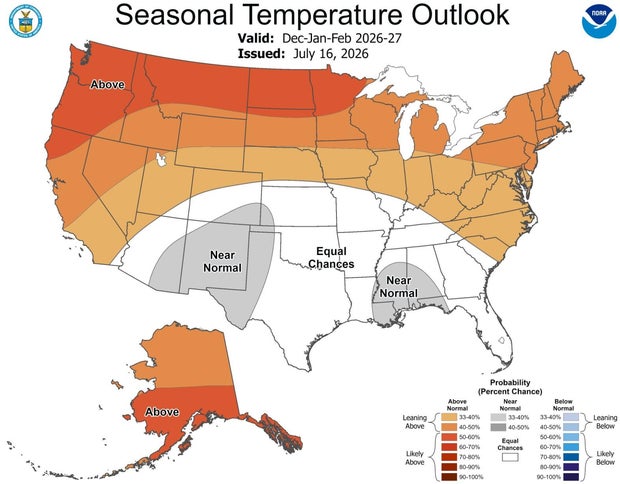
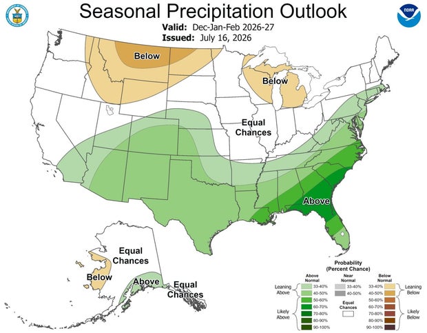
NOAA's official winter outlook will not be released until October, so these early forecasts will continue to change as we get closer to the season.
One of the biggest factors to watch will be El Niño.
El Niño occurs when warmer-than-average sea surface temperatures develop in the central and eastern equatorial Pacific Ocean. This can shift weather patterns around the world, including across the United States.
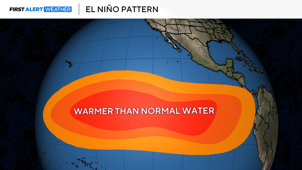
El Niño has strengthened over the past month, and NOAA says there is now a 97% chance it will continue through early spring 2027.
There is also an 81% chance El Niño becomes very strong between October and December. If that happens, this event could rank among the strongest El Niños in the historical record dating back to 1950.
For Chicago and the Great Lakes, El Niño winters tend to favor a jet stream positioned farther south, which can reduce the frequency of storm systems moving through the region and favor milder conditions.
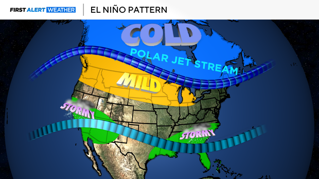
However, even a very strong El Niño does not guarantee a warm or snowless winter in Chicago. Individual cold outbreaks and winter storms can still occur, and the exact storm track will ultimately play a major role in our seasonal snowfall.
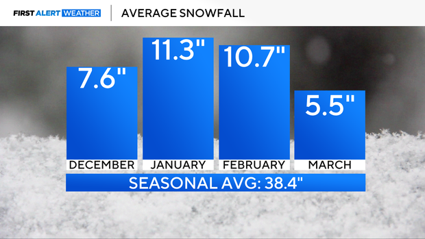
On average, Chicago receives around 38 inches of snow each season, with January typically the coldest and snowiest month.
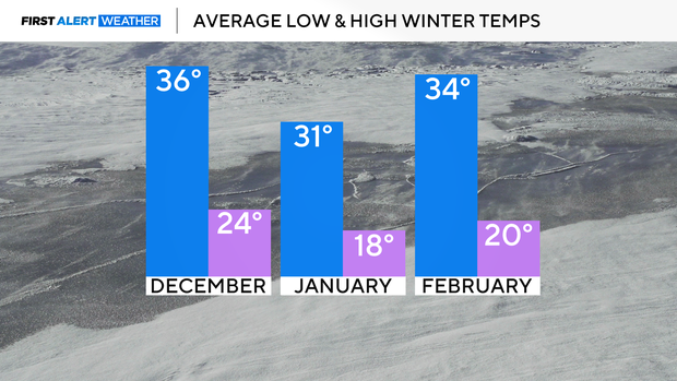
High temperatures in January generally stay in the low to mid-30s, while lows often fall into the teens and 20s.
For now, the early signal favors a warmer-than-average winter, but there is still plenty of time for the outlook to evolve. A clearer picture will emerge this fall, with NOAA's official winter outlook arriving in October.


