Chicago First Alert Weather: Mixed skies this weekend

CHICAGO (CBS) -- A Pacific storm system moves through the Rockies Friday night and into the plains Saturday.
As the storm travels across the country, we are watching the storm track for snow chances.

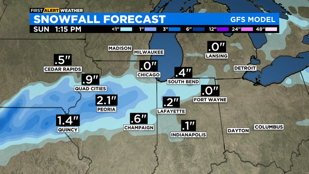
Model trends favor a more southern track, but the northern edge of the snow shield could reach areas south of I-80 Saturday night into Sunday morning.
However, better moisture content remains far south of our area. Current forecast keeps the city out of snow chances. At most we could see a few flurries early Sunday morning.
If the edge of that system reaches south of the Kankakee River Valley, only minor amounts of snow are expected there into Sunday morning – amounting to a dusting to a few tenths of an inch.
We may receive extra clouds from this system across our viewing area.
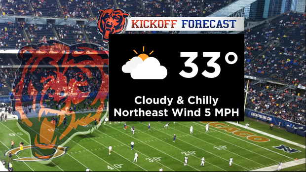
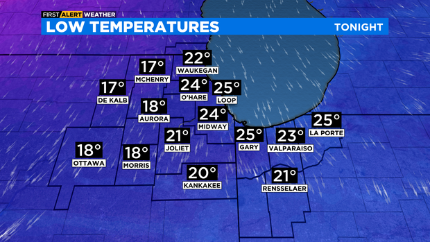
Tonight: Mostly cloudy, low 24.
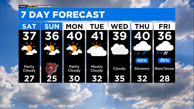
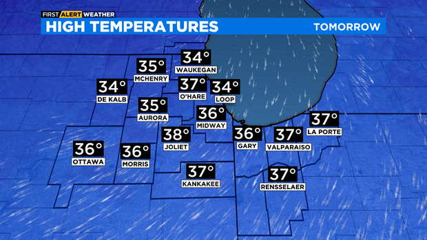
Saturday: Partly cloudy, high 37.
Sunday: Early flurries south of I-80, otherwise partly cloudy. High 37.