New mile markers on Atlanta Beltline aim to minimize emergency response times

The Beltline, Atlanta's popular destination for locals and tourists, has a new addition throughout the 22-mile stretch of trails.
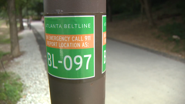
On each side of every lightpost are stickers with unique identification numbers. These are known as Beltline Emergency Response mile markers, or BL locators, to help emergency responders get a precise location once a call for help is made.
"We refer to them as BL locators or Beltline locators," Atlanta Fire Rescue Department Chief Roderick Smith said. "Those Beltline indicators are actually in our computer-aided dispatch system, and we've associated them with street addresses and street locations. When they do make a call to 911, they can help us to get to them quickly. Like any other trail, there are accessibility challenges that public safety runs into, so those Beltline locators help us to quickly identify the closest access point so we can actually get out on the trail to tend to an emergency."
Priscilla Harper uses the Beltline twice a month, down from her normal twice-a-week usage of the trail.
"We decided to scale back due to the crime that's been going on and basically a lot of weird stuff," Harper said. "It's to the point to where we just think, you know what, we think it's best if we just stay home. The idea is great, but my thing for that is the response time."
Smith said minimizing response times is a top priority for his department and first responders, and having precise locations will make responding much easier and more efficient.
More information on the Beltline can be found here and here.


