Atmospheric river update: Bay Area hit by flooding, downed trees, power outages
SAN FRANCISCO -- A potent Cat. 4 atmospheric river winter storm roared into the San Francisco Bay Area Tuesday, bringing with it damages from the heavy rain and winds along with power outages.
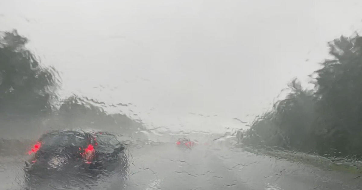
Heavy rain overnight and into the morning turned the morning commute into a chaotic mess and added to the woes of travelers stranded at local airports. The deluge triggered a flood advisory for most of the Bay Area in the pre-dawn hours as the storm made landfall in the North Bay to the sound of thunder, rustling trees, and pounding showers.
Thousands of Pacific Gas and Electric customers lost power during the storm with outages that lingered into Tuesday afternoon. The utility said gusty winds resulted in outages from trees or limbs striking power equipment. As of 9 a.m., PG&E reported 33,800 were without power across the utlity's service area. By 3 p.m. the outages had dropped to 11,693 customers, about 3,300 of those in the Bay Area.
In Oakland, the right two lanes of westbound Interstate Highway 580 were flooded Tuesday morning near Mills College in Oakland, a Caltrans spokesperson said.
The flooding started roughly around 6 a.m., spokesperson Janis Mara said.
Traffic at 10 a.m. was backed up a little less than a mile because of the flooding. Caltrans trucks and crews were on the scene and expected to ease the flooding by about 11 a.m., Mara said.
KPIX 5 First Alert Weather: Current Conditions, Forecasts, Alerts For Your Area
Also in East Bay, a section of Moraga Road was closed Tuesday due to a fallen tree, according to Lafayette and Moraga police.
The street was closed around 11:30 a.m. between Sky Hy Drive and St. Mary's Road due to a large tree that fell on power lines near the intersection of Moraga and Rimrock roads.
PG&E workers were working to repair the power lines and adjacent poles. Lafayette police did not give an estimated reopening time for Moraga Road, but Moraga police estimated that the repairs would be completed by 1 p.m.
Meanwhile, San Ramon authorities were at the Big 5 on Crow Place early Tuesday morning where the roof collapsed. No injuries were reported; however, surrounding stores were also closed pending roof inspections.
By 6 a.m., the National Weather Service said Mt Tamalpais had gotten 4.10 inches, 3.45 inches had fallen in Kentfield, 2.13 inches at the Marin Civic Center, Mill Valley had received 1.16 inches, and San Francisco 1.27 inches since midnight.
"A Flood Advisory for San Francisco and the Bay Shoreline has been issued through 2 p.m. today to account for roadway flooding reports in those areas and potential flooding for small streams," weather service forecasters said. "Coyote Creek near Milpitas is forecast to approach 'Action Stage' but stay below 'Minor Flood Stage.' Thus, this continued rain will attribute to rising stream levels."
ALSO READ: Storm roars into Sierra: 180 mph winds, whiteout blizzard conditions, avalanche warning
In Marin County, standing water was reported across all lanes of northbound U.S. Highway 101 at Lucky Drive in Corte Madera, causing issues for morning commuters. In Sonoma County, a rockslide tumbled onto Highway 116 south of Guerneville, reducing travel to one lane.
The California Highway Patrol issued a plea for motorists to slow down. CHP officers were responding to more than 60 incidents on Bay Area freeways at 8:30 a.m.
A crash in the northbound lanes of 101 near San Francisco International backed traffic up for miles, while in Concord, a jackknifed big rig had two left lanes on northbound 242 before Concord Ave. blocked.
In addition, BART trains were delayed by up to 20 minutes due to the wet weather, officials with the transit system said Tuesday.
As predicted, the potent storm front began its march across the Bay Area as the Santa Cruz Mountain communities braced for five or more inches of rain. Ben Lomond and Scott Creek had already gotten two inches of rain and the storm's fury had yet to arrive.
Winds were also whipping up as gusts over higher terrain have been peaking between 40 to 60 mph.
"SFO airport has seen gusts between 35 to 47 mph thus far," weather service forecasters said. "Keep in mind that these windy conditions could also cause some downed branches/trees and make driving difficult"
Power outages began to spring up all across the Bay Area in the predawn hours as falling branches and toppling trees were pulling down lines.
Intense storm cells were also embedded in the storm, triggering a hail storm warning for San Francisco and the East Bay until at least 8 a.m.
Fortunately, the storm will quickly move through the Bay Area, but the storm door remains open through the final days of the year.
"Showers will remain through Tuesday, clearing out for Wednesday as a transient ridge slides across, bringing us all a day to dry out and pick up the pieces," forecasters said. "But there is no rest for the weary as showers return on Thursday and linger into Friday. Another potent cold front will drop in late Friday and Saturday, bringing another bout of wind and rain. At this time it looks like the front will clear the area just before midnight NYE."


