AP
A close-up portion of the Opportunity's first 360-degree, high-resolution color image, as captured by the rover's panoramic camera. The exposed rock outcropping is a future target for further examination.
NASA/JPL
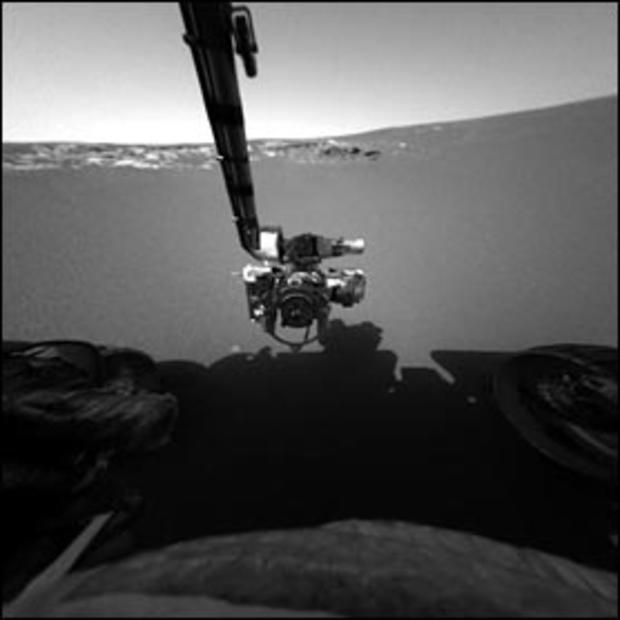
This image taken by Opportunity's front hazard-identification camera shows the rover's arm, or instrument deployment device, in its extended position. The rover, now sitting 3 feet away from the lander, can be seen in the foreground.
AP
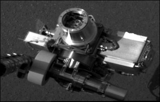
This image taken by Opportunity's panoramic camera shows the rover's rock abrasion tool (the circular device in center), also known as a "rat," located on its instrument deployment device.
AP
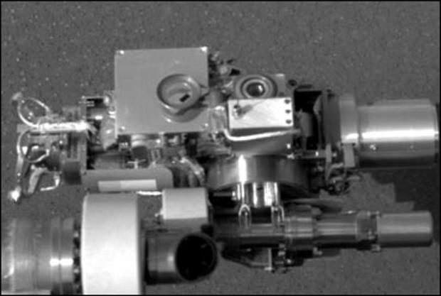
This image taken by Opportunity's panoramic camera shows the rover's microscopic imager (the circular device in center), located on its instrument deployment device.
AP
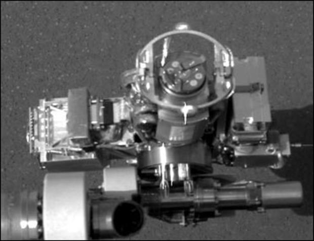
This image taken by Opportunity's panoramic camera shows the rover's alpha particle X-ray spectrometer (the circular device in center), located on its instrument deployment device.
NASA/JPL
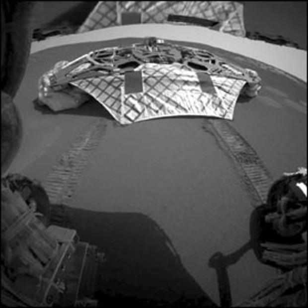
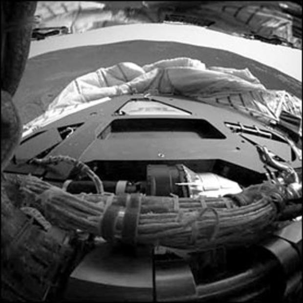
This image captured by Opportunity's rear hazard-identification camera shows the now-empty lander that carried the rover 283 million miles to Meridiani Planum, Mars. Engineers received confirmation that Opportunity's six wheels successfully rolled off the lander and onto martian soil at 3:01 a.m. PST, January 31, 2004.
NASA/JPL
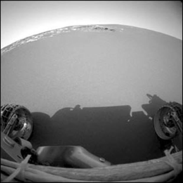
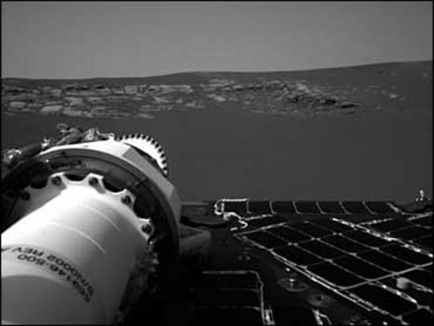
This image taken by the rover's front hazard-identification camera shows Opportunity's view of the martian horizon from its new position on the surface of Mars. The rover is approximately 3 feet in front of the lander, facing north.
NASA/JPL
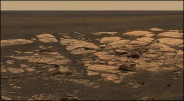
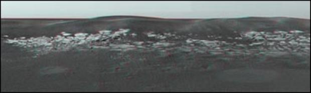
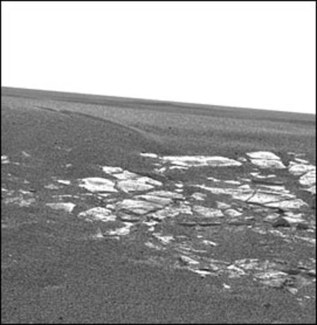
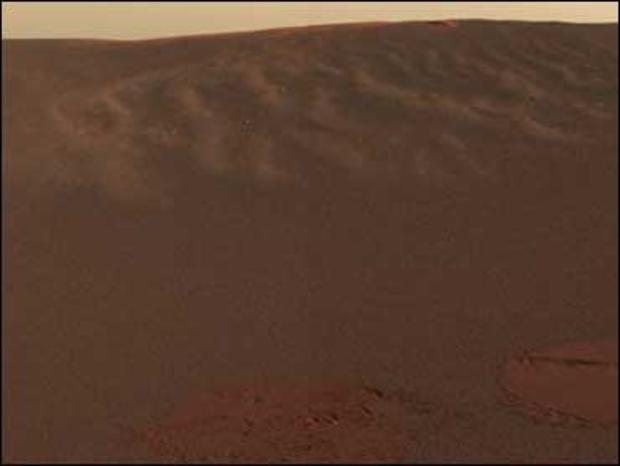
The Opportunity discovered layering in martian rocks just yards from where it landed, as shown in this portion of a black and white panoramic image, Jan. 27, 2004. Scientists are eager to determine whether the layering could have been formed in water.
AP/NASA/JPL
This image, taken by the Mars Exploration Rover Opportunity's hazard-identification camera, shows the view from behind the rover. Opportunity zipped its first pictures of Mars to Earth on Jan. 25, 2004, delighting and puzzling scientists just hours after the spacecraft bounced to a landing.
AP/NASA/JPL
This "postcard" from the panoramic camera on the Mars Exploration Rover Opportunity shows the view of the martian landscape southwest of the rover.
NASA/JPL
Scientists believe the circular feature in this image is a crater near the Mars Exploration Rover Opportunity. The image, which spans about 3/4 of a mile, was taken at an altitude of 4,606 feet by the descent image motion estimation system camera located on the bottom of the rover.
AP/NASA/JPL
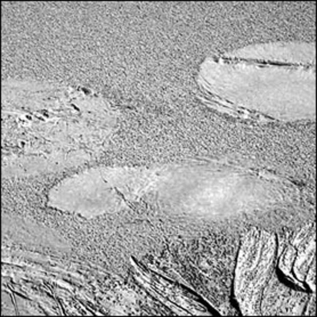
This image taken by Opportunity's panoramic camera shortly after its landing shows where the rover's airbags left impressions in the martian soil. The drag marks were made after the rover successfully landed at Meridiani Planum and its airbags were retracted.
AP/NASA/JPL
Another view of the impressions rover's airbags left in the martian soil. The rover can be seen in the foreground.
NASA
This color image shows the martian landscape at Meridiani Planum, where the Mars Exploration Rover Opportunity successfully landed at 9:05 p.m. PST on Jan. 24, 2004. This is one of the first images beamed back to Earth from the rover shortly after it touched down. The image was captured by the rover's panoramic camera.
AP Photo/NASA
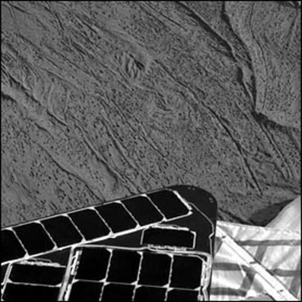
This image shows one of the Mars Exploration Rover Opportunity's first breathtaking views of the martian landscape after its successful landing at Meridiani Planum on Mars. On the left, the rover's mast can be seen in a stowed position. The image was taken by the rover's navigation camera.
NASA/JPL
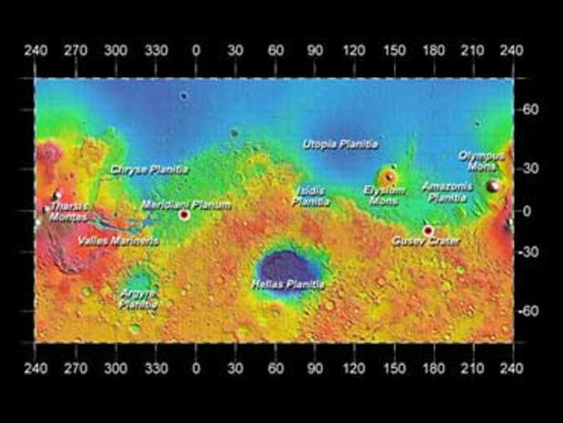
This image from the orbiting Mars Odyssey spacecraft shows Opportunity's landing site at Meridiani Planum, Spirit's landing site at Gusev Crater and other locations on Mars.