NASA uses satellite technology to better understand earthquakes

High above Earth, a new radar satellite is giving scientists an unprecedented look at how the ground beneath Southern California is moving—sometimes by just millimeters.
Scientists are using the cutting-edge satellite technology from the NASA-ISRO Synthetic Aperture Radar (NISAR) to rethink how we understand earthquakes.
"The NISAR satellite is a radar satellite," said Eric Fielding, a researcher at NASA. "It images the Earth with radar waves and by using a very special technique called interferometry, we can make a difference between one date and the next date and see how the ground has moved and what areas didn't move during the earthquake."
That ability sets NISAR apart—especially in places where older satellites struggled.
"NISAR is going to give us much better images because the radar wavelength is less sensitive to vegetation; it's able to see through the vegetation and see the ground surface and how the ground surface moves," Fielding said.
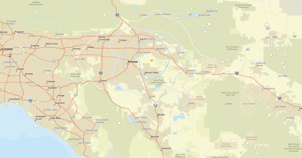
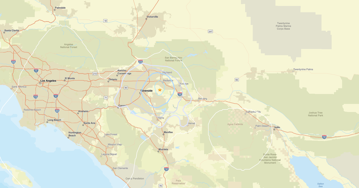
For Southern California, that means clearer insight into how faults behave between earthquakes.
"One of the things that we use the high sensitivity for is to study the gradual deformation that happens in between earthquakes," he said.
By mapping where stress is quietly building or slowly releasing, scientists can better understand earthquake risk.
"If we can see where faults are accumulating stress or releasing the stress gradually, then we can have a better idea which places are more likely to have earthquakes in the future," he said.
Then, when a major quake does strike, NISAR can quickly help guide emergency response.
"We do have this special urgent response mode that's automatically activated after a large earthquake that prioritizes the processing of the data to get the data processed as soon as it's acquired and out to the scientists," he explained.
That data can even show where damage is likely to occur.
"It allows us to detect where buildings were destroyed and other things changed drastically, caused by the earthquake," he said.
From earthquakes to landslides, NISAR is already delivering.
"The most important thing is to be able to measure these natural hazards and prepare in advance and the emergency response capability of NISAR will be very helpful if a future disaster happens," Fielding said.
From hundreds of miles above Earth, NISAR is helping scientists here at JPL turn motion into meaning and data into preparedness.
During the CBS LA Ready SoCal Week, it's a reminder that the more we understand what's happening beneath our feet, the better prepared we are when the shaking starts.