NEXT Weather Alert Day: Severe storms possible in southeast Michigan Wednesday


The CBS News Detroit NEXT Weather team is monitoring the potential for strong to severe storms Wednesday in southeast Michigan.
The National Weather Service has issued a tornado watch for all of southeast Michigan until 4 p.m. Wednesday.
The watch covers more than 35 counties and much of Lower Michigan.
A tornado watch means conditions are favorable for severe weather, so be prepared.
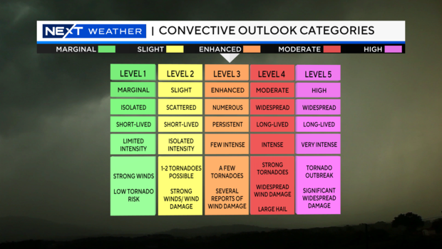
The Storm Prediction Center has labeled most of lower Michigan under an ENHANCED risk for severe weather. That is a Level 3 out of 5. This means numerous, persistent storms are possible, with a few storms that develop to be locally intense. Wind damage, large hail, flooding and tornadoes will all be possible.
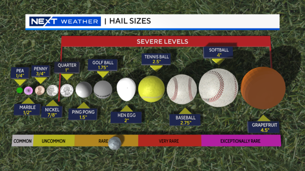
Storms have already caused hail to be from 0.5" to 2.5" in diameter across lower Michigan. As storms continue to flare up today, the main window for severe weather looks to be from 10 AM until 7 PM. All severe weather threats are on the table today, so make sure you have a way to get alerts. Be sure to download the CBS Detroit News app.
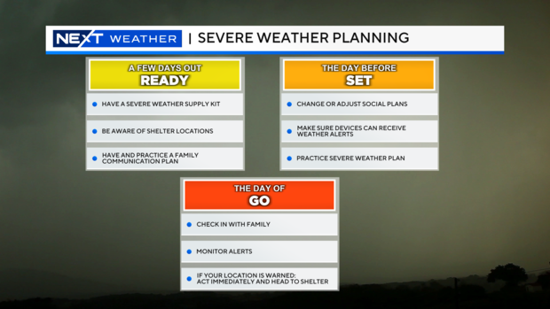
Make sure to go over and practice your weather safety procedures and prepare your safe place in case you need to seek shelter. Also, a good reminder to make sure your electronic devices are charged ahead of the storm in case you lose power. That way you can still get all the information you need by streaming the NEXT Weather team.
The NEXT Weather team will walk you through the severe weather event every step of the way. Remember to stick with us here at CBS Detroit News on-air, online and streaming live.


