Winter storm arrives in Michigan today. Here's how much snow our meteorologists forecast.


(CBS DETROIT) - Michigan's weather forecast will be dominated by snow, rain, wind and bitterly cold temperatures over the next few days.
Michiganders can expect to see the snowy conditions beginning Friday afternoon.
The low-pressure system is a more powerful system compared to what we had earlier this week. Friday's disturbance will gain strength as it tracks across southeast Michigan. However, some uncertainty remains about where the rain and snow line will set up, but as of Friday morning, it looks to be a colder system, so expect more snow.
When will the Michigan winter storm start?
Friday morning will be dry but foggy in some areas. Precipitation will begin to fall in the early afternoon hours. The precipitation type should begin as wet, heavy snow with the most intensity (about 1/2 inch to 1 inch of snow per hour is possible). The snow should change to rain by 8 p.m. Lighter snowfall will continue after midnight Saturday. The system will depart around daybreak on Saturday. Lake effect snow showers will persist through the rest of Saturday and Sunday.
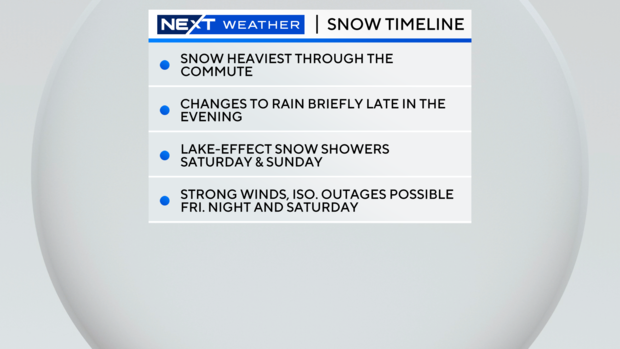
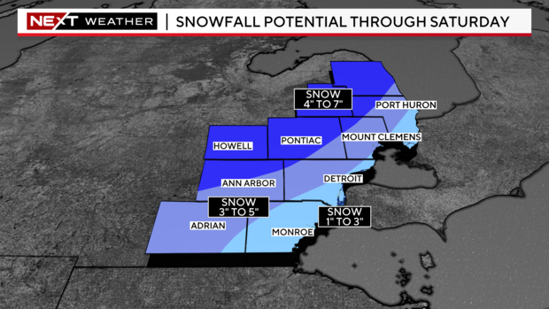
Temperatures on Friday will also play a role in the precipitation type we expect. If snow changes to rain earlier than 8 p.m., our snow totals could also be hampered. Currently, snow totals between Friday afternoon through Saturday will be less towards the furthest southeast corner of Michigan (1 inch and up to 3 inches). However, up to 7 inches of snowfall will be possible in areas north of I-96/I-696 and west of US-23 in our viewing area. Additional snowfall accumulation of 1 to 3 inches is possible from lake effect snow on Saturday and Sunday.
Michigan winter storm brings strong winds to southeast Michigan
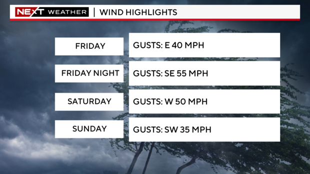
Wind is another huge component of this system. Winds on Friday are expected to come out of the east, gusting between 30 to 40 miles per hour in the afternoon. By Friday evening, winds will shift to the south-southwest, sustained at 30 to 40 miles per hour, gusting up to 55 miles per hour. On Saturday, wind gusts will be out of the west, helping produce lake-effect snow. These winds will be sustained around 30 to 40 miles per hour and gusting to 50 miles per hour or more. These winds could produce blowing snow, low visibility, and power outages.
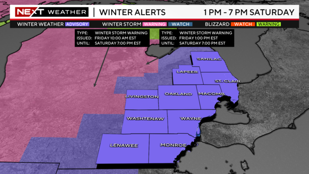
Between the possible high snowfall amounts, gusty winds, and low visibility, winter weather advisories have been issued for southeast Michigan from 1 p.m. Friday until 7 p.m. Saturday.
Michigan winter storm updates from NEXT Weather Team
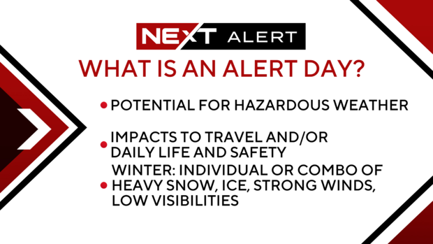
Because of all these factors, the NEXT Weather Team is making Friday a NEXT Weather Alert Day. When we have an alert day, this means we increase our weather staffing, weather coverage, and digital information and get our NEXT Tracker vehicle on the road to feed back raw weather data, including road surface temperatures. We only declare an Alert Day when the weather has the potential to be impactful to your daily life on a larger scale than a normal winter event might bring.
Temperatures will plummet in southeast Michigan
Lastly, as this low-pressure system moves out of Michigan, arctic air will filter in. Temperatures on Friday and Friday evening will reach above freezing, but temps will drop through the day on Saturday, reaching into the mid-twenties by late afternoon. Wind chills will fall into the low teens by that time but will continue to drop Saturday night. Temperatures on Sunday morning will begin in the low teens as wind chills will be below zero and struggle to make it above zero by Sunday afternoon. Expect temperatures to reach highs in the teens for the first half of the week. Lows will remain in the single digits through mid-week.
DTE Energy "prepared as possible" for Michigan winter storm
Leaders with DTE Energy say awareness is one of the most important factors during a winter storm.
The preparation before and after can make the difference between shelling out hundreds of dollars or losing your power.
People with the power company gave us plenty of tips for how to stay safe and aware during winter storms.
"In all, we have thousands of people geared up and ready to assist with restoration, and more specifically, we have 1,100 linemen at both DTE and around the country to help support our customers in need of these restoration outages," said DTE Energy's director of storm emergency preparedness and response. "If a customer does experience an outage, please know we know how disruptive and uncomfortable it is to be without power, and everyone at DTE is committed to getting your service restored as safely and quickly as possible."
Your NEXT Weather Team will continue to monitor this storm system and update you with the latest information. For your latest NEXT Weather forecast, watch on air on CBS Detroit, on our stream on CBSDetroit.com, or on Pluto TV.


