Maryland Weather: Lingering rain keeps things damp overnight before clearing out
BALTIMORE -- The winter storm that has plagued the area for the past 24 hours is moving out of the region.
Some showers have redeveloped on the back side of the system and will continue to fill in the area overnight through the early morning hours on Friday.
The rain will be light and will be just enough to keep things damp, but heavy rain is not expected.
The highest ridge tops in Frederick and Washington counties may still see some slight icing through late tonight, but the wintry weather threat has pretty much ended across the region.
As we head into Friday, we'll start the day with clouds, but sunshine should build in by the afternoon.
Highs will reach the mid and upper 40s.
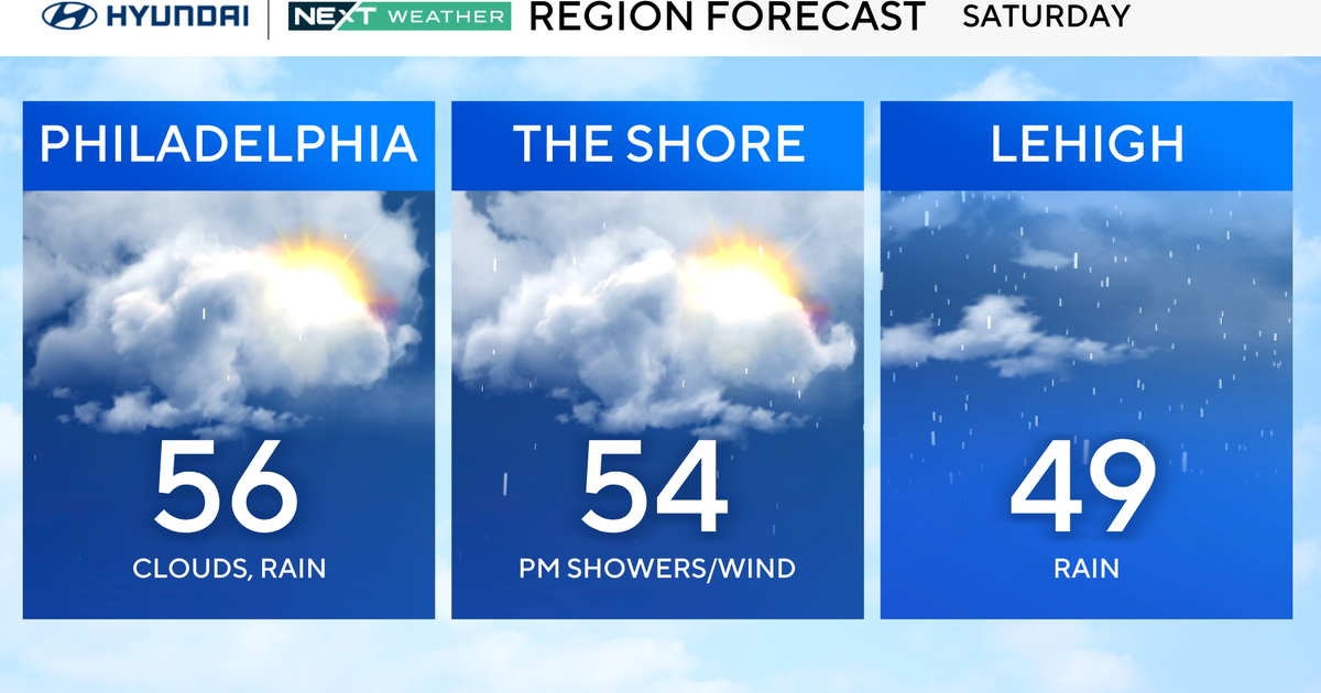
This weekend will see sun and clouds with cooler temps. Highs will reach the 40s with lows in the 20s.
Next week, we will see a continuation of nice weather through mid-week with sunny skies.
High temps will top out in the 40s with lows in the 20s.
A strong Arctic cold front will drop into the area by late week leading up to Christmas Eve which could bring the coldest temps of the season and a winter weather threat. We'll keep you posted in the coming days.