California weather forecasters bolstered by airborne researchers diving into atmospheric rivers

As the parade of storms hitting California leaves behind widespread damage and impacts, scientists are literally diving into these atmospheric river events to better predict and understand what's coming on the horizon.
Flying over the Pacific Ocean on specially-equipped aircraft, the "hurricane hunters" of the National Oceanic and Atmospheric Administration (NOAA) play a huge role in helping communities determine the severity of atmospheric river storms.
Atmospheric rivers are essentially rivers of water vapor in the sky that are pushed along by strong, low-altitude winds, sometimes at hurricane speeds. Since the start of this year California has been battling major atmospheric rivers that have caused devastation to many here locally.
Due to these storms, the Bay Area has already received more rain than we would get during a normal rainy season. That means if we don't see a drop of rain until September, we would still be above average for the year.
The NOAA Hurricane Hunters have been hard at work flying into these atmospheric rivers to collect data to improve the weather models that we local meteorologists use to forecast your weather. They fly long missions over these atmospheric rivers releasing dropsondes, which are small instruments that drift down by parachute and measure wind speed and direction, water vapor, temperature, and pressure. That information is sent to the global weather data hub, where weather forecasting models draw from to start the next forecast.
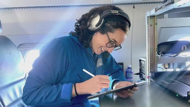
My friend Sofia de Solo, one of the meteorologists on this team, caught up with me after her mission on Monday night where she shared with me what these missions fully entail.
"Yeah, so these atmospheric rivers, they form deep in the Pacific Ocean where we do not have as many observations as we do on land," de Solo said. "So when we collect this data, this data immediately goes into these weather models, and it essentially corrects them or essentially fixes them right because you can't tell the future without knowing what's going to happen right now."
Not only are they improving these forecast models, but they are also collecting this data to be researched later. Researchers will use the collected data from these missions to help better understand the science behind atmospheric rivers and this will help future planning.
How frequently has this team been up over the Pacific lately collecting such important data?
"So we've been flying the storms not only the past couple of days, but the past couple of weeks and even in the last month we were from a storm, so we've had continuous data to these atmospheric rivers, filling the data void that's in the Pacific Ocean," said de Solo. "And this data, like I said, not only goes into the models, helps in future research, but it also helps emergency managers and city officials with water management and decision-making.
Overall, the analysis has shown that atmospheric river recon data improves predictions and reduced the precipitation forecast error significantly. This contributes to accurate warnings and emergency responses for us here locally.
With this data, we will see atmospheric river forecasts continue to improve through the years to come, and we will watch for how these systems could play a role in future climate change. For now, we will continue to use the enhanced tools we have to help you at home prepare for any of these storms to come.


