Showers and wind return to our mid-week Sacramento Valley forecast; here's what we are watching

High pressure has kept our weather dry through Tuesday, but clouds begin to increase mid-week as multiple weather systems line up off the coast.
By Wednesday morning, most of us in the Sacramento Valley stay dry, but it will be cloudy to start the day.
Rain begins to move in closer to noon spreading west to east through lower elevations increasing across the foothills and mountains early afternoon. We do have the chance of a few thunderstorms developing across the Northern Sacramento Valley and foothills during the late afternoon and evening.
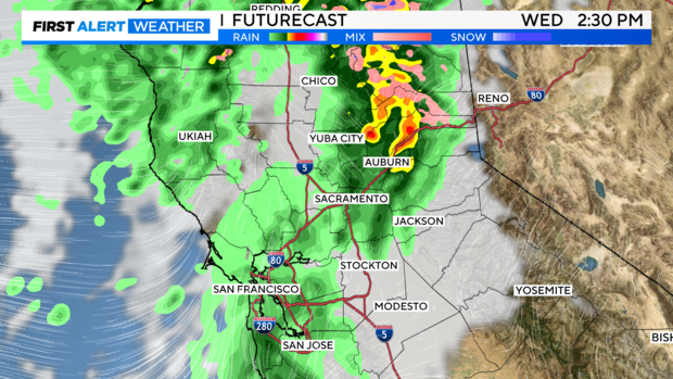
Snow starts at pass level and lowers through the evening into Thursday. If you are going to be traveling over the Sierra, be prepared for winter travel and possible delays.
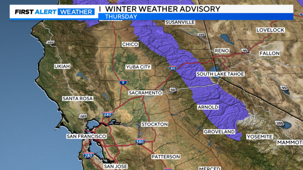
A Winter Weather Advisory has been issued from the Northern Sierra to the Central Sierra from 10 AM to 10 PM Thursday.
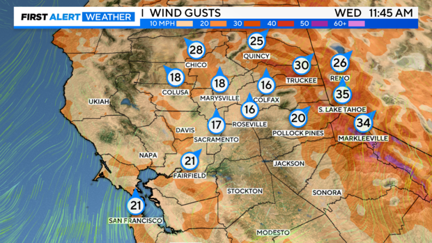
Along with the showers, wind increases on Wednesday, mainly over the Sierra and the northern Sacramento Valley. Wind gusts up to 25-30 mph are expected across the northern Sacramento Valley, with gusts up to 30-45 mph across the Sierra.
OUR PATTERN
A ridge of high pressure has kept the storm track well to the north. Impacting the Pacific Northwest the past several days with rounds of heavy rain and snow, across Oregon and Washington as systems tap into different atmospheric rivers.
The ridge over the southwest begins to shift east Wednesday through Thursday opening a small window for a few systems to move across Northern California.
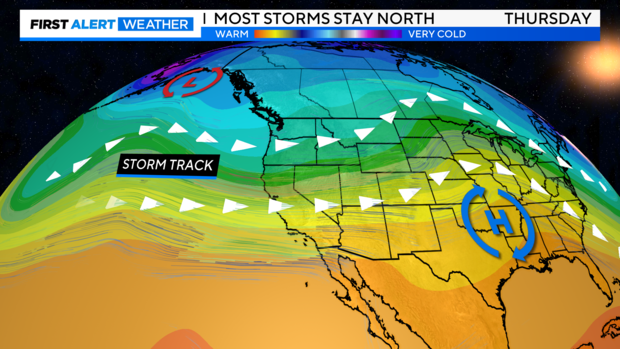
The first one arrives through the day Wednesday into early Thursday. The second system, a very fast-moving front slides in Thursday afternoon and clears by Thursday evening bringing much colder air.
RAIN AND SNOW AMOUNTS
Through this 48-hour time period, rain amounts will be generally lighter across the region. As these storm systems will be quick-hitters
The biggest amounts will be focused across portions of the foothills mainly from I-80 to the north into Plumas County. Also, along the Coastal Range, amounts could be up to 3" to 6'' of rain across Eureka.
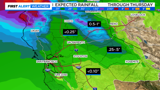
As for the Sacramento Valley, amounts range from .10'' to .25'' from the Central Valley to Chico. From Nevada County to Plumas County, up to an inch of rain is expected.
Looking at snow amounts, snow starts off mainly across Pass level Wednesday before dropping as low as 4,000 ft. Friday morning.
Snow will come in rounds with the first being Wednesday evening to Thursday morning, before the next round arrives Thursday afternoon.
Across the passes, we could be looking at 2" to 6'' with some ranging up to 10'' across some of our higher peaks such as Donner Pass.
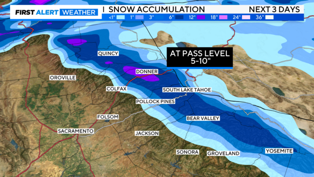
Higher amounts will depend on how quickly cold air arrives with this system and how long it stays around.
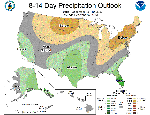
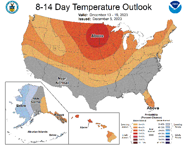
OUTLOOK NEXT WEEK
NOAA's Climate Prediction outlooks keep us dry through early next week before models hint at a pattern change, suggesting more precipitation and warmer temperatures across Northern California the week before Christmas.
Make sure to stay with CBS Sacramento First Alert Weather team as we watch for any incoming storm systems.


