Near miss; Atmospheric river shifts toward Southern California
SAN FRANCISCO -- After weeks of atmospheric rivers slamming into Northern California, triggering flooding and landslides, the jet stream has shifted the latest blast of subtropical moisture toward Southern California, forecasters said.
But it won't be a complete miss on Tuesday. The northern edge of the river will bring moderate rain to parts of the Bay Area and 2 inches or more to the waterlogged Santa Cruz Mountains and the flooded communities in Monterey County.
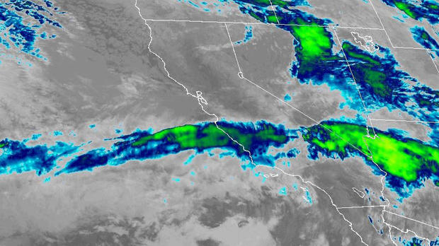
"We will get rain on Tuesday," KPIX Meteorologist Darren Peck said of the Bay Area. "The majority of the rain will be south. Southern California will get significant rain out of this."
The rain will be much like Sunday's showers. Light to moderate downpours with a chance of a thundershower.
By 9 a.m. Sunday, San Francisco had gotten 0.67 inches over the last 24 hours, Oakland and Santa Rosa half an inch and Ben Lomond 0.59 inches.
"With the current track of this system, rainfall will be greatest along the coastal ranges from the Santa Cruz Mountains southward through the Santa Lucia Range with 1-3 inches expected," the National Weather Service said. "Lower elevations of the Central Coast can expect 0.50-1.25 inches with the potential for slightly lower totals in the rain shadowed valleys."
While hundreds remain evacuated in Monterey County, particularly in the flooded community of Pajaro, concerns were elevating for farms near Vernalis southeast of Tracy in the San Joaquin watershed.
The San Joaquin River was expected to exceed "danger stage" on Sunday at 29.5 feet.
Meanwhile, forecasters said the Sierra could be getting a couple feet of new snow added to their impressive season totals from the two storms this week.
At the UC Berkeley Central Sierra Snow Lab, the season totals surpassed 670 inches Monday morning.
"With 7.7" (19.5 cm) of #snow over the last day, '22/'23 has passed '82/'83 as the 2nd snowiest season (Oct 1 - Sept 30) since the CSSL was built in 1946!," the researchers tweeted. "We now have a season total of 677" (56.4 feet."


