Multiple rounds of rain, snow move into Northern California starting Wednesday
After a quiet weather pattern for Super Bowl weekend and sunny skies to start the week, our weather pattern begins to change starting Wednesday, bringing more widespread rain, gusty winds and heavy Sierra snow to Northern California.
Tuesday will be the transition day with mostly sunny skies and highs in the upper 50s to low 60s. Clouds will increase Tuesday night into Wednesday as storm number one moves in.
Our unsettled pattern
The storm door is reopening just in time for Valentine's Day as high pressure breaks down allowing storm systems to move in.
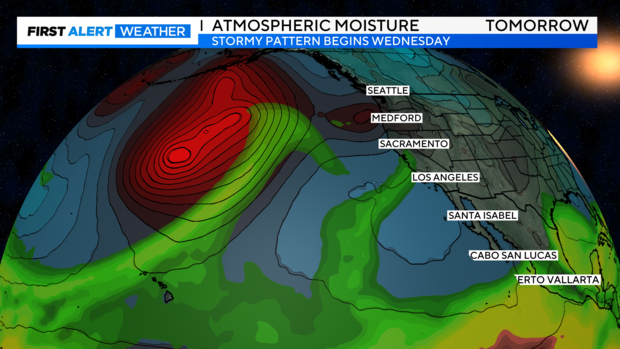
We'll be watching the connections storm systems have to atmospheric river moisture. The better the connection of this river of moisture, the better our chances are of getting stronger storms with heavy rain, snow and strong wind.
Here are the connections we're watching: The first wave arrives Wednesday night through Thursday morning. The second arrives Saturday night through Sunday morning, and the last arrives Sunday night through Tuesday.
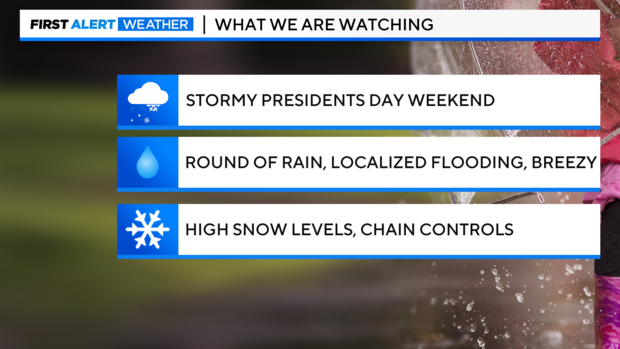
The takeaway is an unsettled pattern for the rest of this week, President's Day weekend and the start of next week.
Round 1: Valentine's Day through Thursday morning
Wednesday will start cloudy, with a few scattered showers before sunrise.
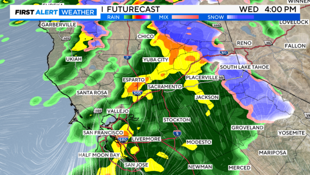
It's not until the afternoon and evening the main event with this storm system moves in, increasing rain and snow rates and picking up wind gusts across the region.
Rain increases through the valley and foothills in the afternoon. Rounds of heavy rain and downpours will be possible. Wednesday will be a First Alert Action Day.
Wind will pick up yet stay below the threshold we saw on Feb. 4.
Gusts up to 25-30 miles per hour will be possible for most valley locations. Northern portions of the Sacramento Valley and higher elevations may see gusts up to 40-plus miles per hour through Wednesday night.
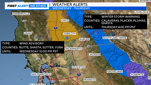
A Wind Advisory has been issued through 10 p.m. Wednesday.
Snow across the Sierra increases Wednesday night as the bulk of the storm moves in.
Snow levels will start high at around 6,000-6,800 feet Wednesday afternoon and evening, which means a little rain near ski resort bases will be possible.
But snow levels are forecast to drop quickly as the bulk of the precipitation moves in Wednesday night. Snow levels stay around 5,000 feet.
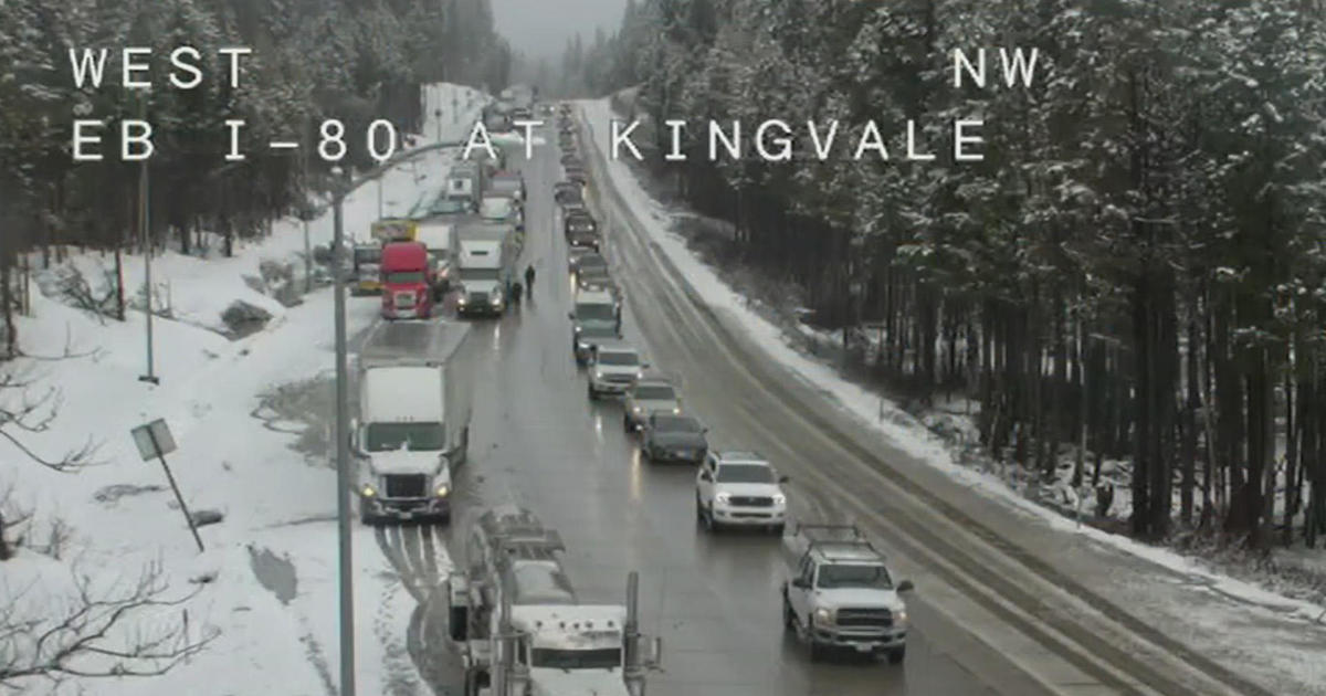
Expect slick roads, travel delays and chain controls. A Winter Storm Warning has been issued starting at 4 a.m. Wednesday through 4 p.m. Thursday.
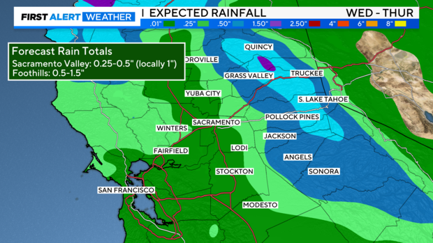
This first system will stay with us through early Thursday. The rain will be heavy at times, with half of an inch possible for most of the valley. Up to 1-2 inches of rain for the foothills.
Across the Sierra, we could get 6 to 12 inches of snow at pass level before the storm winds down early Thursday. The higher peaks may receive up to two feet.
Rounds 2 and 3: Saturday through Tuesday
After storm one, we will get some dry time through the day on Thursday and Friday before the next storm lines up on Saturday.
Scattered showers will be possible Friday evening, yet rain won't be as organized until Saturday.
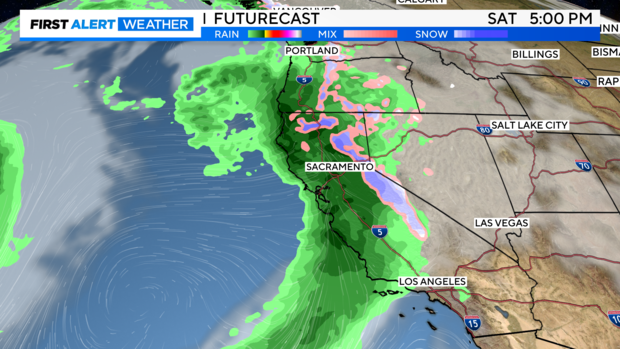
Rain picks up through the day Saturday, with the heaviest rain moving in Saturday night as storm number two arrives.
This storm will have similar impacts as storm number one, with rounds of heavy rain and gusty winds. It will be better to make plans indoors than outdoors for President's Day weekend.
Snow levels will start at 6,000 to 7,000 feet on Saturday before lowering to 5,000 feet on Sunday. Expect travel impacts with slick roads, chain controls and delays. The heaviest snow for the Sierra arrives on Saturday night.
This will be a very fast-moving storm system and quick to clear by Sunday morning.
The next storm isn't expected to arrive until late Sunday evening into Monday morning. This one looks to pack a punch to Monday morning's commute, with heavy rain expected.
Storm number three is expected to be slow-paced as low pressure near the coast slowly moves to our south, producing rain through Tuesday before clearing out.
After several days of rain, localized flooding on roads will be likely. Monday will be a First Alert Action Day.
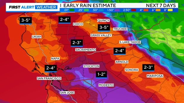
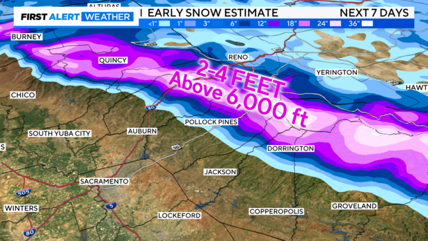
Storm number three is still several days out; details could change to timing and amounts. But if we combine rain and snow amounts over the next 7 days, here are early estimates we're expecting.
Rain estimates bring a general 2-3 inches of rain to the valley. Amounts trend higher across the northern Sacramento Valley and Bay Area with up to 4 inches of rain possible through next Tuesday.
Hardest-hit spots in the foothills could receive 3-5 inches of rain by next week.
Across the Sierra, we're expecting several feet of snow within the next seven days. Snow levels will mainly stay around 5,000 feet as these incoming storms are on the warmer side.
We'll be watching the trends closely over the next several days. Make sure to stay with CBS Sacramento's First Alert Weather Team for any changes to the forecast timing and amounts.
