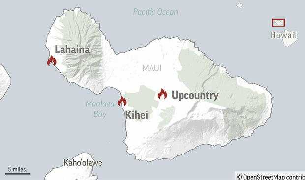
Map, satellite images show where Hawaii fires burned throughout Lahaina, Maui
As crews began to assess the damage from the deadly wildfires that killed dozens on the Hawaiian island of Maui, satellite images show the extent of the devastation.
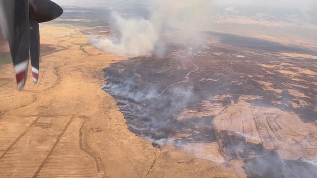
Massive blazes broke out and spread rapidly on Maui and the Big Island earlier this week, as strong winds generated by Hurricane Dora — a distant Category 4 hurricane traveling across the Pacific hundreds of miles south of the island chain — and dry conditions on land created an environment where wildfires can ignite and grow more easily, according to the National Weather Service. Officials said Wednesday that the exact cause of the fires was still unknown.
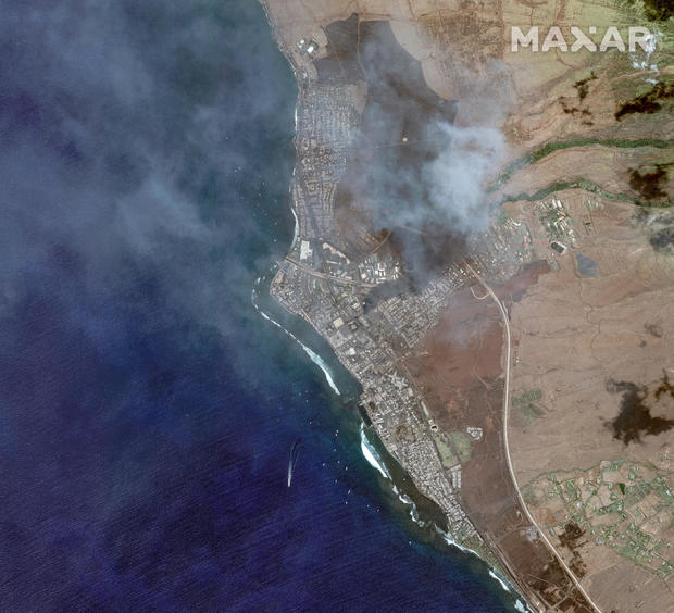
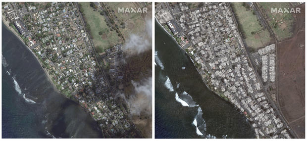
The West Maui town of Lahaina, a popular tourist destination and commercial hub with a long and rich cultural history, was hit especially hard by the fires. Aerial video footage and satellite images captured by Maxar Technologies offered a harrowing look at the destruction.
People dove into the water at Lahaina Harbor while trying to escape the smoke and encroaching flames on Tuesday. The U.S. Coast Guard confirmed later that crews rescued 17 people from the harbor, all of whom were reported to be stable.
Side-by-side images of Lahaina, taken before the blaze and on Wednesday after it tore through, showed the once lush area badly burned, with the harbor and building rooftops along the shoreline appearing visibly charred.
As wind and heavy smoke that previously grounded National Guard helicopters abated somewhat on Wednesday afternoon, flyovers by the U.S. Civil Air Patrol and the Maui Fire Department showed hundreds of structures were damaged, Maui County officials said. The damage was described as "widespread" in West Maui, where Lahaina is located.
Front Street, a central part of the town with a high concentration of businesses, was "completely burned," Lahaina resident Kekoa Lansford told CBS Honolulu affiliate KGMB-TV.
"We need help. A lot of help. We got to get people down here. We need funds allocated for fixing our home(s). We are out here working," Lansford said.
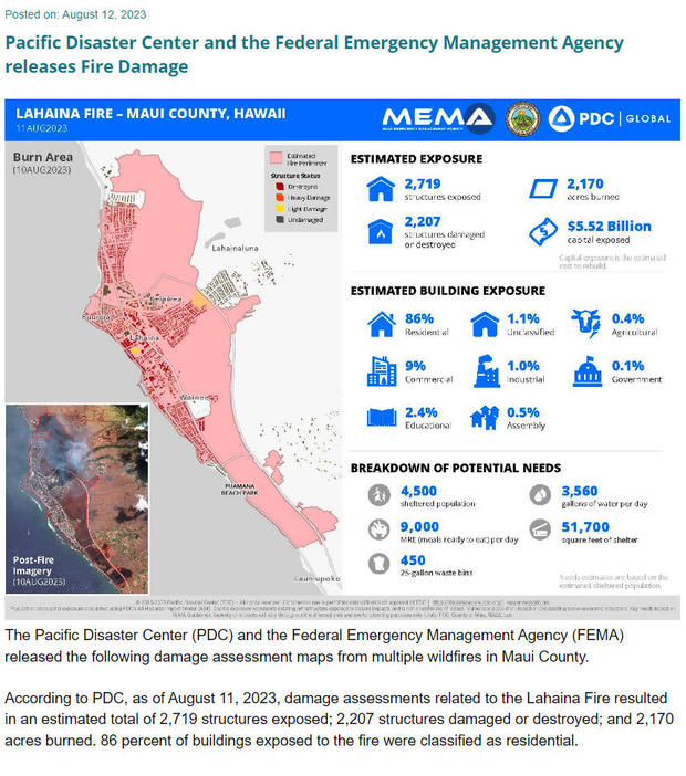
The Pacific Disaster Center and the Federal Emergency Management Agency estimated Friday that more than 2,200 structures had been damaged or destroyed.
In addition to the widespread destruction in Lahaina, wildfires also affected communities inland in Maui's Upcountry region and spread Wednesday along the island's southwestern coast near Kihei.
"On behalf of the U.S. Coast Guard, I wish to convey my sincere condolences to the communities who have been tragically affected by the fires in Maui," said Capt. Aja L. Kirksey, Sector Commander of Coast Guard Sector Honolulu, in a statement. "Our collaboration with partner agencies and neighboring jurisdictions remains steadfast, as we unite our resources, knowledge, and equipment to ensure responder and public safety and amplify the impact of our response efforts."
Thousands of people were evacuated from impacted areas this week while travelers slept in the Kahului Airport. Hawaiian Airlines continued to operate flights into and out of Maui's Kahului Airport "in support of essential travel" and "coordinating with the state, county and nonprofits to transport first responders, equipment and supplies to Maui," the airline said.
Public health officials said that Maui Memorial Medical Center said has been treating patients since Tuesday night for burns, smoke inhalation and other fire-related injuries.
–The Associated Press contributed reporting.