Next-generation GOES weather satellite launched to monitor western United States
A United Launch Alliance Atlas 5 rocket boosted the third of four advanced GOES weather satellites into orbit Tuesday to monitor conditions across the Pacific Ocean, Alaska, Hawaii and the western United States, part of an ongoing $11 billion upgrade to the nation's forecasting infrastructure.
"The GOES series has revolutionized severe event monitoring for us," said Steve Volz, a senior manager with the National Oceanic and Atmospheric Administration.
"With regard to storms and other environmental hazards such as wildfires, which are always a threat to many of our western states, the cutting edge technology aboard GOES-T, once operational, will allow us to see the bigger picture across the entire hemisphere while still reading the fine print of the dozens of weather stories that are happening simultaneously around the earth and around the U.S."
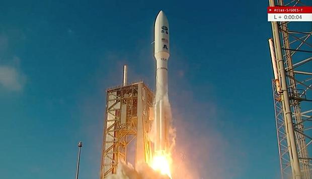
The Atlas 5's Russian-built RD-180 first stage engine roared to life at 4:38 p.m. EST, followed an instant later by ignition of four strap-on solid fuel boosters. With a combined 2.3 million pounds of thrust, the 20-story tall rocket majestically climbed away from pad 41 at the Cape Canaveral Space Force Station atop a brilliant jet of fiery exhaust.
Twelve minutes later, the Atlas 5's Centaur second stage completed the first of three engine firings needed to deliver the GOES-T satellite to its intended elliptical "transfer" orbit. Deployment was expected three-and-a-half hours after launch.
Over the next several weeks, an on-board thruster will be used to raise the low point of the ellipse, putting GOES-T into a circular 22,300-mile-high orbit over the equator. At that altitude, the satellite will complete one orbit every 24 hours, rotating in lockstep with the planet below to continuously observe from the same vantage point.
Once checked out and on station, GOES-T will be renamed GOES-18, replacing the GOES-17 satellite currently providing coverage of the Pacific Ocean, Hawaii, Alaska, Mexico, Central America and the western United States. The new satellite will work in concert with GOES-16 over the Atlantic Ocean while GOES-17 serves as an operational spare.
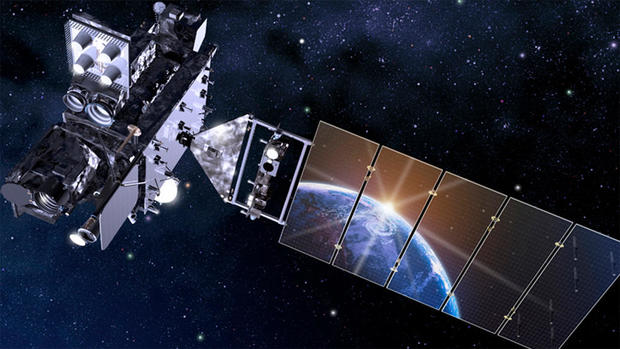
Built by Lockheed Martin Space Systems, GOES-T tips the scales at 11,508 pounds loaded with the propellant needed to operate for at least 10 years.
The latest generation features an advanced camera providing HDTV-quality data, a sensitive magnetometer, an ultraviolet X-ray sensor to measure how solar radiation affects the upper atmosphere, an ultraviolet imager to constantly monitor the sun and sensors to measure charged particles from the sun that can affect communications and navigation.
The satellite also is equipped with a lightning mapper that will image lightning fields in the western hemisphere about 200 times a second to give meteorologists a better sense of where significant storms are brewing.
"NOAA's geostationary satellites provide the only continuous coverage of weather and hazardous environmental conditions in the Western Hemisphere, protecting the lives and property of the one billion people who live and work in the Americas," said Pam Sullivan, the GOES program director at NOAA.
"These observations are even more critical now in a time when the U.S. is experiencing a record number of billion-dollar disasters. ... NOAA's western satellite is extremely important because most of the weather that affects the U.S. travels in a west-to-east direction. And so the western satellite gives us a great upstream view of what is coming."
GOES-T also will monitor weather affecting air and sea traffic between Asia and the United States and provide accurate weather monitoring before, during and after disasters.
The satellites bring "advanced new capabilities to help forecasters better monitor and predict dangerous environmental conditions like hurricanes, thunderstorms, floods and fires," Sullivan said. "Compared to the previous generation, the (new) satellites deliver 60 times more imagery and they have a new Lightning camera to track severe storms that spawn tornadoes and damaging winds."


