2023 Atlantic hurricane outlook worsens as ocean temperatures hit record highs, forecasters say
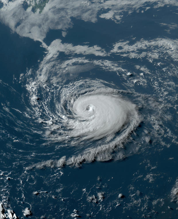
Forecasters at the National Oceanic and Atmospheric Administration have updated their predictions for the Atlantic hurricane season, announcing on Wednesday that at least 14 and as many as 21 named storms could materialize before the year is up. At least six and as many as 11 of those storms may become hurricanes, the agency said.
The Atlantic hurricane season occurs annually, beginning each year on June 1 and ending on Nov. 30. Climate officials released their initial hurricane outlook just before this season began, and suggested at the time that it would be "near normal," bringing somewhere between 12 and 17 named storms and five to nine hurricanes.
An updated outlook released this week by NOAA has amended that original forecast to predict an "above normal" hurricane season, owing to the shift earlier this year from La Niña to El Niño as well as record-high sea surface temperatures in parts of the Atlantic Ocean this summer. Warmer ocean temperatures came as massive heat waves on land touched vast sections of the world, from the United States to Europe and beyond, fueling concerns about the effects of climate change on contemporary weather patterns while setting their own records, too.
"The main climate factors expected to influence the 2023 Atlantic hurricane activity are the ongoing El Niño and the warm phase of the Atlantic Multi-Decadal Oscillation, including record-warm Atlantic sea surface temperatures," said Matthew Rosencrans, the lead hurricane season forecaster at NOAA's Climate Prediction Center, in a statement introducing the updated storm outlook. "Considering those factors, the updated outlook calls for more activity, so we urge everyone to prepare now for the continuing season."
El Niño is a recurring climate pattern that replaces its counterpart, La Niña, every few years as part of an ongoing cycle determined by sea surface temperatures and precipitation levels across the equatorial Pacific Ocean that depart from the "neutral" standard, according to NOAA. Considered the cycle's "warm phase," El Niño officially arrived in June. It can significantly affect weather patterns in the U.S., and is known for bringing wetter conditions to portions of the Southeast and the Gulf Coast, including severe and sometimes disastrous flooding. Conditions are usually hotter and drier in northern parts of the U.S. and Canada during this phase of the cycle.
Although La Niña is typically associated with increased hurricanes in the U.S., forecasters at NOAA said in a news release Wednesday that the atmospheric conditions normally created by El Niño, which "help to lessen tropical activity during the Atlantic hurricane season," have so far developed slowly and "may not be in place for much of the remaining hurricane season." The agency's Climate Prediction Center said recently that there is more than a 95% chance that El Niño will continue through the winter.
An average hurricane season in the Atlantic corresponds with 14 named storms, which NOAA characterizes as those with winds of 39 miles per hour or higher, and seven hurricanes, which have winds of at least 74 miles per hour. In an average year, the season will produce three hurricanes considered "major," meaning their wind speeds reach 111 miles per hour or more. The 2023 hurricane season is now expected to bring between two and five major hurricanes, according to NOAA's latest outlook.


