NASA Satellite Tracks Carbon Monoxide Spreading From California Wildfires To Great Lakes, Canada
PASADENA (CBSLA) — Carbon monoxide from California's wildfires is more than 10 times the typical amounts, a NASA satellite has observed.
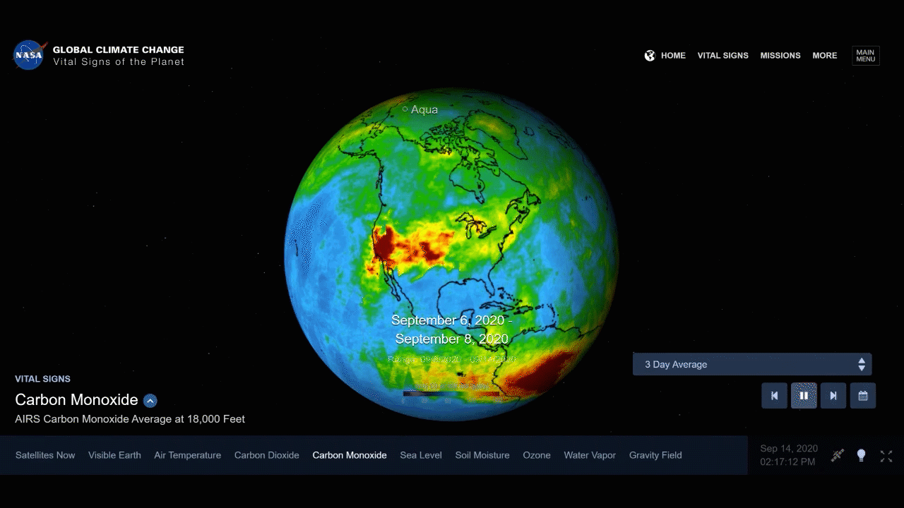
NASA's Atmospheric Infrared Sounder, aboard the Aqua satellite, captured infrared images of carbon monoxide plumes coming from the 28 major wildfires burning across the state as of Monday. Carbon monoxide concentrations show up as dark red on NASA's animation, and the plume starts out concentrated over the West Coast, but grows progressively to cover much of the Southwest, stretching all the way to the Great Lakes.
Another, larger plume to the north is more widespread, and appears to cover a large swath of North America, including Canada, stretching from the Pacific Ocean to the Great Lakes.
The growing red and orange areas of the animation indicate regions with extremely high carbon monoxide concentrations of greater than 350 parts per billion by volume, according to NASA. The intense heat of the wildfires is sending the carbon monoxide high into the atmosphere, making it visible to NASA's satellites, and a jet stream is spreading the carbon monoxide plume eastward across the U.S.
Carbon monoxide is a pollutant that can persist in the atmosphere for about a month and can be transported great distances, NASA said, playing a role in both air pollution and climate change.
California's wildfires are also spewing smoke and ash into the air, and have darkened the skies and made the air very unhealthy for much of the West Coast.


