Snow tapering off in Chicago area, but flurries could linger on Saturday

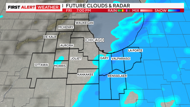
CHICAGO (CBS) — Light snow in the Chicago area will taper off west to east on Friday evening.
A front from Wisconsin will pass through the Chicago area Friday night, bringing a chilly northwest wind flow and a few snow showers.
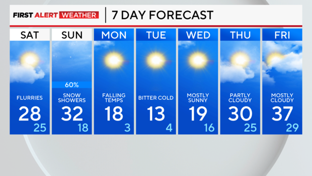
A few flurries may linger Saturday. Temperatures will struggle Saturday with highs in the upper 20s. High clouds advance Saturday afternoon ahead of our next snowmaker.
On Sunday, an Alberta Clipper will bring snow showers. Since the temperature will reach the lower 30s we could end up with some freezing drizzle in the afternoon. Minor amounts of snow Sunday.
The big deal is the Arctic blast arriving Monday, when daytime highs will be in the upper teens, and fall into the single digits overnight.
Forecast at a glance
TONIGHT: FEW SNOW SHOWERS. LOW 20.
SATURDAY: FEW FLURRIES. HIGH 28.
SUNDAY: SNOW SHOWERS AND SPOTTY FREEZING DRIZZLE. HIGH 32.


