Chicago First Alert Weather; Wind advisory for some areas through 7 p.m.

CHICAGO (CBS) – A wind advisory is in effect for parts of the Chicago area through 7 p.m., with gusts of up to 45 mph expected.
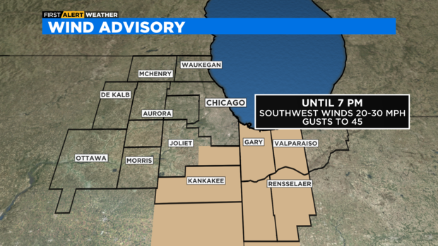
The wind advisory covers Ford, Iroquois, Kankakee, and eastern Will counties in Illinois; and Benton, Jasper, Lake, Newton, and Porter counties in northwest Indiana.
According to the National Weather Service, southwest winds of 20 to 30 mph are expected, with gusts of up to 45 mph.
The winds could cause tree limbs to fall down, causing power outages in some areas.
Drivers should use extra caution on the roads, especially if driving a high-profile vehicle.
People also should secure loose objects left outdoors.
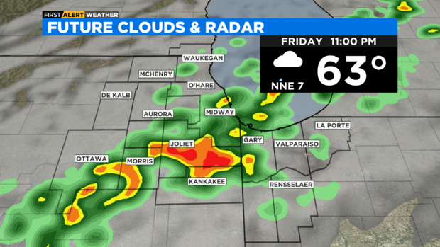
Between 5 p.m. and 6 p.m., a cold front will cross the Chicago area, shifting the winds to a cooler, northwesterly flow.
Showers follow the front and increase in coverage overnight with downpours and thunderstorms at times.
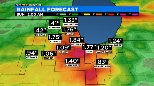
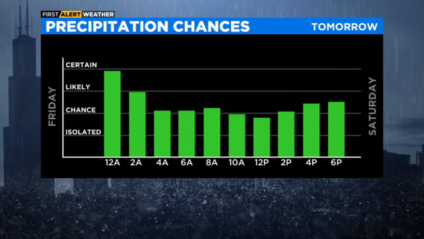
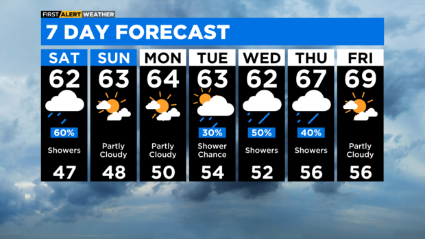
Passing showers dominate the Saturday pattern. Healthy rain amounts of 1" to 2" possible.
We dry out Sunday, and temperatures will be cooler than normal for the next seven days.
TONIGHT: SHOWERS & THUNDERSTORMS. LOW 58.
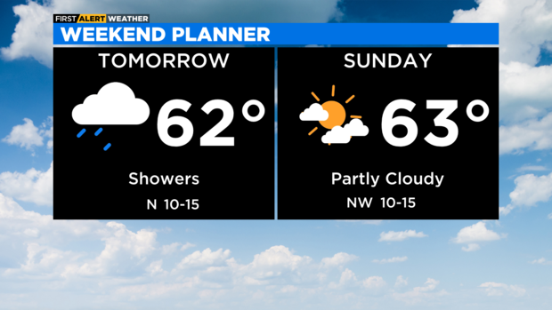
SATURDAY: SHOWERS LIKELY. COOLER. HIGH 62.
SUNDAY: PARTLY CLOUDY. HIGH 63.


