NASA/JPL
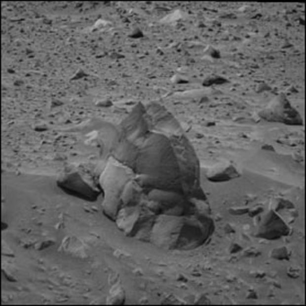
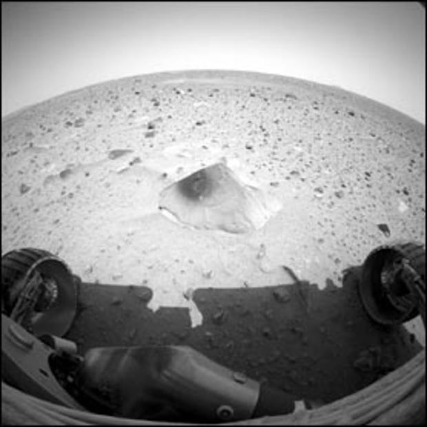
This image of the rock called "Humphrey" was taken by Spirit's navigational camera. Standing about 2 feet tall, it is one of the largest blocks of what scientists believe is ejected material from one of the rover's long-term targets, the crater dubbed "Bonneville." Scientists are eager to investigate ejected rocks, as they give a glimpse of the composition of what lies beneath the Red Planet's surface.
NASA/JPL/Texas A&M/Cornell
Opportunity's panoramic camera captured the Sun as it set over the southwest horizon. Scientists say there is nearly twice as much dust as there was when the Mars Pathfinder spacecraft imaged the sunset in 1997. This causes the Sun to be many times fainter.
NASA/JPL
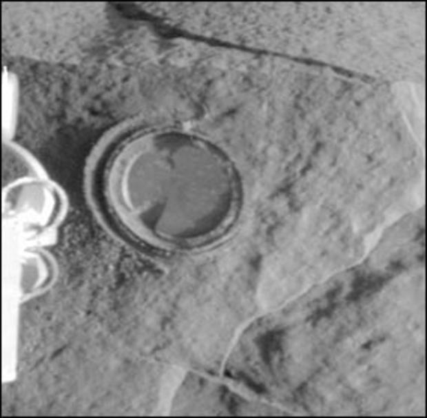
This image taken by Opportunity's front hazard-avoidance camera provides a circular sign of the success of the rover's first grinding of a rock. The round, shallow hole seen in this image is on a rock dubbed "McKittrick," located in the "El Capitan" area of the larger outcrop near Opportunity's landing site.
NASA/JPL
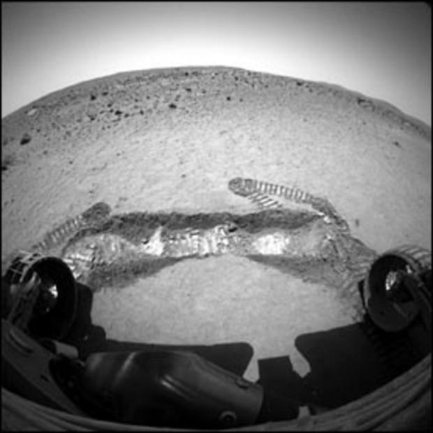
A view from the front hazard-avoidance camera of NASA's Spirit rover shows a trench excavated by the rover's left front wheel within the "Laguna Hollow" area. The trench, dubbed "Road Cut," is 3 inches deep.
NASA/JPL
This image shows the patch of soil at the bottom of the shallow depression dubbed "Laguna Hollow," where the Mars Exploration Rover Spirit was set to dig a trench.
NASA/JPL
This image shows Spirit in its new location at a circular depression dubbed "Laguna Hollow." Scientists are interested in the abundance of very fine, dust-like soil here. To get a better look at the variations in the fine-grained dust at different depths, controllers commanded Spirit to "jiggle" its wheels in the soil before backing away to a distance that allows the area to be reached with the robotic arm.
NASA/JPL
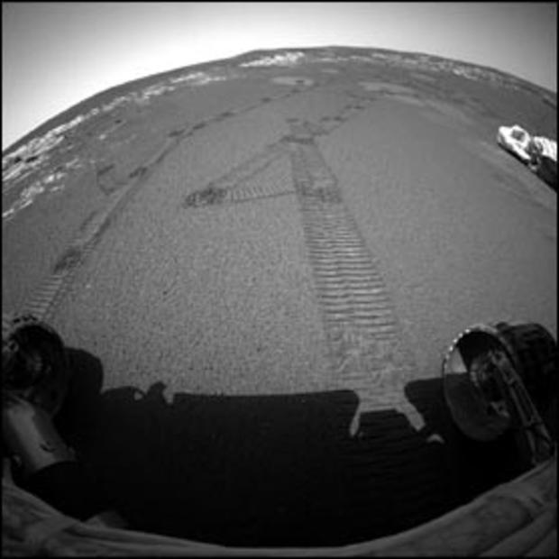
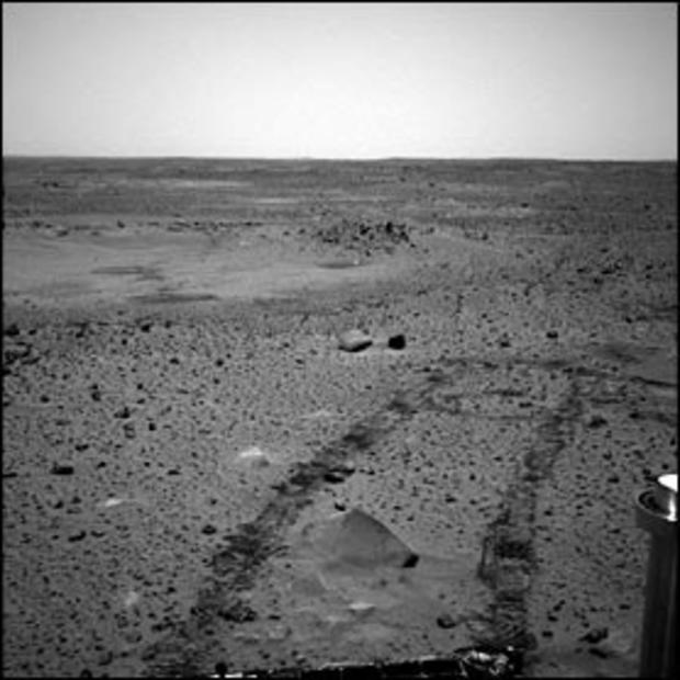
Opportunity made its first U-turn on Mars on Feb. 14, 2004, as the final maneuver of its longest one-day drive, covering about 30 feet. This view from the right front hazard-avoidance camera shows the scene in front of the rover after the turn, with the selected location for the mission's first trenching operation now directly in front.
NASA/JPL
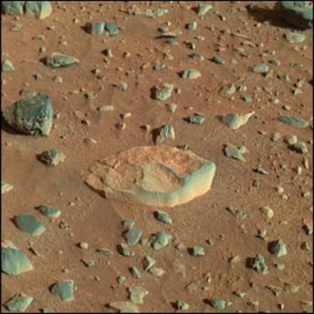
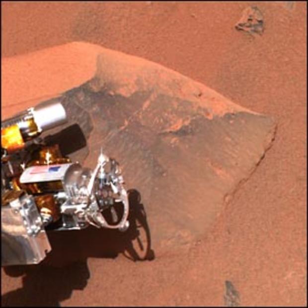
This is a composite red-green-blue image of the rock called White Boat. It is the first rock target that Spirit drove to after finishing a series of investigations on the rock Adirondack. White Boat stood out to scientists due to its light color and more tabular shape compared to the dark, rounded rocks that surround it.
NASA/JPL
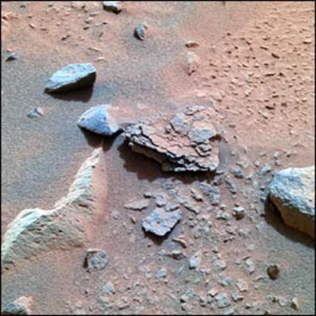
This color image taken by Spirit's panoramic camera is centered on an unusually flaky rock called Mimi, only one of many features in the area known as Stone Council. NASA says Mimi looks very different from any rock that scientists have seen at the Gusev crater site so far.
NASA/JPL
This three-dimensional stereo anaglyph of an image taken by Spirit's front navigation camera shows an interesting patch of rippled soil. Spirit took this image on Feb. 9, 2004, after completing the longest drive ever made by a rover on another planet: 69.6 feet.
NASA/JPL
The wavy feature in this image taken by Spirit's front hazard-avoidance camera is called a bedform. It is created when material is transported and deposited by some process -- in this case, wind. The NASA team is interested in the fact that the crests of this and most other bedforms they've observed are all parallel to each other, indicating uniform wind direction.
NASA/JPL
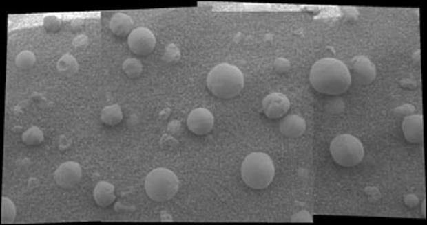
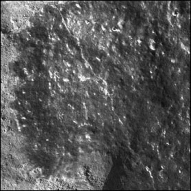
This mosaic image, one of the highest resolution images ever taken by Opportunity's microscopic imager, shows an extreme close-up of round, blueberry-shaped formations in the martian soil. Scientists are studying these curious formations, found near a part of the rock outcrop at Meridiani Planum called Stone Mountain, for clues about the area's past environmental conditions.
NASA/JPL
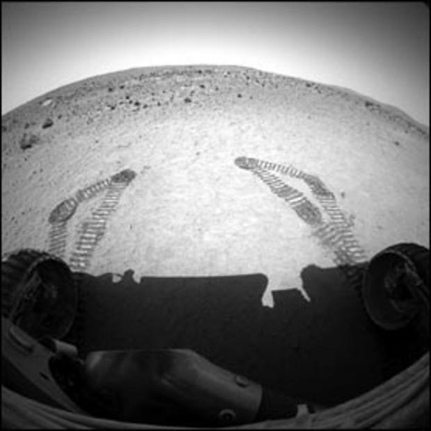
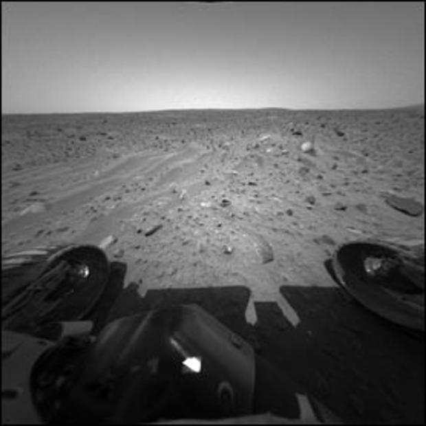
The Spirit rover drove itself 3 feet at Gusev Crater, Mars, on Feb. 8, 2004. This image shows the tracks it created in the martian soil as it drove straight ahead, then to the left. The rover also drove over Adirondack, seen in image bottom center, the bright rock that was targeted by Spirit's rock-abrasion tool, on its way to a rock target called White Boat.
NASA/JPL
The aftermath of Spirit's grinding down of a patch of Adirondack's surface. The apparent dark scarring that can be seen on the rock is dust accumulation from drilling, explained NASA's Steve Gorevan.
NASA/JPL
The rock abrasion tool on the Spirit rover ground off the surface of a patch 1.8 inches in diameter on a rock called Adirondack, Feb. 6, 2004. The hole is 0.1 inch deep, exposing fresh interior material of the rock for close inspection with the rover's microscopic imager and two spectrometers on the robotic arm.
NASA/JPL
This microscopic image shows a cleaned-off portion of the rock dubbed Adirondack. In preparation for grinding into the rock, Spirit wiped off a fine coat of dust with a stainless steel brush located on its rock-abrasion tool. Some of this dust coating can be seen to the left of the image.
NASA/JPL
This image shows Spirit's "hand," or the tip of the instrument-deployment device, poised in front of the rock nicknamed Adirondack, the rover's first science target. In preparation for grinding into Adirondack, Spirit cleaned off a portion of the rock's surface with a stainless steel brush located on its rock-abrasion tool, seen here at the tip of its hand. The image was taken by the rover's panoramic camera.
NASA/JPL
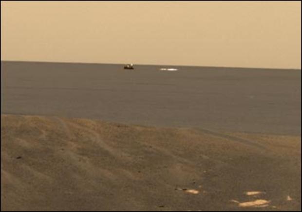
From its new location at the inner edge of the small crater surrounding it, the Opportunity rover was able to look out to the plains where its backshell, left, and parachute, right, landed. This approximate true-color image was created by combining data from the panoramic camera's red, green and blue filters.
NASA/JPL
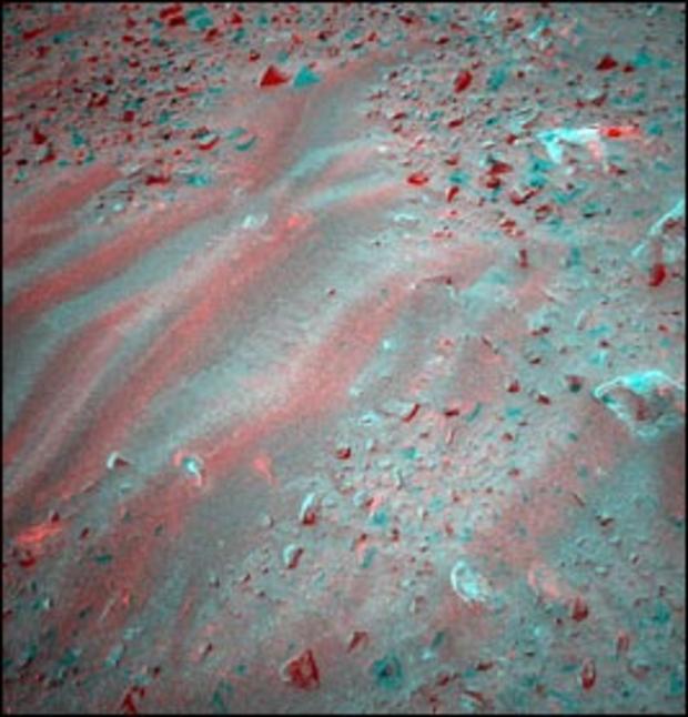
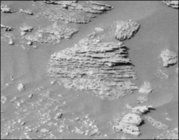
This is a cropped image taken by Opportunity's panoramic camera on Feb. 9, 2004. NASA scientists say the unparallel lines give clues that some "moving current" such as volcanic flow, wind, or water formed these rocks.