Philadelphia Weather: Berks County, Lehigh Valley, Poconos In Enhanced Risk For Severe Weather Thursday Evening
PHILADELPHIA (CBS) -- The final week of March has been quite the rollercoaster. After several days of a cold snap, warmer temperatures and a severe weather threat return to the Delaware and Lehigh Valleys on Thursday.
Berks County, the Lehigh Valley, the Poconos, and suburbs north and west of Philadelphia are now in an enhanced risk for severe weather on Thursday evening. The rest of the Philly region has a slight risk of severe storms.
A warm front will lift through the region early Thursday morning, prompting showers and ushering in a very warm and unstable airmass over the region.
⚠️NEW: far N & W suburbs, Berks, the Lehigh Valley & Poconos now in an Enhanced Risk (level 3 of 5) for severe weather this evening. Rest of the region in a Slight Risk (level 2 of 5). Timing: 5p to 1a from west to east. Wind gusts to 70 mph, isolated tornadoes poss. @CBSPhilly pic.twitter.com/NgWhfav4iC
— Lauren Casey (@ClimateCasey) March 31, 2022
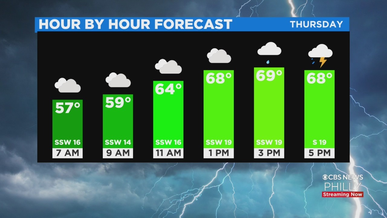
Afternoon temperatures are expected to soar into the 70s across Philadelphia, breaking our four-day streak of below-average temperatures. Windy conditions will also kick off a period of unsettled weather across the region.
Afternoon wind gusts could reach as high as 35 mph independent of possible thunderstorms likely to form late in the day. After 4 p.m., thunderstorms will begin to develop which could lead to heavy rain, small hail, and damaging wind gusts.
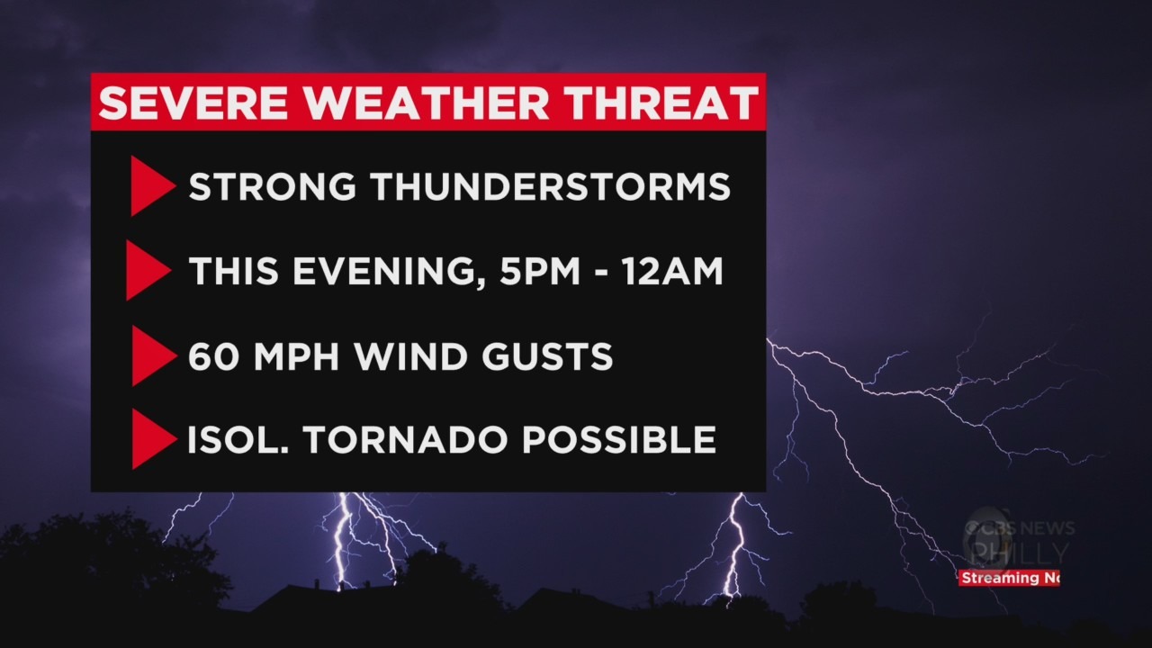
Stronger storms will be capable of producing gusts as high as 60 mph. Isolated tornadoes have been upgraded for areas west of Philadelphia and in the I-95 corridor.
At this time the tornado threat looks low, but a few isolated twisters cannot be completely ruled out. Scattered power outages are not out of the question.
People traveling home should remain alert for possible downpours and reduced visibility during their commute home. The downpours could also cause flooding.
Storm Timeline
- 3 p.m. - 7 p.m. Poconos, Lehigh Valley
- 4 p.m. - 8 p.m. Upper Pennsylvania Suburbs
- 5 p.m. - 9 p.m. I-95 Corridor
- 8 p.m. - 11 p.m. South Jersey and The Shore
- Severe weather threat ends after midnight.
People across the area should have a way of receiving alerts. Remember downloading the CBS Philly app is free and alerts are pushed through the second they go live.
Rain showers will continue overnight before drier air arrives by daybreak on Friday.
The weekend is trending seasonable with a sunny and breezy Saturday night. There's a slight chance of a rain shower Sunday, but early next week looks quiet.
Temperatures will warm into the 60s each day, and rain chances return by Wednesday.