Keep An Eye On Flooding This Stormy Thursday
Follow CBSMIAMI.COM: Facebook | Twitter
MIAMI (CBSMiami) -- South Florida still remains in a very stubborn weather pattern.
Upper level winds continue to race overhead, meaning the wind is blowing from the southwest to the northeast. This is also referred to as the southern branch of the Jetstream - one classic example of an El Niño winter.
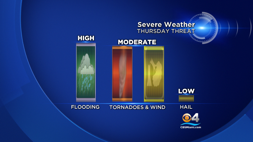
Thursday's primary severe weather threat is flooding, followed by storms capable of producing tornadoes and damaging wind gusts.
There is a broad area of low pressure over the southeast Gulf of Mexico. As this low slowly develops and slowly moves east-northeast, South Floridians will notice a gradual change with the weather.
The atmospheric profile is not as "unstable" compared to Wednesday.
Storms will continue to move across the same areas, causing concern for flooding.
Remember to give yourself extra travel time and keep your wipers on while driving in the rain. Watch out for water that has collected on the roads.
Better weather is in the forecast just in time for the weekend.
Click here for the latest weather information. For weather forecasts 24/7, get the app.