Pittsburgh Weather: Wind, Cold Temperatures, And Early Snow Showers Start The Weekend
PITTSBURGH (KDKA) - It's a blustery start to our Friday so for all the shoppers - BUNDLE UP!
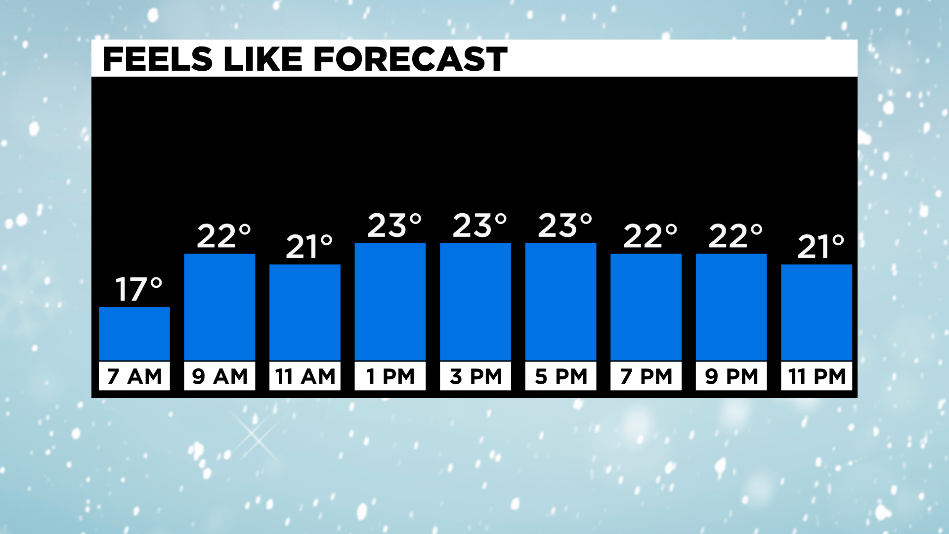
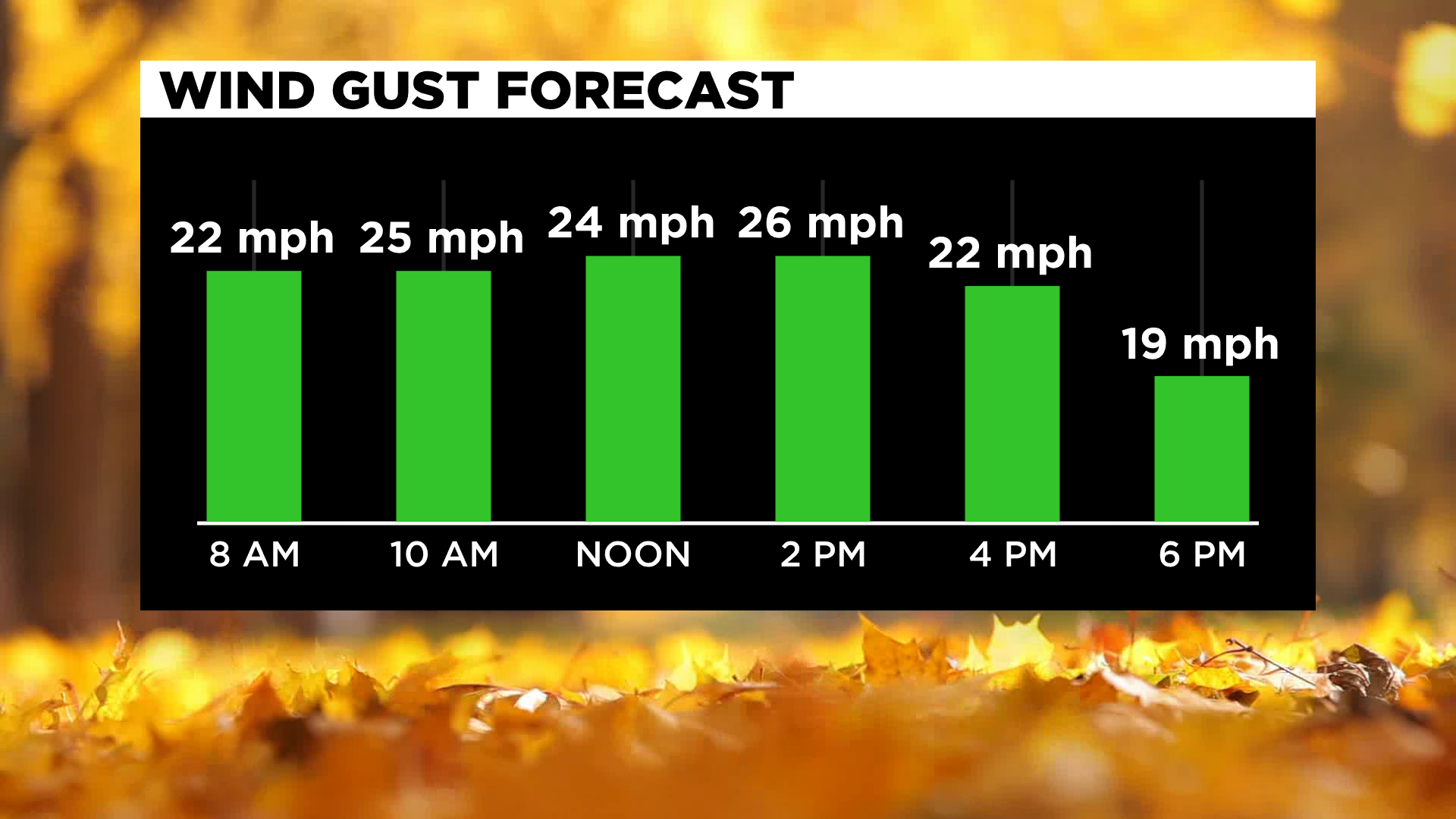
We have wind gusts 25-30 mph through the first part of the day making our high of 32 feels in the low 20s.
WEATHER LINKS:
Current Conditions | School Delays & Closings | Local Radar | Weather App | Photos
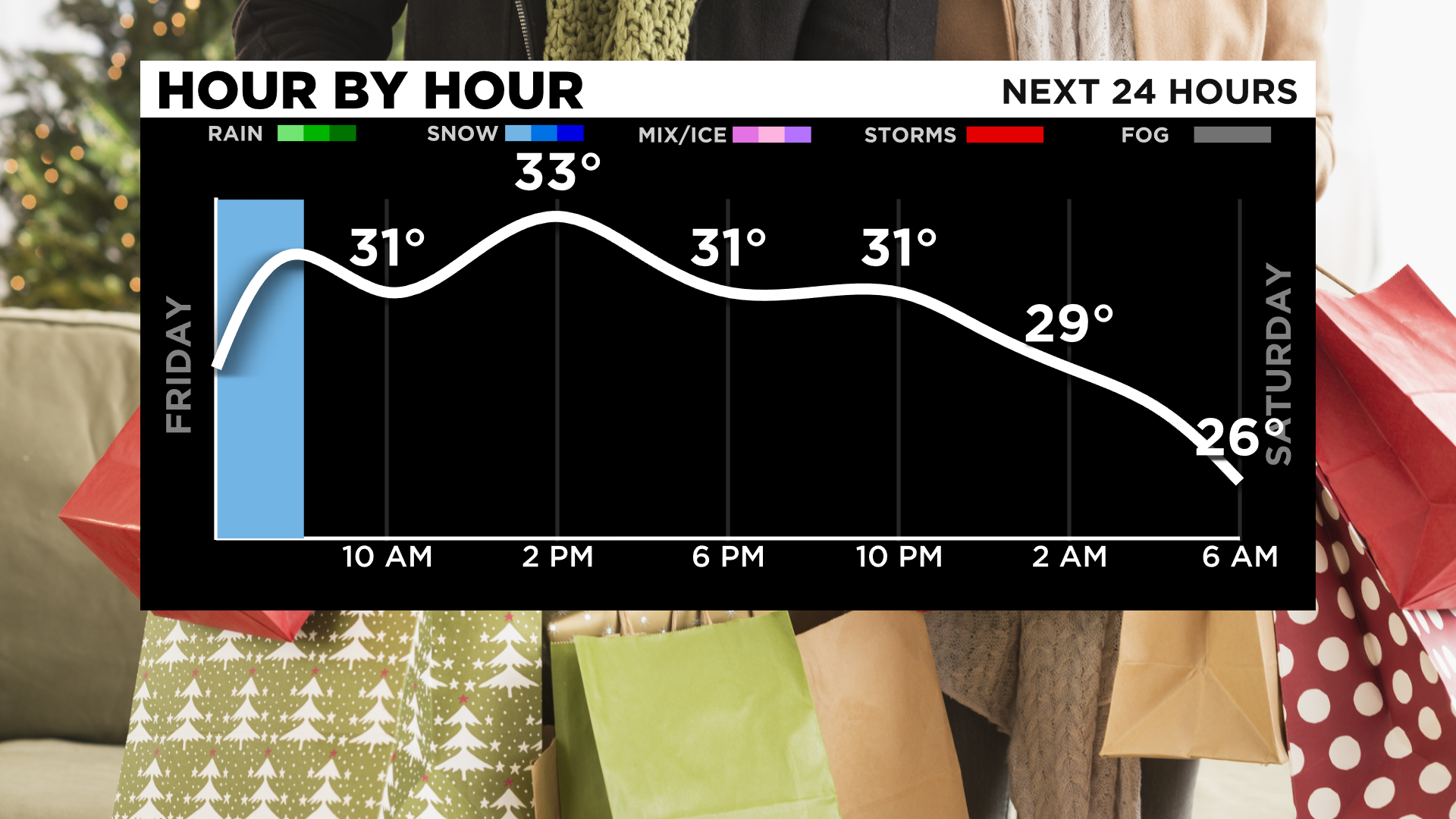
Behind a cold front, rain showers and transitioning to snow showers, leaving wet roadways so make sure you're taking it slow when heading out especially with all the wet leaves on the ground.
Most areas north of I-80 will see a little bit of accumulation with lake-enhanced snow showers and the ridges and higher elevations due to upslope enhancement. Most places around the Pittsburgh region will see little to no accumulation and just a few flurries for the rest of the day and tonight.
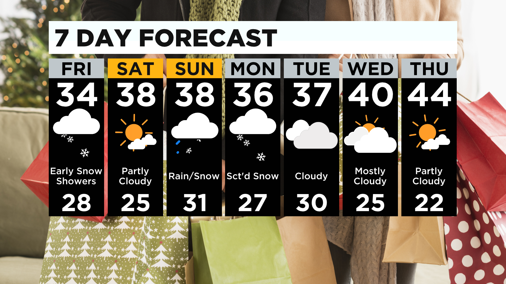
Saturday will stay dry with sunshine and highs around 40° but more snow is on the way!
Late Saturday and into Sunday snow showers are expected with areas north and the ridges seeing 1-3" and Pittsburgh picking up less than an inch.
Another round of snow is possible Sunday to Monday with another shot Monday to early Tuesday but it's still too early to determine how much accumulation there will be.
Stay up to date with the KDKA app, which you can download here.