Pittsburgh Weather: Storm Chances Linger On Friday
PITTSBURGH (KDKA) - Good morning, day four in a row with strong storms expected in our area today.
WEATHER LINKS:
Current Conditions | School Delays & Closings | Local Radar | Weather App | Photos
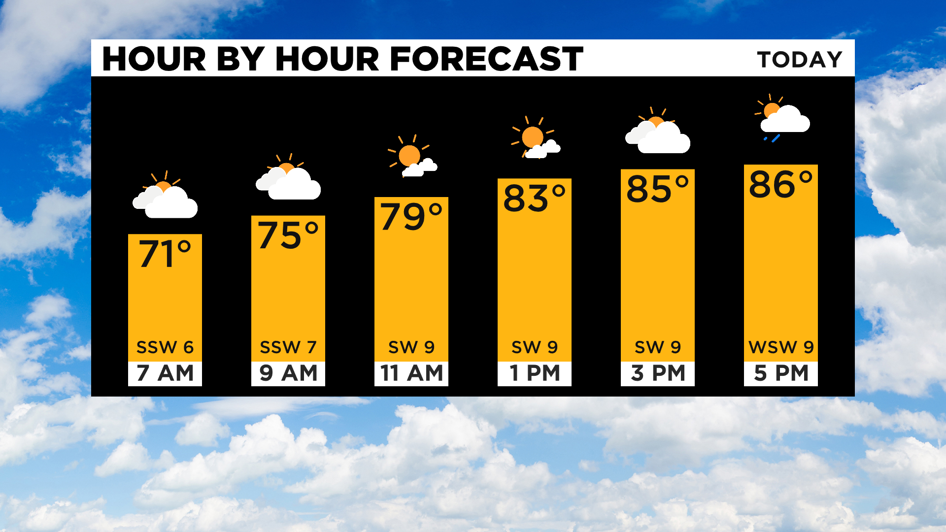
Similar to yesterday most of today will be dry with the window for strong storms opening up after 6:00 p.m. once again.
Stormy conditions may stick around later than last night due to a cold front pushing through the state. I actually have the cold front moving through around 5:00 a.m.-7:00 a.m. on Saturday morning.
We will continue to have a rain chance until it passes by.
Similar to yesterday, the biggest concern as storms arrive later on today will be with strong winds but a near equal concern will exist when it comes to potential flooding.
I don't think we will see any areas dealing with what we saw yesterday when it comes to more than 4" of rain possibly falling according to radar estimates.
Totals well over an inch and maybe over two inches should be easily possible.
Rain showers will continue overnight just ahead of the cool front.
I have the cool front moving through Pittsburgh before 8:00 a.m. on Saturday.
The city will have a chance for rain through the passage of the front
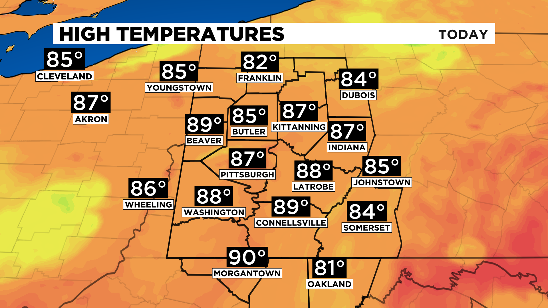
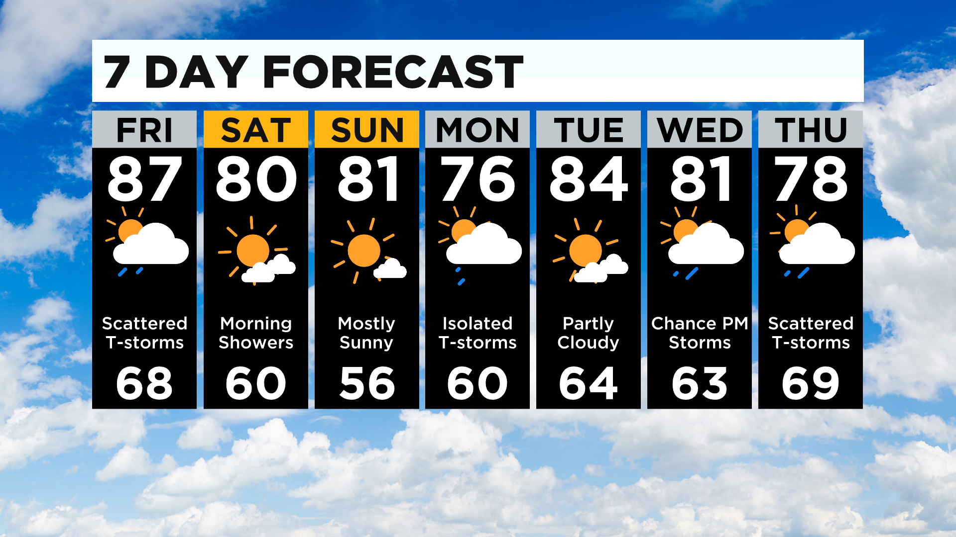
High temperatures today will hit the mid to upper 80s.
Highs tomorrow with cooler and drier air in place will barely get back to 80 degrees. We stay comfortable through Sunday.
Stay up to date with the KDKA app, which you can download here.