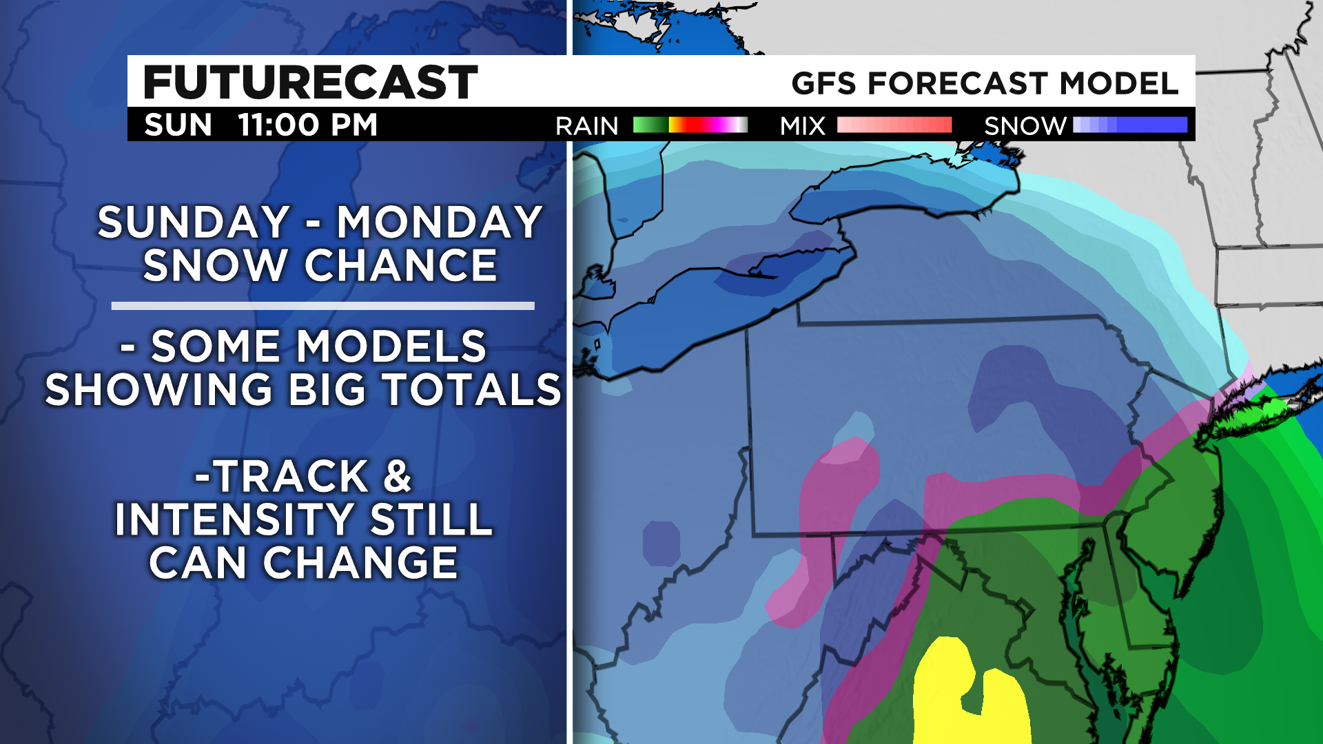
Pittsburgh Weather: Several Inches Of Snow Possible This Coming Weekend
PITTSBURGH (KDKA) - More and more information is pointing to a significant snow event occurring this weekend.
The track of heaviest snow may very well end up moving through parts of Western Pennsylvania. At this time it is too soon to have high confidence on the track though.
WEATHER LINKS:
Current Conditions | School Delays & Closings | Local Radar | Weather App | Photos
Other things that can change from now through Sunday include the storm's intensity along with if any warm air wraps itself into the system. Warm air moving into the system would bring snow totals down due to us seeing rain instead of snow.
At this time you should make sure to monitor the situation. We will continue to have the latest with data and numbers throughout today and every day through the storm passing us by.
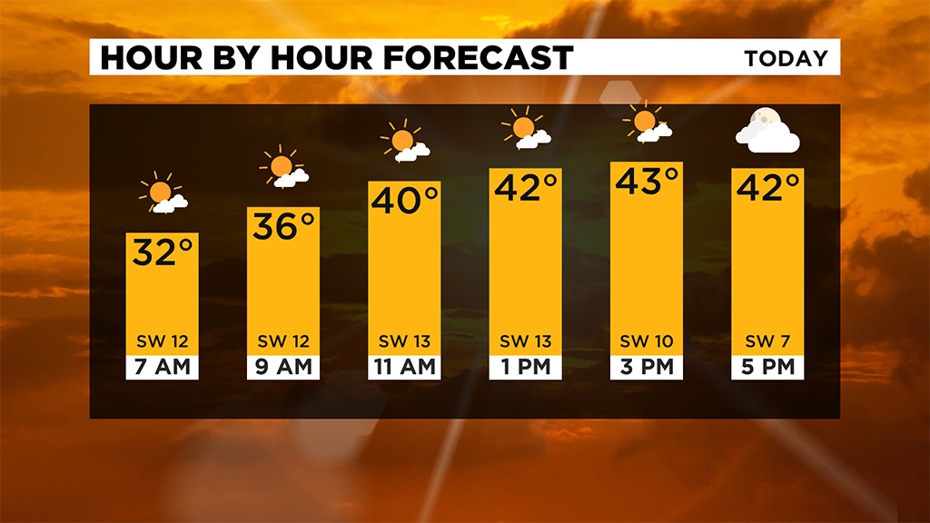
Today will be warmer than yesterday with highs in the mid-40s expected. Clouds will roll in for the afternoon with skies turning overcast by sunset.
Looking ahead I have just a small chance for some light snow north of I-80 in the forecast for Thursday.
Friday will see a better chance for snow with some accumulation expected for parts of the Laurel Highlands and other elevated areas.
Stay up to date with the KDKA app, which you can download here.