Pittsburgh Weather: Different Models, Shifting Tracks Leave Winter Storm Snow Totals Uncertain
PITTSBURGH (KDKA) -- First things first, this evening, a few rain and snow showers will be mixing in with little to no snow accumulation expected.
Temperatures will stay near normal on Friday with much of the day being dry.
We then get a blast of cold air for the weekend starting Saturday morning, with lows in the teens and possibly single digits. It will feel like it's in the single digits and highs in the afternoon only make it near 20 degrees.
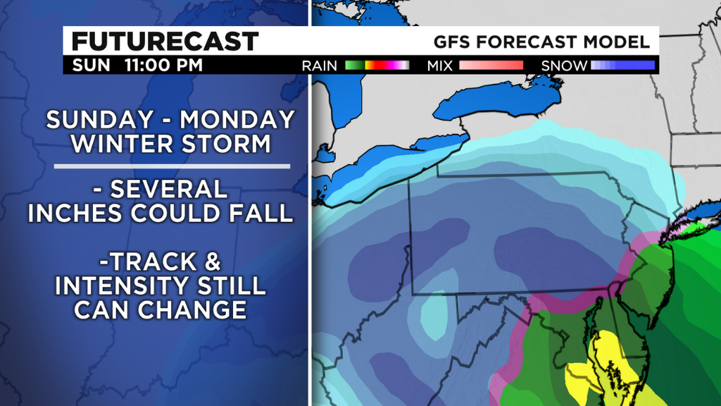
Sunday will start off dry, but conditions will begin to change around dinner time. That's when we will begin seeing flakes.
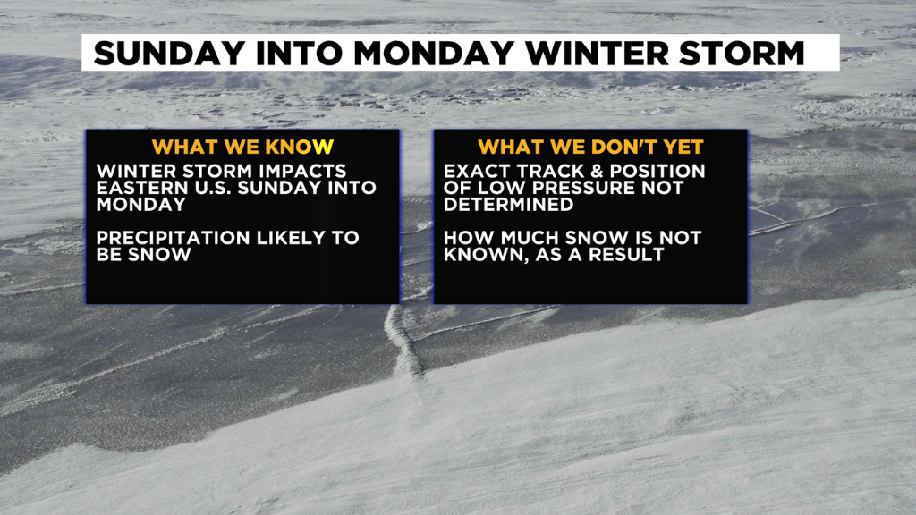
What we know for certain is, there will be snow, KDKA Meteorologist Mary Ours said. However, it is still too soon to say just now much accumulation we will see.
The track has shifted further east in some models, which means less snow for us. If it stays further inland, though, we could get some bigger snow totals. Some models have the snowstorm staying well south and east, but the track can and will change as the system approaches.
This mid-level low will be picking up moisture from the Gulf, so it is a big system. It looks like areas east, no matter the track, will get hit with high snow totals.
WEATHER LINKS:
Current Conditions | School Delays & Closings | Local Radar | Weather App | Photos
This system looks to exit early Monday and temperatures return to normal for the start of the week. The chance for snow showers could stick around for the first part of the week.
Stay up to date with the KDKA app, which you can download here.